While takeoff favors left for Andean views, the landing approach over the Panama Canal and Gatun Lake system is the more distinctive and geographically significant feature of this route. Right seats capture the canal infrastructure and lake system that define the approach corridor, making it the better overall choice.
Flown SCL to PTY? Did we get it right?
Flight Path
Santiago to Panama City is 2,988 miles (4,809 km), a flight of about 5 hours.
The flight path crosses the Pacific coast of Chile near Valparaíso, then proceeds northwest over open ocean. Around the midpoint (2.5 hours), the aircraft passes over the Galápagos region (though typically 200+ miles south of the islands). The route then continues northwest toward Central America, passing over the Pacific waters off Costa Rica and into Panamanian airspace. The descent begins over the Caribbean side, with views of the Darién Gap rainforest and the Panama Canal approach zone. Notable geographic transition: from the dry Pacific coast of Chile to tropical rainforest and canal infrastructure in Panama.
Great circle distance and headings ›


Phase by phase
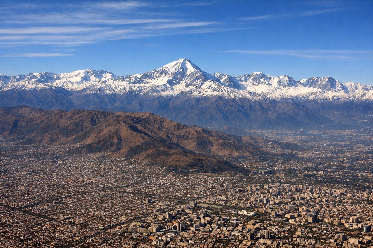
Takeoff from SCL
LEFTSantiago typically departs runway 07 (westbound) or 25 (northbound). Left seats offer views of the Andes cordillera rising dramatically to the east during initial climb, with the snow-capped peaks of the Central Chilean range providing the most striking visual during the first 10-15 minutes of flight.
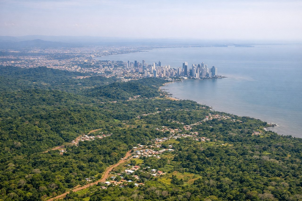
Landing at PTY
RIGHTTocumen uses runway 03 (northbound) or 21 (southbound) for most arrivals. Right seats provide views of the Panama Canal approach corridor and the Gatun Lake system during descent. The canal's locks and the surrounding rainforest landscape are visible from 8,000-15,000 feet on the right side during the final approach phase.
Will your flight be in sunlight?
Pick a date and time in the Sun Map to watch the sun move across your whole flight.
About This Route
Which side of the plane should I sit on flying from Arturo Merino Benitez International (SCL) to Tocumen International (PTY)?
Sit on the Right side of the plane for the best views on flights from Santiago to Panama City. While takeoff favors left for Andean views, the landing approach over the Panama Canal and Gatun Lake system is the more distinctive and geographically significant feature of this route. Right seats capture the canal infrastructure and lake system that define the approach corridor, making it the better overall choice.
What can I see during takeoff from Arturo Merino Benitez International in Santiago?
During takeoff from Arturo Merino Benitez International (SCL), sit on the Left side for the best views. Santiago typically departs runway 07 (westbound) or 25 (northbound). Left seats offer views of the Andes cordillera rising dramatically to the east during initial climb, with the snow-capped peaks of the Central Chilean range providing the most striking visual during the first 10-15 minutes of flight. Notable sights include: Andes Mountains (Central range with peaks 13,000-15,000 ft), Maipo River valley running north-south below, Santiago urban sprawl to the west, Aconcagua massif visible on the distant southern horizon.
What can I see when landing at Tocumen International in Panama City?
When landing at Tocumen International (PTY), sit on the Right side for the best views. Tocumen uses runway 03 (northbound) or 21 (southbound) for most arrivals. Right seats provide views of the Panama Canal approach corridor and the Gatun Lake system during descent. The canal's locks and the surrounding rainforest landscape are visible from 8,000-15,000 feet on the right side during the final approach phase. Notable sights include: Panama Canal (Gatun Locks visible as geometric structures), Gatun Lake (large freshwater body with island-dotted surface), Panama City skyline to the southeast, Darién rainforest canopy to the south and west.
How long is the flight from Santiago to Panama City?
The flight from Arturo Merino Benitez International (SCL) to Tocumen International (PTY) takes about 5 hours. The shortest flight path between them is 2,988 miles (4,809 km); winds and air traffic control usually add a few percent.
What does the Santiago to Panama City flight path pass over?
The flight path crosses the Pacific coast of Chile near Valparaíso, then proceeds northwest over open ocean. Around the midpoint (2.5 hours), the aircraft passes over the Galápagos region (though typically 200+ miles south of the islands). The route then continues northwest toward Central America, passing over the Pacific waters off Costa Rica and into Panamanian airspace. The descent begins over the Caribbean side, with views of the Darién Gap rainforest and the Panama Canal approach zone. Notable geographic transition: from the dry Pacific coast of Chile to tropical rainforest and canal infrastructure in Panama.