Right-side seats capture the most visually distinctive feature on takeoff—the Ohio River's dramatic curves through Louisville—which outweighs the landing advantage of left-side seats viewing the Hudson River and Manhattan.
Flown SDF to EWR? Did we get it right?
Flight Path
Louisville to Newark is 641 miles (1,031 km), a flight of about 2 hours 15 minutes.
The flight path crosses the Appalachian foothills of eastern Kentucky and West Virginia, with the ridge lines of the Cumberland Mountains visible as a series of parallel ridges running northeast-southwest. The Kanawha River valley in West Virginia appears as a linear green corridor. As you progress northeast, the terrain gradually transitions from Appalachian ridges to the rolling hills of Pennsylvania, with the Allegheny Mountains forming a distant horizon feature. The Pennsylvania landscape becomes increasingly developed with scattered towns and agricultural fields. Near the end of the flight, the terrain flattens into the coastal plain of New Jersey with increasing urban and suburban development visible.
Great circle distance and headings ›

Phase by phase
Takeoff from SDF
RIGHTRight-side seats offer views of the Ohio River as it curves through Louisville and the downtown skyline. The river's distinctive meanders are clearly visible during climb-out, and you'll see the urban grid of Louisville spreading eastward.
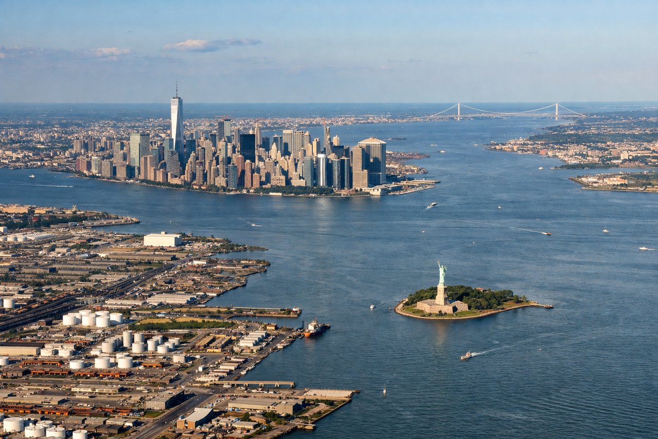
Landing at EWR
LEFTLeft-side seats provide excellent views during descent into Newark. You'll see the Hudson River, Manhattan's skyline across the water, and the industrial landscape of northern New Jersey as you approach from the southwest.
Will your flight be in sunlight?
Pick a date and time in the Sun Map to watch the sun move across your whole flight.
About This Route
Which side of the plane should I sit on flying from Louisville Muhammad Ali International Airport (SDF) to Newark Liberty International (EWR)?
Sit on the Right side of the plane for the best views on flights from Louisville to Newark. Right-side seats capture the most visually distinctive feature on takeoff—the Ohio River's dramatic curves through Louisville—which outweighs the landing advantage of left-side seats viewing the Hudson River and Manhattan.
What can I see during takeoff from Louisville Muhammad Ali International Airport in Louisville?
During takeoff from Louisville Muhammad Ali International Airport (SDF), sit on the Right side for the best views. Right-side seats offer views of the Ohio River as it curves through Louisville and the downtown skyline. The river's distinctive meanders are clearly visible during climb-out, and you'll see the urban grid of Louisville spreading eastward. Notable sights include: Ohio River, Louisville downtown skyline, Watterson Expressway corridor, residential neighborhoods extending east toward Shelbyville.
What can I see when landing at Newark Liberty International in Newark?
When landing at Newark Liberty International (EWR), sit on the Left side for the best views. Left-side seats provide excellent views during descent into Newark. You'll see the Hudson River, Manhattan's skyline across the water, and the industrial landscape of northern New Jersey as you approach from the southwest. Notable sights include: Hudson River, Manhattan skyline, Newark Bay, industrial and port facilities of Newark and Jersey City.
How long is the flight from Louisville to Newark?
The flight from Louisville Muhammad Ali International Airport (SDF) to Newark Liberty International (EWR) takes about 2 hours 15 minutes. The shortest flight path between them is 641 miles (1,031 km); winds and air traffic control usually add a few percent.
What does the Louisville to Newark flight path pass over?
The flight path crosses the Appalachian foothills of eastern Kentucky and West Virginia, with the ridge lines of the Cumberland Mountains visible as a series of parallel ridges running northeast-southwest. The Kanawha River valley in West Virginia appears as a linear green corridor. As you progress northeast, the terrain gradually transitions from Appalachian ridges to the rolling hills of Pennsylvania, with the Allegheny Mountains forming a distant horizon feature. The Pennsylvania landscape becomes increasingly developed with scattered towns and agricultural fields. Near the end of the flight, the terrain flattens into the coastal plain of New Jersey with increasing urban and suburban development visible.