Seattle to Santa Ana is 979 miles (1,576 km), a flight of about 2 hours 45 minutes.
The left side delivers a stronger overall experience: Mount Rainier at takeoff, then a long cruise past the snow-capped Cascade volcanoes including Mount Shasta and glimpses of the Sierra Nevada, offering more sustained landmark density than the right side's ocean-dominated cruise, even though the right side wins the final coastal approach into SNA.
Flight Path
Mount Shasta and the southern Cascade Range, the Sierra Nevada foothills, and California's Central Valley farmland are visible along the direct SEA-SNA routing before the descent into the Los Angeles basin.
Great circle distance and headings ›


.jpg?width=600)
Phase by phase
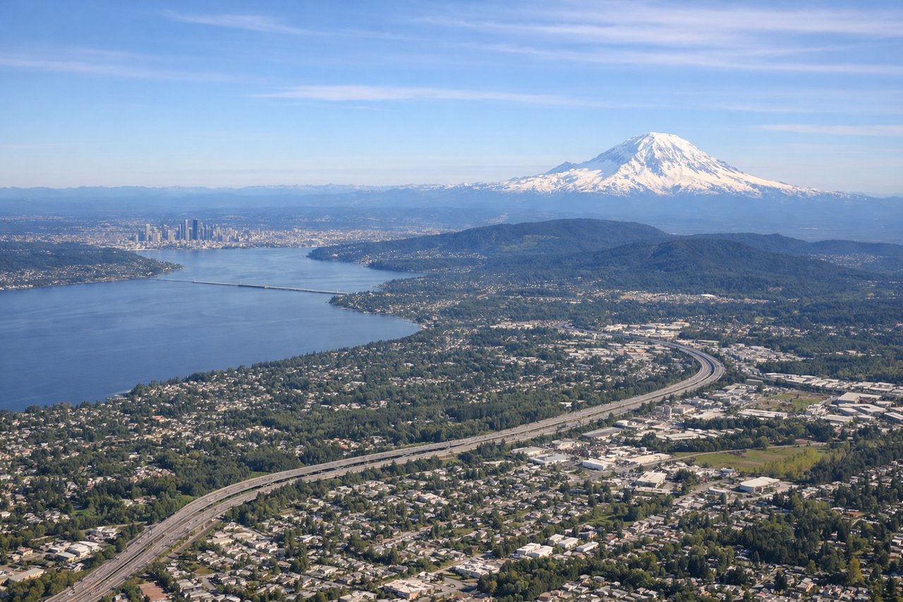
Takeoff from SEA
LEFTAfter departing SEA southbound, the aircraft banks over the Kent-Auburn valley with Mount Rainier's glaciated cone dominating the eastern horizon on the left side. This is one of the most recognizable volcanic peaks in North America and is almost always visible on clear-day southbound departures.
Landing at SNA
RIGHTSNA's approach comes in from the northeast on a southwest heading, so the final descent puts the Pacific coastline, Newport Beach, and the harbor on the right side of the aircraft. This coastal panorama, including offshore Catalina Island on clear days, makes for a more scenic final approach than the inland hills seen from the left.
Landmarks on this routeAll landmarks →
Will your flight be in sunlight?
Pick a date and time in the Sun Map to watch the sun move across your whole flight.
About This Route
Which side of the plane should I sit on flying from Seattle Tacoma International (SEA) to John Wayne Arpt Orange Co (SNA)?
Sit on the Left side of the plane for the best views on flights from Seattle to Santa Ana. The left side delivers a stronger overall experience: Mount Rainier at takeoff, then a long cruise past the snow-capped Cascade volcanoes including Mount Shasta and glimpses of the Sierra Nevada, offering more sustained landmark density than the right side's ocean-dominated cruise, even though the right side wins the final coastal approach into SNA.
What can I see during takeoff from Seattle Tacoma International in Seattle?
During takeoff from Seattle Tacoma International (SEA), sit on the Left side for the best views. After departing SEA southbound, the aircraft banks over the Kent-Auburn valley with Mount Rainier's glaciated cone dominating the eastern horizon on the left side. This is one of the most recognizable volcanic peaks in North America and is almost always visible on clear-day southbound departures. Notable sights include: Mount Rainier, Cascade foothills, Green River valley, distant Mount St. Helens.
What can I see when landing at John Wayne Arpt Orange Co in Santa Ana?
When landing at John Wayne Arpt Orange Co (SNA), sit on the Right side for the best views. SNA's approach comes in from the northeast on a southwest heading, so the final descent puts the Pacific coastline, Newport Beach, and the harbor on the right side of the aircraft. This coastal panorama, including offshore Catalina Island on clear days, makes for a more scenic final approach than the inland hills seen from the left. Notable sights include: Newport Beach coastline, Balboa Peninsula, Pacific Ocean, Catalina Island (distant).
How long is the flight from Seattle to Santa Ana?
The flight from Seattle Tacoma International (SEA) to John Wayne Arpt Orange Co (SNA) takes about 2 hours 45 minutes. The shortest flight path between them is 979 miles (1,576 km); winds and air traffic control usually add a few percent.
What does the Seattle to Santa Ana flight path pass over?
Mount Shasta and the southern Cascade Range, the Sierra Nevada foothills, and California's Central Valley farmland are visible along the direct SEA-SNA routing before the descent into the Los Angeles basin.