While takeoff offers excellent delta views on the right, the landing approach provides more dramatic and visually distinctive scenery. The Yangtze estuary and Hangzhou Bay are geographically more impressive than the Mekong Delta when viewed from aircraft altitude, and left-side seats capture this during the critical final descent phase when visibility is typically best.
Flown SGN to PVG? Did we get it right?
Flight Path
Ho Chi Minh City to Shanghai is 1,707 miles (2,746 km), a flight of about 3 hours.
The flight path crosses the Gulf of Tonkin (visible as open water with occasional fishing vessel activity), then transitions over the Hainan Island region (mountainous terrain visible on clear days), and continues northeastward across the South China Sea toward the Yangtze River Delta. The Hainan highlands and the transition from tropical to subtropical landscape are notable midpoint features, though these are typically viewed from higher altitudes (25,000-35,000 feet) where detail is limited.
Great circle distance and headings ›


Phase by phase
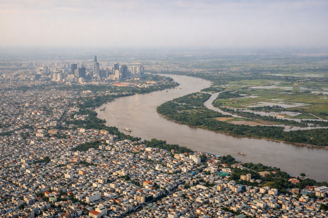
Takeoff from SGN
RIGHTRight-side seats offer views of the Saigon River delta and Mekong River distributaries as the aircraft climbs northward. The dense network of waterways, rice paddies, and the sprawling Mekong Delta are clearly visible during the initial climb-out phase.
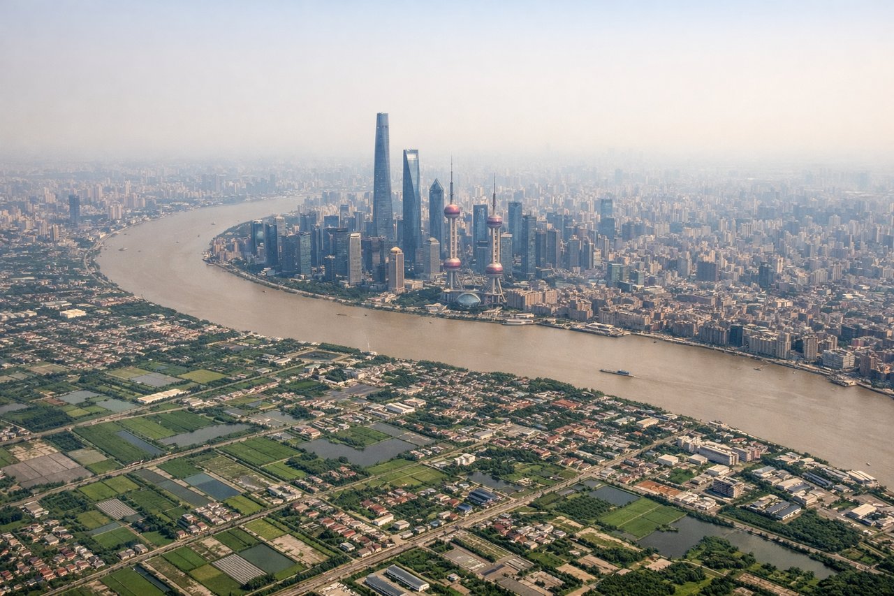
Landing at PVG
LEFTLeft-side seats provide excellent views during descent into Shanghai. The Yangtze River estuary, Hangzhou Bay, and the distinctive industrial landscape of the Yangtze River Delta are prominent on the left side as the aircraft approaches from the south.
Will your flight be in sunlight?
Pick a date and time in the Sun Map to watch the sun move across your whole flight.
About This Route
Which side of the plane should I sit on flying from Tansonnhat International (SGN) to Shanghai Pudong International (PVG)?
Sit on the Left side of the plane for the best views on flights from Ho Chi Minh City to Shanghai. While takeoff offers excellent delta views on the right, the landing approach provides more dramatic and visually distinctive scenery. The Yangtze estuary and Hangzhou Bay are geographically more impressive than the Mekong Delta when viewed from aircraft altitude, and left-side seats capture this during the critical final descent phase when visibility is typically best.
What can I see during takeoff from Tansonnhat International in Ho Chi Minh City?
During takeoff from Tansonnhat International (SGN), sit on the Right side for the best views. Right-side seats offer views of the Saigon River delta and Mekong River distributaries as the aircraft climbs northward. The dense network of waterways, rice paddies, and the sprawling Mekong Delta are clearly visible during the initial climb-out phase. Notable sights include: Saigon River (flowing southeast through Ho Chi Minh City), Mekong River Delta (extensive agricultural flatlands with visible water channels), Can Tho city area (approximately 100 km southwest), Vung Tau peninsula (visible to the southeast on clear days).
What can I see when landing at Shanghai Pudong International in Shanghai?
When landing at Shanghai Pudong International (PVG), sit on the Left side for the best views. Left-side seats provide excellent views during descent into Shanghai. The Yangtze River estuary, Hangzhou Bay, and the distinctive industrial landscape of the Yangtze River Delta are prominent on the left side as the aircraft approaches from the south. Notable sights include: Yangtze River estuary (massive muddy-brown river delta), Hangzhou Bay (large coastal indentation with visible tidal patterns), East China Sea coastline, Shanghai's Pudong district skyline (visible during final approach).
How long is the flight from Ho Chi Minh City to Shanghai?
The flight from Tansonnhat International (SGN) to Shanghai Pudong International (PVG) takes about 3 hours. The shortest flight path between them is 1,707 miles (2,746 km); winds and air traffic control usually add a few percent.
What does the Ho Chi Minh City to Shanghai flight path pass over?
The flight path crosses the Gulf of Tonkin (visible as open water with occasional fishing vessel activity), then transitions over the Hainan Island region (mountainous terrain visible on clear days), and continues northeastward across the South China Sea toward the Yangtze River Delta. The Hainan highlands and the transition from tropical to subtropical landscape are notable midpoint features, though these are typically viewed from higher altitudes (25,000-35,000 feet) where detail is limited.