Ho Chi Minh City to San Francisco is 7,828 miles (12,598 km), a flight of about 13 hours 45 minutes.
The right side wins at takeoff with the HCMC cityscape, but the left side delivers the more dramatic payoff on arrival with the full San Francisco Bay approach. Across the Pacific, the left side also tracks closer to the Aleutian Islands arc and the Alaskan coastline during the great-circle routing, offering occasional glimpses of volcanic peaks and coastal terrain on clear days.
Flight Path
The great-circle route from SGN to SFO arcs northeastward over the South China Sea, crosses the Philippine Sea east of Luzon, then tracks across the open North Pacific. The route passes south of Japan and curves up toward the Aleutian Islands chain, where volcanic peaks like Shishaldin on Unimak Island may be visible on clear days. The final leg descends along the California coast before turning into the Bay Area.
Great circle distance and headings ›Phase by phase
Takeoff from SGN
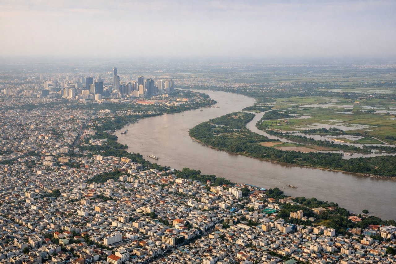
RIGHTTân Sơn Nhất's primary departure runway 25L/07R means northwestbound departures swing right over central Ho Chi Minh City. The right side gets a clear look down at the dense urban grid of Districts 1 and 3, the Saigon River bends, and the sprawling city extending toward the Mekong Delta lowlands to the south.
Landing at SFO
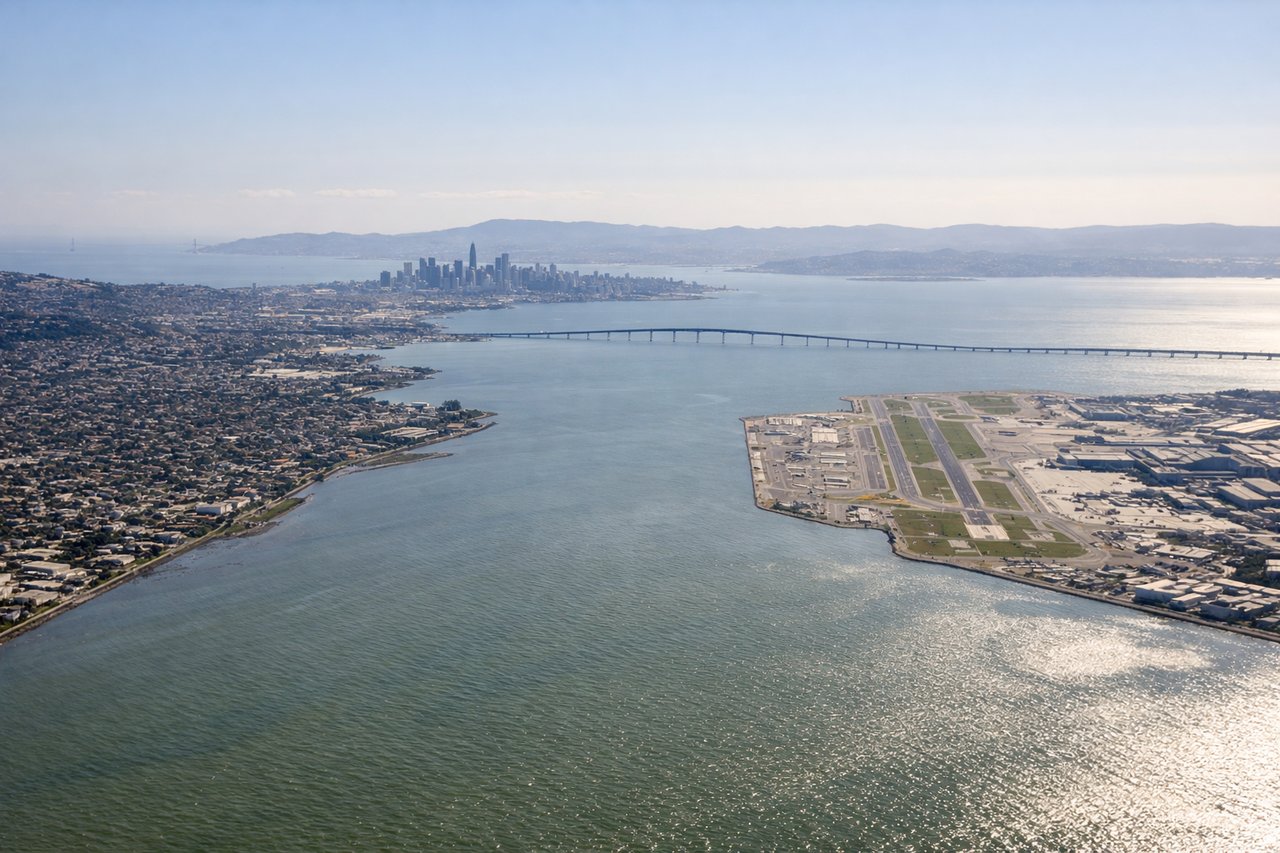
LEFTSFO's dominant arrival configuration uses the 28L/28R runways with approaches from the east over the Bay. Left-side passengers get the full panorama of San Francisco Bay, the city peninsula, and the Golden Gate as the aircraft descends over the water from the east.
Landmarks on this routeAll landmarks →
Will your flight be in sunlight?
Pick a date and time in the Sun Map to watch the sun move across your whole flight.
About This Route
Which side of the plane should I sit on flying from Tansonnhat International (SGN) to San Francisco International (SFO)?
Sit on the Left side of the plane for the best views on flights from Ho Chi Minh City to San Francisco. The right side wins at takeoff with the HCMC cityscape, but the left side delivers the more dramatic payoff on arrival with the full San Francisco Bay approach. Across the Pacific, the left side also tracks closer to the Aleutian Islands arc and the Alaskan coastline during the great-circle routing, offering occasional glimpses of volcanic peaks and coastal terrain on clear days.
What can I see during takeoff from Tansonnhat International in Ho Chi Minh City?
During takeoff from Tansonnhat International (SGN), sit on the Right side for the best views. Tân Sơn Nhất's primary departure runway 25L/07R means northwestbound departures swing right over central Ho Chi Minh City. The right side gets a clear look down at the dense urban grid of Districts 1 and 3, the Saigon River bends, and the sprawling city extending toward the Mekong Delta lowlands to the south. Notable sights include: Saigon River bends through central HCMC, Districts 1 and 3 urban core, Bình Dương industrial corridor to the north, flat Mekong Delta plain to the south.
What can I see when landing at San Francisco International in San Francisco?
When landing at San Francisco International (SFO), sit on the Left side for the best views. SFO's dominant arrival configuration uses the 28L/28R runways with approaches from the east over the Bay. Left-side passengers get the full panorama of San Francisco Bay, the city peninsula, and the Golden Gate as the aircraft descends over the water from the east. Notable sights include: San Francisco Bay, San Francisco city peninsula and downtown skyline, San Mateo Bridge, Oakland and East Bay hills.
How long is the flight from Ho Chi Minh City to San Francisco?
The flight from Tansonnhat International (SGN) to San Francisco International (SFO) takes about 13 hours 45 minutes. The shortest flight path between them is 7,828 miles (12,598 km); winds and air traffic control usually add a few percent.
What does the Ho Chi Minh City to San Francisco flight path pass over?
The great-circle route from SGN to SFO arcs northeastward over the South China Sea, crosses the Philippine Sea east of Luzon, then tracks across the open North Pacific. The route passes south of Japan and curves up toward the Aleutian Islands chain, where volcanic peaks like Shishaldin on Unimak Island may be visible on clear days. The final leg descends along the California coast before turning into the Bay Area.