The takeoff from Ho Chi Minh City offers more visually distinctive and extended scenic value—the Mekong Delta's intricate waterway patterns and agricultural geometry are unique and visible for a longer period during climb-out than the landing approach provides.
Flown SGN to LHR? Did we get it right?
Flight Path
Ho Chi Minh City to London is 6,350 miles (10,219 km), a flight of about 11 hours 45 minutes.
Over central Asia: Hindu Kush and Pamir mountain ranges (Afghanistan/Tajikistan border region, visible as snow-capped peaks around 8-10 hours into flight); Caspian Sea (large inland water body, visible as you cross into European airspace); Black Sea (visible during descent into European airspace); Carpathian Mountains (Romania/Eastern Europe, visible during final approach phase over continental Europe)
Great circle distance and headings ›


Phase by phase
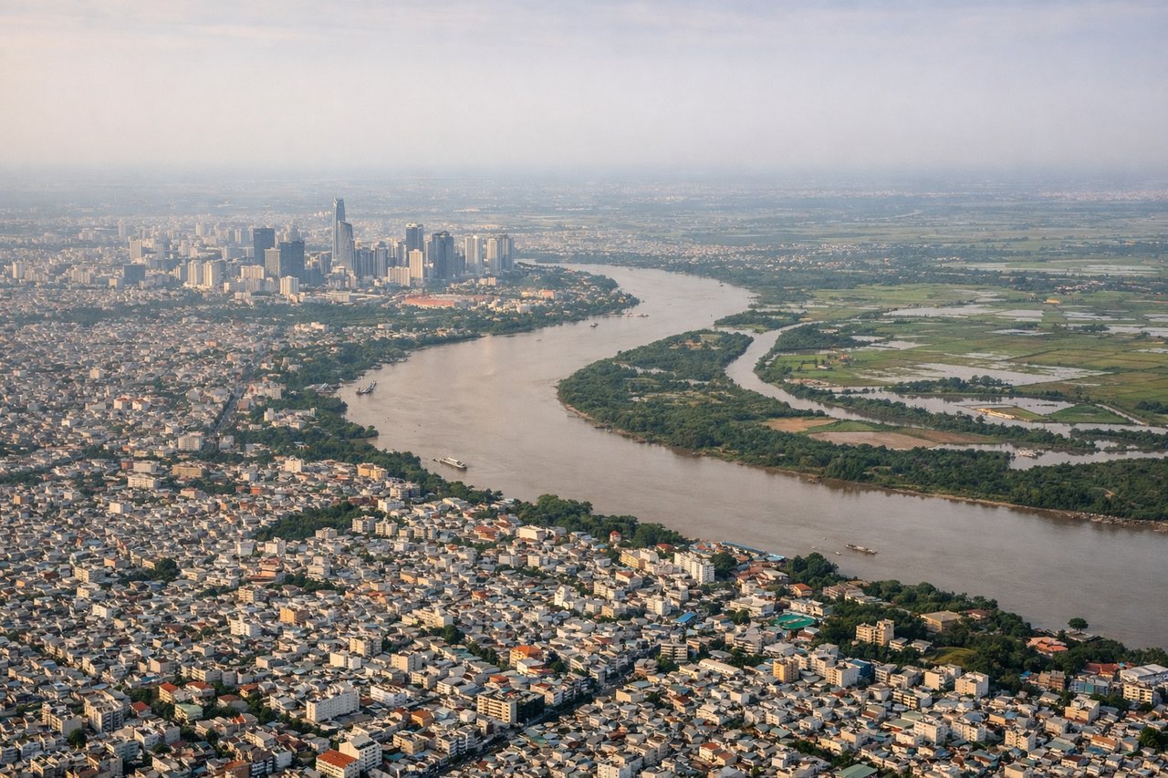
Takeoff from SGN
RIGHTRight-side seats offer views of the Saigon River delta and Mekong Delta wetlands during the initial climb-out heading northwest. The intricate waterway patterns and agricultural patchwork are distinctive and visible up to 8,000 feet.
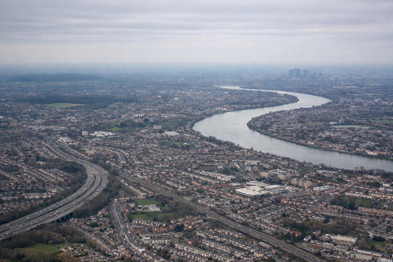
Landing at LHR
LEFTLeft-side seats provide excellent views during the descent approach to Heathrow. You'll see the Thames River winding through London, the city's urban sprawl, and the Chiltern Hills to the northwest—all prominent landmarks during the final 30 minutes of descent.
Will your flight be in sunlight?
Pick a date and time in the Sun Map to watch the sun move across your whole flight.
About This Route
Which side of the plane should I sit on flying from Tansonnhat International (SGN) to Heathrow (LHR)?
Sit on the Right side of the plane for the best views on flights from Ho Chi Minh City to London. The takeoff from Ho Chi Minh City offers more visually distinctive and extended scenic value—the Mekong Delta's intricate waterway patterns and agricultural geometry are unique and visible for a longer period during climb-out than the landing approach provides.
What can I see during takeoff from Tansonnhat International in Ho Chi Minh City?
During takeoff from Tansonnhat International (SGN), sit on the Right side for the best views. Right-side seats offer views of the Saigon River delta and Mekong Delta wetlands during the initial climb-out heading northwest. The intricate waterway patterns and agricultural patchwork are distinctive and visible up to 8,000 feet. Notable sights include: Saigon River (curving through Ho Chi Minh City), Mekong Delta distributaries (branching waterways), Can Tho city (visible as urban cluster ~100 km southwest), agricultural grid patterns (rice paddies and fish farms creating geometric landscape).
What can I see when landing at Heathrow in London?
When landing at Heathrow (LHR), sit on the Left side for the best views. Left-side seats provide excellent views during the descent approach to Heathrow. You'll see the Thames River winding through London, the city's urban sprawl, and the Chiltern Hills to the northwest—all prominent landmarks during the final 30 minutes of descent. Notable sights include: Thames River (distinctive meanders through London), London urban area (Greater London sprawl visible as dense development), Chiltern Hills (elevated terrain northwest of London), Windsor area and surrounding Home Counties (patchwork of green fields and towns).
How long is the flight from Ho Chi Minh City to London?
The flight from Tansonnhat International (SGN) to Heathrow (LHR) takes about 11 hours 45 minutes. The shortest flight path between them is 6,350 miles (10,219 km); winds and air traffic control usually add a few percent.
What does the Ho Chi Minh City to London flight path pass over?
Over central Asia: Hindu Kush and Pamir mountain ranges (Afghanistan/Tajikistan border region, visible as snow-capped peaks around 8-10 hours into flight); Caspian Sea (large inland water body, visible as you cross into European airspace); Black Sea (visible during descent into European airspace); Carpathian Mountains (Romania/Eastern Europe, visible during final approach phase over continental Europe)