San Francisco to Ho Chi Minh City is 7,828 miles (12,598 km), a flight of about 15 hours 40 minutes.
Both ends of this transpacific flight offer strong bookends, but the left side's departure sequence over San Francisco Bay — with the Golden Gate Bridge, city skyline, and Marin coastline — is a more visually iconic and higher-contrast scene than the delta-and-skyline glimpse on landing, giving the left side a slight edge over an otherwise ocean-dominated route.
Flight Path
The route crosses well over 12 hours of open North Pacific water with no land visible, arcing up toward higher latitudes before descending through the western Pacific past Taiwan and the Philippines, then crossing the South China Sea and Vietnam's coastline near the Con Dao Islands on the way into Ho Chi Minh City.
Great circle distance and headings ›Phase by phase
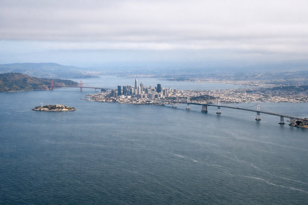
Takeoff from SFO
LEFTDeparting SFO on the eastbound runway, the aircraft must loop back left toward its northwest heading for Asia, and during that turn the nose swings through due north — putting San Francisco's skyline, the Golden Gate Bridge, and the Marin Headlands squarely on the left side before the plane heads out over open water.
Landing at SGN
RIGHTOn final approach into Tan Son Nhat the aircraft descends over the flat green checkerboard of the Mekong Delta's rice paddies and canals southwest of the city; because downtown sits south of the runway centerline, the Saigon River and Ho Chi Minh City's skyline appear off the right side just before touchdown.
Landmarks on this routeAll landmarks →
Will your flight be in sunlight?
Pick a date and time in the Sun Map to watch the sun move across your whole flight.
About This Route
Which side of the plane should I sit on flying from San Francisco International (SFO) to Tansonnhat International (SGN)?
Sit on the Left side of the plane for the best views on flights from San Francisco to Ho Chi Minh City. Both ends of this transpacific flight offer strong bookends, but the left side's departure sequence over San Francisco Bay — with the Golden Gate Bridge, city skyline, and Marin coastline — is a more visually iconic and higher-contrast scene than the delta-and-skyline glimpse on landing, giving the left side a slight edge over an otherwise ocean-dominated route.
What can I see during takeoff from San Francisco International in San Francisco?
During takeoff from San Francisco International (SFO), sit on the Left side for the best views. Departing SFO on the eastbound runway, the aircraft must loop back left toward its northwest heading for Asia, and during that turn the nose swings through due north — putting San Francisco's skyline, the Golden Gate Bridge, and the Marin Headlands squarely on the left side before the plane heads out over open water. Notable sights include: San Francisco skyline, Golden Gate Bridge, Marin Headlands, Pacific coastline.
What can I see when landing at Tansonnhat International in Ho Chi Minh City?
When landing at Tansonnhat International (SGN), sit on the Right side for the best views. On final approach into Tan Son Nhat the aircraft descends over the flat green checkerboard of the Mekong Delta's rice paddies and canals southwest of the city; because downtown sits south of the runway centerline, the Saigon River and Ho Chi Minh City's skyline appear off the right side just before touchdown. Notable sights include: Mekong Delta rice paddies and canals, Saigon River, Ho Chi Minh City skyline (Landmark 81, Bitexco Financial Tower).
How long is the flight from San Francisco to Ho Chi Minh City?
The flight from San Francisco International (SFO) to Tansonnhat International (SGN) takes about 15 hours 40 minutes. The shortest flight path between them is 7,828 miles (12,598 km); winds and air traffic control usually add a few percent.
What does the San Francisco to Ho Chi Minh City flight path pass over?
The route crosses well over 12 hours of open North Pacific water with no land visible, arcing up toward higher latitudes before descending through the western Pacific past Taiwan and the Philippines, then crossing the South China Sea and Vietnam's coastline near the Con Dao Islands on the way into Ho Chi Minh City.