The right side wins on both ends of the flight: Ho Chi Minh City's river and skyline during takeoff, and Taiwan's Central Mountain Range during the descent into Taipei, giving it more consistent visual interest than the ocean-and-flat-coast views on the left.
Flown SGN to TPE? Did we get it right?
Flight Path
Ho Chi Minh City to Taipei is 1,372 miles (2,208 km), a flight of about 3 hours 15 minutes.
South China Sea open water, Pratas Island (Dongsha Atoll) reef visible below cruise track, Luzon Strait and Bashi Channel near the Batanes Islands as the route nears Taiwan
Great circle distance and headings ›Phase by phase
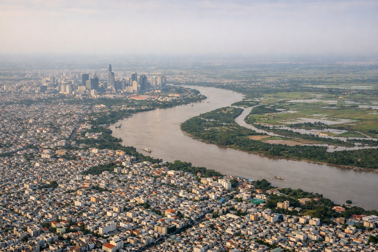
Takeoff from SGN
RIGHTDeparting Tan Son Nhat, the initial turn onto the northeast track puts Ho Chi Minh City's downtown core and the looping Saigon River on the right side of the aircraft, with the dense grid of the city giving way to the green patchwork of the Mekong Delta's canals. The left side mostly shows flat, undistinguished suburban sprawl and rice paddies with no real landmarks.
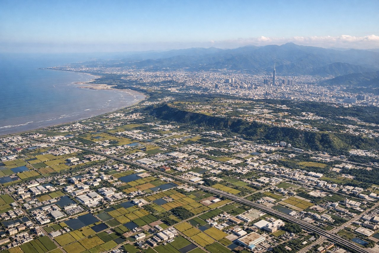
Landing at TPE
RIGHTOn the descent into Taipei, the approach path tracks up along Taiwan's west coast, and the right side faces inland toward the Central Mountain Range, whose steep green ridgelines rise dramatically just a short distance from the coastal plain. The left side only shows the flat Taiwan Strait and featureless coastal lowlands near Taoyuan.
Will your flight be in sunlight?
Pick a date and time in the Sun Map to watch the sun move across your whole flight.
About This Route
Which side of the plane should I sit on flying from Tansonnhat International (SGN) to Chiang Kai Shek International (TPE)?
Sit on the Right side of the plane for the best views on flights from Ho Chi Minh City to Taipei. The right side wins on both ends of the flight: Ho Chi Minh City's river and skyline during takeoff, and Taiwan's Central Mountain Range during the descent into Taipei, giving it more consistent visual interest than the ocean-and-flat-coast views on the left.
What can I see during takeoff from Tansonnhat International in Ho Chi Minh City?
During takeoff from Tansonnhat International (SGN), sit on the Right side for the best views. Departing Tan Son Nhat, the initial turn onto the northeast track puts Ho Chi Minh City's downtown core and the looping Saigon River on the right side of the aircraft, with the dense grid of the city giving way to the green patchwork of the Mekong Delta's canals. The left side mostly shows flat, undistinguished suburban sprawl and rice paddies with no real landmarks. Notable sights include: Saigon River bends through District 1, Ho Chi Minh City skyline (Landmark 81 tower), Mekong Delta waterways, Bien Hoa agricultural plains.
What can I see when landing at Chiang Kai Shek International in Taipei?
When landing at Chiang Kai Shek International (TPE), sit on the Right side for the best views. On the descent into Taipei, the approach path tracks up along Taiwan's west coast, and the right side faces inland toward the Central Mountain Range, whose steep green ridgelines rise dramatically just a short distance from the coastal plain. The left side only shows the flat Taiwan Strait and featureless coastal lowlands near Taoyuan. Notable sights include: Central Mountain Range ridgelines, Taoyuan tea-covered hills, Tamsui River estuary, Taiwan Strait coastline.
How long is the flight from Ho Chi Minh City to Taipei?
The flight from Tansonnhat International (SGN) to Chiang Kai Shek International (TPE) takes about 3 hours 15 minutes. The shortest flight path between them is 1,372 miles (2,208 km); winds and air traffic control usually add a few percent.
What does the Ho Chi Minh City to Taipei flight path pass over?
South China Sea open water, Pratas Island (Dongsha Atoll) reef visible below cruise track, Luzon Strait and Bashi Channel near the Batanes Islands as the route nears Taiwan