The left side tracks the Pacific-facing volcanic spine of Central America and Mexico for most of the flight, then delivers close-up views of Popocatépetl and Iztaccíhuatl on approach, while the right side shows mostly featureless Caribbean lowlands and eastern highlands.
Flown SJO to MEX? Did we get it right?
Flight Path
San Jose to Mexico City is 1,187 miles (1,910 km), a flight of about 3 hours 10 minutes.
The route crosses over Nicaragua's volcanic chain near Lake Nicaragua, the Guatemalan highlands with peaks like Fuego and Acatenango, and the mountainous Chiapas-Oaxaca border region of southern Mexico before descending into the Valley of Mexico.
Great circle distance and headings ›

Phase by phase
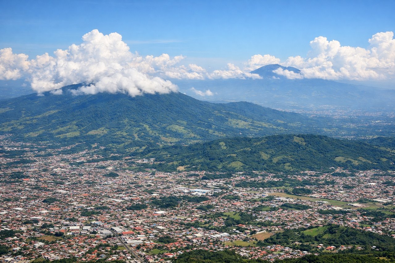
Takeoff from SJO
LEFTAfter departing SJO, aircraft typically bank northwest toward Mexico, putting the Gulf of Nicoya and Costa Rica's Pacific coastline on the left, along with a good look back at the volcanic peaks ringing the Central Valley. The right side mostly shows the Caribbean-facing slopes and lowlands, which are less distinct.
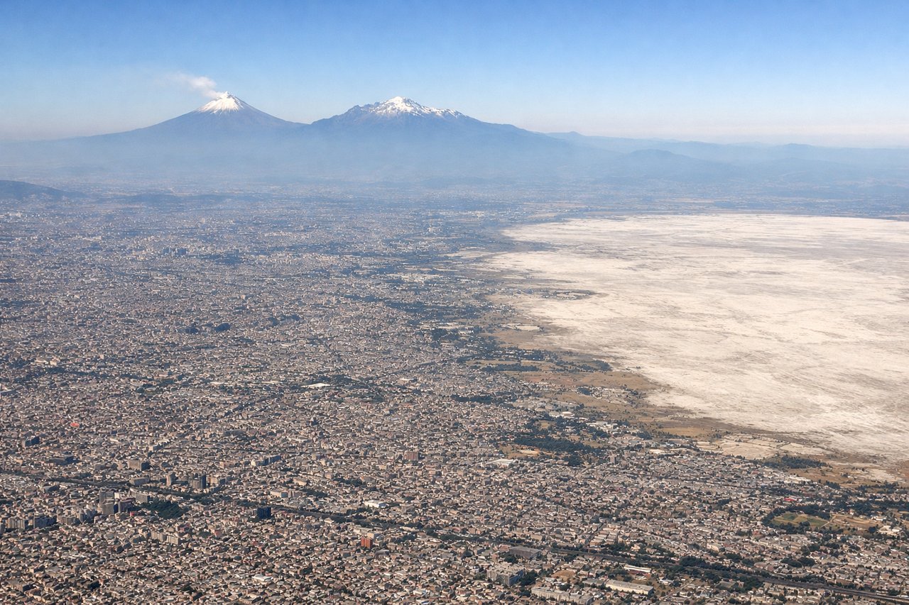
Landing at MEX
LEFTOn the descent into Mexico City from the southeast, the flight path typically skirts north of Popocatépetl and Iztaccíhuatl, keeping these two massive snow-capped volcanoes visible on the left before the aircraft turns into the Valley of Mexico and the sprawling city skyline comes into view. The right side mostly faces the flatter eastern highlands with fewer distinct landmarks.
Will your flight be in sunlight?
Pick a date and time in the Sun Map to watch the sun move across your whole flight.
About This Route
Which side of the plane should I sit on flying from Juan Santamaria International (SJO) to Licenciado Benito Juarez International (MEX)?
Sit on the Left side of the plane for the best views on flights from San Jose to Mexico City. The left side tracks the Pacific-facing volcanic spine of Central America and Mexico for most of the flight, then delivers close-up views of Popocatépetl and Iztaccíhuatl on approach, while the right side shows mostly featureless Caribbean lowlands and eastern highlands.
What can I see during takeoff from Juan Santamaria International in San Jose?
During takeoff from Juan Santamaria International (SJO), sit on the Left side for the best views. After departing SJO, aircraft typically bank northwest toward Mexico, putting the Gulf of Nicoya and Costa Rica's Pacific coastline on the left, along with a good look back at the volcanic peaks ringing the Central Valley. The right side mostly shows the Caribbean-facing slopes and lowlands, which are less distinct. Notable sights include: Gulf of Nicoya, Central Valley volcanic rim (Poás/Barva), Pacific coastline of Costa Rica.
What can I see when landing at Licenciado Benito Juarez International in Mexico City?
When landing at Licenciado Benito Juarez International (MEX), sit on the Left side for the best views. On the descent into Mexico City from the southeast, the flight path typically skirts north of Popocatépetl and Iztaccíhuatl, keeping these two massive snow-capped volcanoes visible on the left before the aircraft turns into the Valley of Mexico and the sprawling city skyline comes into view. The right side mostly faces the flatter eastern highlands with fewer distinct landmarks. Notable sights include: Popocatépetl volcano, Iztaccíhuatl volcano, Valley of Mexico basin, Mexico City skyline.
How long is the flight from San Jose to Mexico City?
The flight from Juan Santamaria International (SJO) to Licenciado Benito Juarez International (MEX) takes about 3 hours 10 minutes. The shortest flight path between them is 1,187 miles (1,910 km); winds and air traffic control usually add a few percent.
What does the San Jose to Mexico City flight path pass over?
The route crosses over Nicaragua's volcanic chain near Lake Nicaragua, the Guatemalan highlands with peaks like Fuego and Acatenango, and the mountainous Chiapas-Oaxaca border region of southern Mexico before descending into the Valley of Mexico.