Right side scores higher (3.5 vs 2.5) due to superior coastal and urban scenery on both ends of the flight. The San Juan departure captures the Caribbean harbor and city waterfront, while the LAX arrival delivers the Pacific coastline, Santa Monica Bay, and the dramatic approach over the Los Angeles basin. Left side is dominated by inland terrain with less visual variety and fewer recognizable landmarks.
Flown SJU to LAX? Did we get it right?
Flight Path
San Juan to Los Angeles is 3,382 miles (5,443 km), a flight of about 5 hours 45 minutes.
The flight path crosses the continental United States from southeast to southwest. Notable features visible from cruise altitude include the Mississippi River valley and its tributaries (around 2h into flight), the Great Plains and Rocky Mountain foothills (3h-3.5h), the Colorado Plateau and high desert regions of Arizona and New Mexico (4h-4.5h), and finally the Mojave Desert and San Bernardino Mountains approaching Los Angeles (final 45 minutes). The route typically passes south of the Grand Canyon but north of the Sonoran Desert. On clear days, the Colorado River, Lake Mead, and the Sierra Nevada mountains may be visible in the final descent phase.
Great circle distance and headings ›Phase by phase
Takeoff from SJU
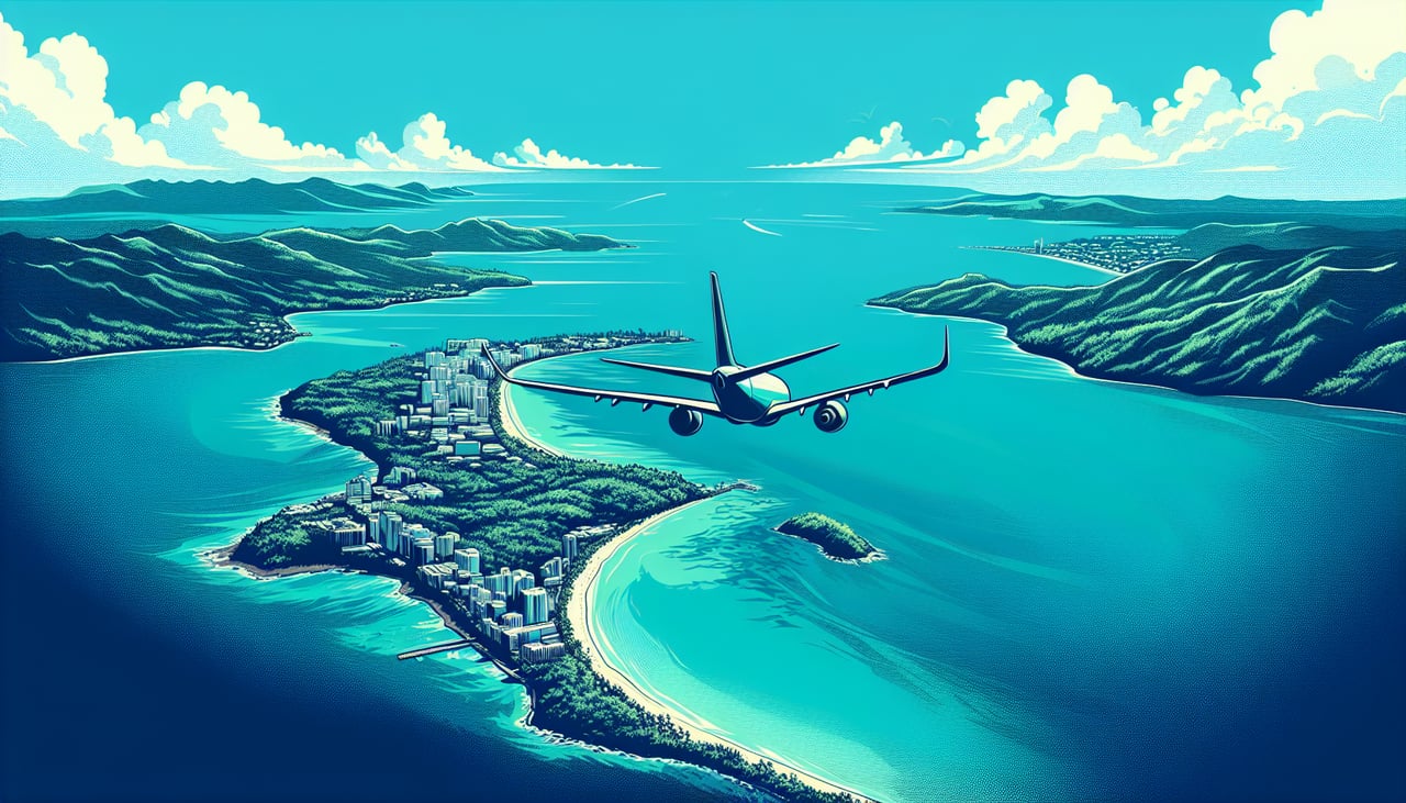
RIGHTRight side captures San Juan harbor, the city waterfront, and the northeastern Puerto Rico coastline during the typical eastward departure on runway 08. Left side faces inland toward the central island interior with minimal urban or coastal features.
Landing at LAX
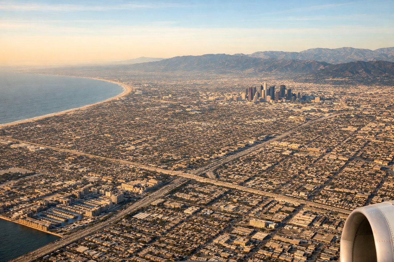
RIGHTRight side offers the most dramatic approach scenery: the descent over the Pacific Ocean, the Los Angeles basin sprawl, and the final approach over Santa Monica Bay and the coastal mountains. Left side during typical west-flow landing (runway 24R/25L) faces the inland desert and urban sprawl without coastal drama.
Will your flight be in sunlight?
Pick a date and time in the Sun Map to watch the sun move across your whole flight.
About This Route
Which side of the plane should I sit on flying from Luis Munoz Marin International (SJU) to Los Angeles International (LAX)?
Sit on the Right side of the plane for the best views on flights from San Juan to Los Angeles. Right side scores higher (3.5 vs 2.5) due to superior coastal and urban scenery on both ends of the flight. The San Juan departure captures the Caribbean harbor and city waterfront, while the LAX arrival delivers the Pacific coastline, Santa Monica Bay, and the dramatic approach over the Los Angeles basin. Left side is dominated by inland terrain with less visual variety and fewer recognizable landmarks.
What can I see during takeoff from Luis Munoz Marin International in San Juan?
During takeoff from Luis Munoz Marin International (SJU), sit on the Right side for the best views. Right side captures San Juan harbor, the city waterfront, and the northeastern Puerto Rico coastline during the typical eastward departure on runway 08. Left side faces inland toward the central island interior with minimal urban or coastal features. Notable sights include: San Juan Bay and harbor, Old San Juan waterfront district, northeastern Puerto Rico coastline, Atlantic Ocean horizon.
What can I see when landing at Los Angeles International in Los Angeles?
When landing at Los Angeles International (LAX), sit on the Right side for the best views. Right side offers the most dramatic approach scenery: the descent over the Pacific Ocean, the Los Angeles basin sprawl, and the final approach over Santa Monica Bay and the coastal mountains. Left side during typical west-flow landing (runway 24R/25L) faces the inland desert and urban sprawl without coastal drama. Notable sights include: Santa Monica Bay, Pacific coastline, Santa Monica and Malibu beaches, San Gabriel Mountains in the distance, Los Angeles basin urban grid.
How long is the flight from San Juan to Los Angeles?
The flight from Luis Munoz Marin International (SJU) to Los Angeles International (LAX) takes about 5 hours 45 minutes. The shortest flight path between them is 3,382 miles (5,443 km); winds and air traffic control usually add a few percent.
What does the San Juan to Los Angeles flight path pass over?
The flight path crosses the continental United States from southeast to southwest. Notable features visible from cruise altitude include the Mississippi River valley and its tributaries (around 2h into flight), the Great Plains and Rocky Mountain foothills (3h-3.5h), the Colorado Plateau and high desert regions of Arizona and New Mexico (4h-4.5h), and finally the Mojave Desert and San Bernardino Mountains approaching Los Angeles (final 45 minutes). The route typically passes south of the Grand Canyon but north of the Sonoran Desert. On clear days, the Colorado River, Lake Mead, and the Sierra Nevada mountains may be visible in the final descent phase.