Samarkand to Istanbul is 1,997 miles (3,213 km), a flight of about 4 hours 10 minutes.
The left side wins both takeoff and landing with genuine terrain and city interest — Samarkand's mountain-backed oasis on departure and the Bosphorus/Istanbul skyline on arrival — while cruise-phase views over the southern Caspian coast and Alborz foothills add further variety on that side.
Flight Path
Southern Caspian Sea coastline, Alborz Mountains foothills (northern Iran), eastern Anatolian plateau near Lake Van and the Ararat massif region
Great circle distance and headings ›


_in_Istanbul.jpg?width=600)
Phase by phase
Takeoff from SKD
LEFTDeparting SKD to the west, the left (south) side looks toward the Zeravshan Range foothills and the irrigated Zeravshan River valley around Samarkand, while the right side only shows the flat Kyzylkum desert fringe.
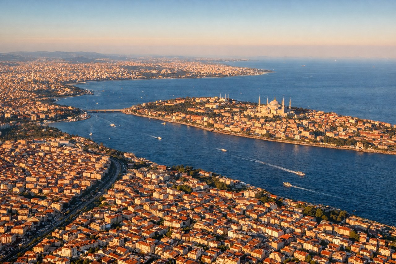
Landing at IST
LEFTOn approach into IST from the east, the south-facing side gives passengers a view over the Sea of Marmara and the Bosphorus mouth with Istanbul's skyline and bridges, while the north side mostly shows forested Black Sea hinterland with no coastline visible.
Landmarks on this routeAll landmarks →
Will your flight be in sunlight?
Pick a date and time in the Sun Map to watch the sun move across your whole flight.
About This Route
Which side of the plane should I sit on flying from Samarkand International Airport (SKD) to İstanbul Airport (IST)?
Sit on the Left side of the plane for the best views on flights from Samarkand to Istanbul. The left side wins both takeoff and landing with genuine terrain and city interest — Samarkand's mountain-backed oasis on departure and the Bosphorus/Istanbul skyline on arrival — while cruise-phase views over the southern Caspian coast and Alborz foothills add further variety on that side.
What can I see during takeoff from Samarkand International Airport in Samarkand?
During takeoff from Samarkand International Airport (SKD), sit on the Left side for the best views. Departing SKD to the west, the left (south) side looks toward the Zeravshan Range foothills and the irrigated Zeravshan River valley around Samarkand, while the right side only shows the flat Kyzylkum desert fringe. Notable sights include: Zeravshan Range foothills, Zeravshan River valley, Samarkand's oasis farmland.
What can I see when landing at İstanbul Airport in Istanbul?
When landing at İstanbul Airport (IST), sit on the Left side for the best views. On approach into IST from the east, the south-facing side gives passengers a view over the Sea of Marmara and the Bosphorus mouth with Istanbul's skyline and bridges, while the north side mostly shows forested Black Sea hinterland with no coastline visible. Notable sights include: Sea of Marmara, Bosphorus Strait, Istanbul skyline, Princes' Islands.
How long is the flight from Samarkand to Istanbul?
The flight from Samarkand International Airport (SKD) to İstanbul Airport (IST) takes about 4 hours 10 minutes. The shortest flight path between them is 1,997 miles (3,213 km); winds and air traffic control usually add a few percent.
What does the Samarkand to Istanbul flight path pass over?
Southern Caspian Sea coastline, Alborz Mountains foothills (northern Iran), eastern Anatolian plateau near Lake Van and the Ararat massif region