San Luis Potosi to Mexico City is 229 miles (369 km), a flight of about 1 hour 15 minutes.
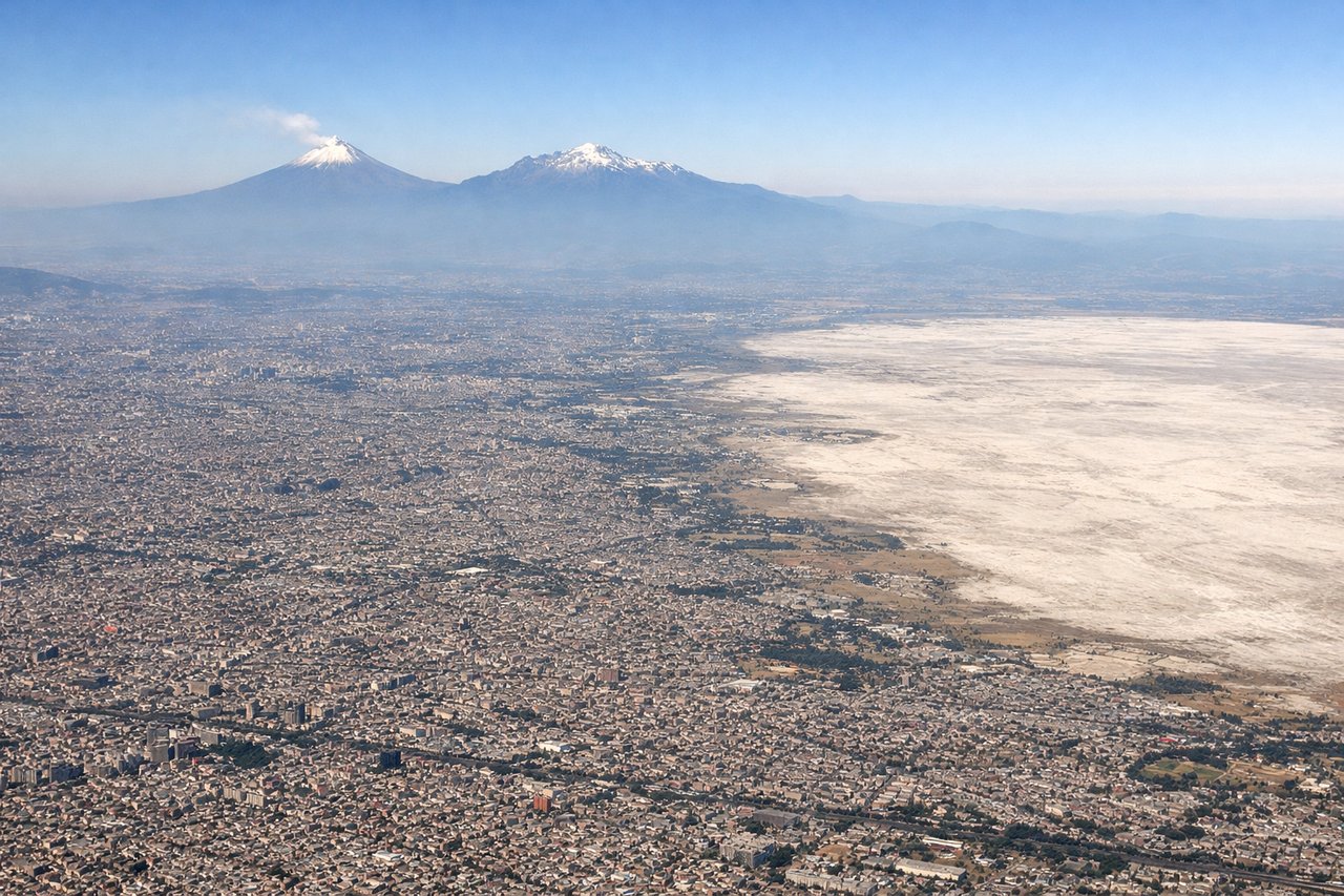
While the takeoff offers good Sierra Madre views on the right, the landing approach provides superior scenic value with the iconic snow-capped volcanoes of the Trans-Mexican Belt dominating the left side during descent. The volcanic peaks are more visually distinctive and memorable than the plateau departure.
Flight Path
Bajío agricultural plains (central Mexico's breadbasket with geometric field patterns), scattered volcanic cones and lava fields (Campos de Lava), transition from high desert to subtropical valley terrain, occasional small lakes and reservoirs in the central highlands
Great circle distance and headings ›_(cropped).jpg?width=600)

Phase by phase
Takeoff from SLP
RIGHTRight-side seats offer views of the Sierra Madre Oriental ridgeline as the aircraft climbs southeastward from San Luis Potosí. The mountain range runs roughly parallel to the initial departure corridor, providing sustained elevation contrast against the high plateau.
Landing at MEX
LEFTLeft-side seats provide excellent views of the Trans-Mexican Volcanic Belt as the aircraft descends into Mexico City from the north. The snow-capped peaks of Popocatépetl and Iztaccíhuatl dominate the approach corridor and are clearly visible during final descent.
Landmarks on this routeAll landmarks →
Will your flight be in sunlight?
Pick a date and time in the Sun Map to watch the sun move across your whole flight.
About This Route
Which side of the plane should I sit on flying from Ponciano Arriaga International (SLP) to Licenciado Benito Juarez International (MEX)?
Sit on the Left side of the plane for the best views on flights from San Luis Potosi to Mexico City. While the takeoff offers good Sierra Madre views on the right, the landing approach provides superior scenic value with the iconic snow-capped volcanoes of the Trans-Mexican Belt dominating the left side during descent. The volcanic peaks are more visually distinctive and memorable than the plateau departure.
What can I see during takeoff from Ponciano Arriaga International in San Luis Potosi?
During takeoff from Ponciano Arriaga International (SLP), sit on the Right side for the best views. Right-side seats offer views of the Sierra Madre Oriental ridgeline as the aircraft climbs southeastward from San Luis Potosí. The mountain range runs roughly parallel to the initial departure corridor, providing sustained elevation contrast against the high plateau. Notable sights include: Sierra Madre Oriental (eastern escarpment), San Luis Potosí city grid (receding northward), high desert plateau terrain, scattered volcanic cones to the southeast.
What can I see when landing at Licenciado Benito Juarez International in Mexico City?
When landing at Licenciado Benito Juarez International (MEX), sit on the Left side for the best views. Left-side seats provide excellent views of the Trans-Mexican Volcanic Belt as the aircraft descends into Mexico City from the north. The snow-capped peaks of Popocatépetl and Iztaccíhuatl dominate the approach corridor and are clearly visible during final descent. Notable sights include: Popocatépetl volcano (5,426 m, often snow-capped), Iztaccíhuatl volcano (5,230 m, distinctive triple-peaked silhouette), Mexico City metropolitan sprawl (visible as urban grid in valley floor), Lake Texcoco remnants (shallow water bodies and wetlands).
How long is the flight from San Luis Potosi to Mexico City?
The flight from Ponciano Arriaga International (SLP) to Licenciado Benito Juarez International (MEX) takes about 1 hour 15 minutes. The shortest flight path between them is 229 miles (369 km); winds and air traffic control usually add a few percent.
What does the San Luis Potosi to Mexico City flight path pass over?
Bajío agricultural plains (central Mexico's breadbasket with geometric field patterns), scattered volcanic cones and lava fields (Campos de Lava), transition from high desert to subtropical valley terrain, occasional small lakes and reservoirs in the central highlands