While takeoff offers coastal Gulf views, the landing sequence provides more dramatic and visually distinctive scenery: the Cascade Range, Mount Rainier, and Puget Sound are far more striking than Florida's flat coastal terrain. Left-side seats capture the best of the approach.
Flown SRQ to SEA? Did we get it right?
Flight Path
Sarasota/Bradenton to Seattle is 2,544 miles (4,094 km), a flight of about 5 hours 15 minutes.
The flight path crosses the continental United States from southeast to northwest. Notable features include: the Mississippi River valley and its tributaries (visible around 2-3 hours into flight), the Great Plains and their subtle topographic variations, the Rocky Mountains (particularly visible over Colorado and Wyoming), the Great Basin's arid terrain, and the Sierra Nevada before reaching the Pacific Northwest. The Appalachian foothills may be visible during the initial climb-out phase over the southeastern United States.
Great circle distance and headings ›


Phase by phase
Takeoff from SRQ
RIGHTRight-side seats offer views of Tampa Bay and the Gulf of Mexico coastline immediately after departure. The aircraft climbs northwestward, and right-side windows capture the broad expanse of Florida's west coast with its barrier islands and shallow gulf waters.
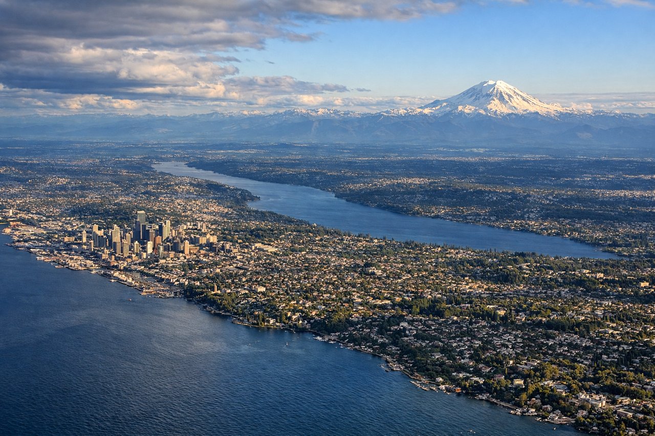
Landing at SEA
LEFTLeft-side seats provide excellent views during the descent into Seattle-Tacoma. The aircraft approaches from the east over the Cascade Range, and left windows frame the dramatic transition from the Cascades through the Puget Sound basin to the airport.
Will your flight be in sunlight?
Pick a date and time in the Sun Map to watch the sun move across your whole flight.
About This Route
Which side of the plane should I sit on flying from Sarasota Bradenton International Airport (SRQ) to Seattle Tacoma International (SEA)?
Sit on the Left side of the plane for the best views on flights from Sarasota/Bradenton to Seattle. While takeoff offers coastal Gulf views, the landing sequence provides more dramatic and visually distinctive scenery: the Cascade Range, Mount Rainier, and Puget Sound are far more striking than Florida's flat coastal terrain. Left-side seats capture the best of the approach.
What can I see during takeoff from Sarasota Bradenton International Airport in Sarasota/Bradenton?
During takeoff from Sarasota Bradenton International Airport (SRQ), sit on the Right side for the best views. Right-side seats offer views of Tampa Bay and the Gulf of Mexico coastline immediately after departure. The aircraft climbs northwestward, and right-side windows capture the broad expanse of Florida's west coast with its barrier islands and shallow gulf waters. Notable sights include: Tampa Bay, Gulf of Mexico, Sanibel Island and barrier islands, Florida's gulf coastline.
What can I see when landing at Seattle Tacoma International in Seattle?
When landing at Seattle Tacoma International (SEA), sit on the Left side for the best views. Left-side seats provide excellent views during the descent into Seattle-Tacoma. The aircraft approaches from the east over the Cascade Range, and left windows frame the dramatic transition from the Cascades through the Puget Sound basin to the airport. Notable sights include: Cascade Range, Mount Rainier, Puget Sound, Lake Washington.
How long is the flight from Sarasota/Bradenton to Seattle?
The flight from Sarasota Bradenton International Airport (SRQ) to Seattle Tacoma International (SEA) takes about 5 hours 15 minutes. The shortest flight path between them is 2,544 miles (4,094 km); winds and air traffic control usually add a few percent.
What does the Sarasota/Bradenton to Seattle flight path pass over?
The flight path crosses the continental United States from southeast to northwest. Notable features include: the Mississippi River valley and its tributaries (visible around 2-3 hours into flight), the Great Plains and their subtle topographic variations, the Rocky Mountains (particularly visible over Colorado and Wyoming), the Great Basin's arid terrain, and the Sierra Nevada before reaching the Pacific Northwest. The Appalachian foothills may be visible during the initial climb-out phase over the southeastern United States.