The left (coastal) side scores higher due to Salvador's scenic harbor departure with Baía de Todos os Santos and Atlantic views, which outweighs Brasília's modernist urban geometry on approach. The takeoff scenery is more visually dramatic and varied than the landing approach, and the flight's midpoint over flat cerrado offers little compensation on either side.
Flown SSA to BSB? Did we get it right?
Flight Path
Salvador to Brasilia is 674 miles (1,085 km), a flight of about 1 hour 50 minutes.
Recôncavo Baiano lowlands transitioning to Planalto Central plateau; sparse cerrado vegetation with scattered lakes and reservoirs; Rio Jequitinhonha valley in the distance; flat to gently rolling terrain with minimal elevation change
Great circle distance and headings ›Phase by phase
Takeoff from SSA
LEFTSalvador's coastal departure offers views of Baía de Todos os Santos and the Atlantic shoreline during climb-out, with urban harbor infrastructure visible. The right side faces inland immediately over flat terrain with minimal visual interest.
Landing at BSB
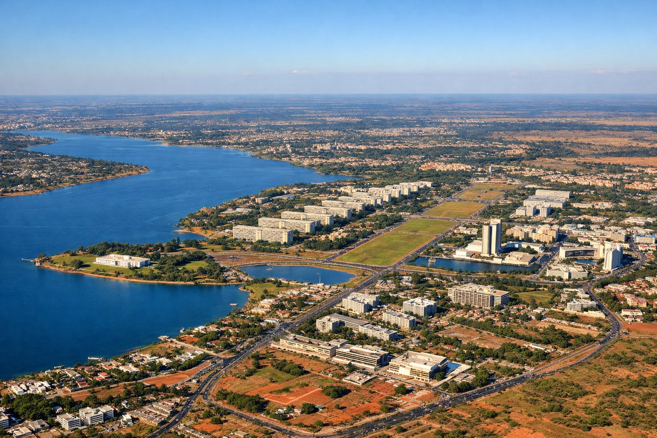
RIGHTBrasília's approach from the east reveals the city's distinctive modernist urban plan and artificial Lago Paranoá, which are visually striking from altitude. The left side shows only flat cerrado scrubland with minimal distinguishing features during descent.
Will your flight be in sunlight?
Pick a date and time in the Sun Map to watch the sun move across your whole flight.
About This Route
Which side of the plane should I sit on flying from Deputado Luis Eduardo Magalhaes (SSA) to Presidente Juscelino Kubitschek (BSB)?
Sit on the Left side of the plane for the best views on flights from Salvador to Brasilia. The left (coastal) side scores higher due to Salvador's scenic harbor departure with Baía de Todos os Santos and Atlantic views, which outweighs Brasília's modernist urban geometry on approach. The takeoff scenery is more visually dramatic and varied than the landing approach, and the flight's midpoint over flat cerrado offers little compensation on either side.
What can I see during takeoff from Deputado Luis Eduardo Magalhaes in Salvador?
During takeoff from Deputado Luis Eduardo Magalhaes (SSA), sit on the Left side for the best views. Salvador's coastal departure offers views of Baía de Todos os Santos and the Atlantic shoreline during climb-out, with urban harbor infrastructure visible. The right side faces inland immediately over flat terrain with minimal visual interest. Notable sights include: Baía de Todos os Santos, Salvador harbor and waterfront districts, Atlantic coastline, Recôncavo Baiano lowlands.
What can I see when landing at Presidente Juscelino Kubitschek in Brasilia?
When landing at Presidente Juscelino Kubitschek (BSB), sit on the Right side for the best views. Brasília's approach from the east reveals the city's distinctive modernist urban plan and artificial Lago Paranoá, which are visually striking from altitude. The left side shows only flat cerrado scrubland with minimal distinguishing features during descent. Notable sights include: Lago Paranoá (artificial lake), Brasília's modernist city grid and monumental axis, Planalto Central plateau, cerrado vegetation patterns.
How long is the flight from Salvador to Brasilia?
The flight from Deputado Luis Eduardo Magalhaes (SSA) to Presidente Juscelino Kubitschek (BSB) takes about 1 hour 50 minutes. The shortest flight path between them is 674 miles (1,085 km); winds and air traffic control usually add a few percent.
What does the Salvador to Brasilia flight path pass over?
Recôncavo Baiano lowlands transitioning to Planalto Central plateau; sparse cerrado vegetation with scattered lakes and reservoirs; Rio Jequitinhonha valley in the distance; flat to gently rolling terrain with minimal elevation change