While takeoff briefly favors the left with Korea's interior ridgelines, the right side dominates the long cruise and arrival phases with the Yellow Sea and Chinese coastline early on, then the Gulf of Tonkin, Vietnamese coast, and finally the Gulf of Thailand and Chao Phraya delta on approach — giving it more consistent coastal and river geography across the flight.
Flown SSN to BKK? Did we get it right?
Flight Path
Seoul East to Bangkok is 2,307 miles (3,712 km), a flight of about 5 hours.
The route crosses the Yellow Sea, skirts the southeastern Chinese coastline near Fujian, passes over the Gulf of Tonkin and northern Vietnam, then continues over the South China Sea before entering the Gulf of Thailand toward Bangkok.
Great circle distance and headings ›

Phase by phase
Takeoff from SSN
LEFTClimbing out from the Seoul area, the left side faces the rugged interior ridgelines of the Sobaek and Gwangju mountain ranges east of the Han River basin, giving a brief but genuine burst of relief terrain before the route turns southwest over flatter coastal plains.
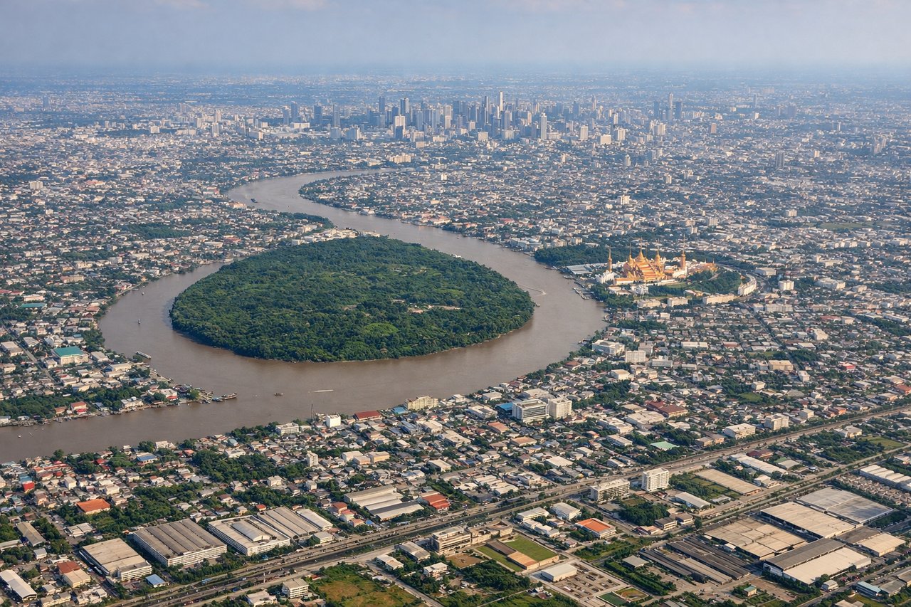
Landing at BKK
RIGHTOn approach into Suvarnabhumi from the north, the right side of the aircraft faces west toward the Gulf of Thailand coastline and the braided channels of the Chao Phraya delta, offering the more distinctive water and river-delta scenery as the plane descends over Bangkok's outskirts.
Will your flight be in sunlight?
Pick a date and time in the Sun Map to watch the sun move across your whole flight.
About This Route
Which side of the plane should I sit on flying from Seoul Ab (SSN) to Suvarnabhumi Airport (BKK)?
Sit on the Right side of the plane for the best views on flights from Seoul East to Bangkok. While takeoff briefly favors the left with Korea's interior ridgelines, the right side dominates the long cruise and arrival phases with the Yellow Sea and Chinese coastline early on, then the Gulf of Tonkin, Vietnamese coast, and finally the Gulf of Thailand and Chao Phraya delta on approach — giving it more consistent coastal and river geography across the flight.
What can I see during takeoff from Seoul Ab in Seoul East?
During takeoff from Seoul Ab (SSN), sit on the Left side for the best views. Climbing out from the Seoul area, the left side faces the rugged interior ridgelines of the Sobaek and Gwangju mountain ranges east of the Han River basin, giving a brief but genuine burst of relief terrain before the route turns southwest over flatter coastal plains. Notable sights include: Han River valley, Gwangju Mountains, southern Seoul suburbs, Korean interior ridgelines.
What can I see when landing at Suvarnabhumi Airport in Bangkok?
When landing at Suvarnabhumi Airport (BKK), sit on the Right side for the best views. On approach into Suvarnabhumi from the north, the right side of the aircraft faces west toward the Gulf of Thailand coastline and the braided channels of the Chao Phraya delta, offering the more distinctive water and river-delta scenery as the plane descends over Bangkok's outskirts. Notable sights include: Gulf of Thailand coastline, Chao Phraya River delta, Bangkok's eastern suburbs, flooded rice paddies.
How long is the flight from Seoul East to Bangkok?
The flight from Seoul Ab (SSN) to Suvarnabhumi Airport (BKK) takes about 5 hours. The shortest flight path between them is 2,307 miles (3,712 km); winds and air traffic control usually add a few percent.
What does the Seoul East to Bangkok flight path pass over?
The route crosses the Yellow Sea, skirts the southeastern Chinese coastline near Fujian, passes over the Gulf of Tonkin and northern Vietnam, then continues over the South China Sea before entering the Gulf of Thailand toward Bangkok.