St. Criox Island to Atlanta is 1,639 miles (2,638 km), a flight of about 4 hours 15 minutes.
While takeoff from St. Croix favors the right side, the landing approach into Atlanta from the northeast provides superior scenic value with the Appalachian foothills, river valley, and urban landscape all visible together. The left side captures this approach sequence most effectively.
Flight Path
The flight path crosses the Atlantic Ocean for roughly 2.5 hours with no major landmarks visible—open ocean and occasional cloud formations. As the aircraft approaches the continental United States, the Georgia coastline becomes visible (Savannah area and barrier islands), followed by the transition inland over central Georgia's forests and agricultural lands. The Chattahoochee River valley becomes increasingly prominent as the aircraft descends toward Atlanta.
Great circle distance and headings ›Phase by phase
Takeoff from STX
RIGHTRight-side seats offer immediate views of St. Croix's southern and eastern coastlines as the aircraft climbs northwestward. You'll see the island's irregular shoreline, shallow turquoise waters, and the transition to deeper blue ocean.
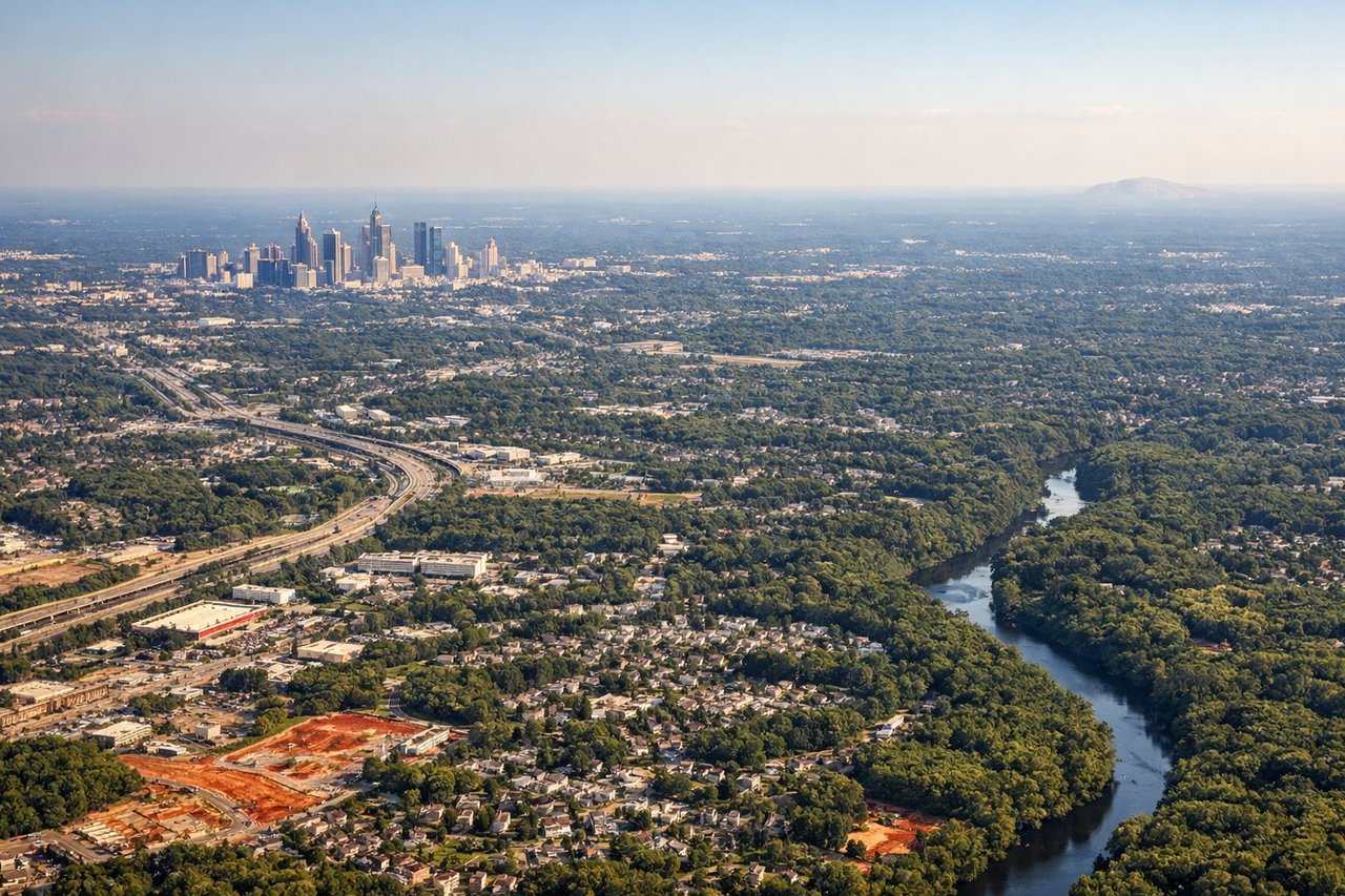
Landing at ATL
LEFTLeft-side seats provide the best views during the final approach into Atlanta. As the aircraft descends from the northeast, you'll see the Appalachian foothills, the Chattahoochee River valley, and Atlanta's sprawling urban grid before touchdown.
Landmarks on this routeAll landmarks →
Will your flight be in sunlight?
Pick a date and time in the Sun Map to watch the sun move across your whole flight.
About This Route
Which side of the plane should I sit on flying from Henry E Rohlsen (STX) to The William B Hartsfield Atlanta International (ATL)?
Sit on the Left side of the plane for the best views on flights from St. Criox Island to Atlanta. While takeoff from St. Croix favors the right side, the landing approach into Atlanta from the northeast provides superior scenic value with the Appalachian foothills, river valley, and urban landscape all visible together. The left side captures this approach sequence most effectively.
What can I see during takeoff from Henry E Rohlsen in St. Criox Island?
During takeoff from Henry E Rohlsen (STX), sit on the Right side for the best views. Right-side seats offer immediate views of St. Croix's southern and eastern coastlines as the aircraft climbs northwestward. You'll see the island's irregular shoreline, shallow turquoise waters, and the transition to deeper blue ocean. Notable sights include: St. Croix's southern coast with Christiansted Harbor, the Caribbean Sea gradient from turquoise shallows to deep blue, Buck Island (small but visible to the northeast).
What can I see when landing at The William B Hartsfield Atlanta International in Atlanta?
When landing at The William B Hartsfield Atlanta International (ATL), sit on the Left side for the best views. Left-side seats provide the best views during the final approach into Atlanta. As the aircraft descends from the northeast, you'll see the Appalachian foothills, the Chattahoochee River valley, and Atlanta's sprawling urban grid before touchdown. Notable sights include: The Appalachian Mountains' southern ridges (Blue Ridge foothills) to the north and northwest, the Chattahoochee River snaking through the landscape, Atlanta's downtown skyline and urban sprawl, Hartsfield-Jackson airport runways and taxiways.
How long is the flight from St. Criox Island to Atlanta?
The flight from Henry E Rohlsen (STX) to The William B Hartsfield Atlanta International (ATL) takes about 4 hours 15 minutes. The shortest flight path between them is 1,639 miles (2,638 km); winds and air traffic control usually add a few percent.
What does the St. Criox Island to Atlanta flight path pass over?
The flight path crosses the Atlantic Ocean for roughly 2.5 hours with no major landmarks visible—open ocean and occasional cloud formations. As the aircraft approaches the continental United States, the Georgia coastline becomes visible (Savannah area and barrier islands), followed by the transition inland over central Georgia's forests and agricultural lands. The Chattahoochee River valley becomes increasingly prominent as the aircraft descends toward Atlanta.