While the right side wins at takeoff for the Tyrrhenian coast and Calabrian mountains, the left side delivers the more sustained and dramatic views across the full flight: the Italian peninsula's western coastline during climb, the Alps crossing with the Swiss and Bavarian Alps visible to the left in the distance, and the rewarding Frankfurt skyline approach. The left side edges it overall.
Flown SUF to FRA? Did we get it right?
Flight Path
Lamezia to Frankfurt is 856 miles (1,377 km), a flight of about 2 hours 40 minutes.
The flight tracks north-northwest over the Italian peninsula, crossing Campania and Lazio before reaching the Po Valley flatlands near Bologna. The Alps are crossed roughly over the Brenner Pass corridor or slightly west, with the Austrian and Bavarian Alps visible as a dramatic snow-capped wall. Descending into Germany, the flight passes over the Swabian highlands and Baden-Württemberg before the Rhine-Main plain opens up toward Frankfurt.
Great circle distance and headings ›


Phase by phase
Takeoff from SUF
RIGHTLamezia Terme's runway 10/28 means northbound departures typically involve a right turn climbing out over the Tyrrhenian Sea. The right side gives you the Calabrian coastline and the Gulf of Sant'Eufemia before the aircraft turns north. The Sila Massif and Aspromonte ranges are visible to the east on the right as you climb.
Landing at FRA
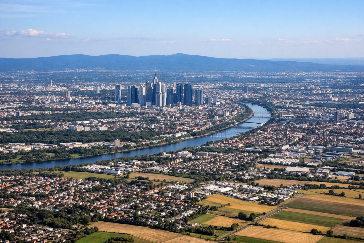
LEFTFrankfurt's main arrival from the south typically uses runway 25L/25R, meaning the aircraft approaches from the southeast over the Rhine-Main region. The left side gives a clear view of Frankfurt's skyline, the Rhine River, and the Taunus hills to the north as you descend. The right side faces south toward flat farmland with fewer distinctive features.
Will your flight be in sunlight?
Pick a date and time in the Sun Map to watch the sun move across your whole flight.
About This Route
Which side of the plane should I sit on flying from Lamezia Terme (SUF) to Frankfurt Main (FRA)?
Sit on the Left side of the plane for the best views on flights from Lamezia to Frankfurt. While the right side wins at takeoff for the Tyrrhenian coast and Calabrian mountains, the left side delivers the more sustained and dramatic views across the full flight: the Italian peninsula's western coastline during climb, the Alps crossing with the Swiss and Bavarian Alps visible to the left in the distance, and the rewarding Frankfurt skyline approach. The left side edges it overall.
What can I see during takeoff from Lamezia Terme in Lamezia?
During takeoff from Lamezia Terme (SUF), sit on the Right side for the best views. Lamezia Terme's runway 10/28 means northbound departures typically involve a right turn climbing out over the Tyrrhenian Sea. The right side gives you the Calabrian coastline and the Gulf of Sant'Eufemia before the aircraft turns north. The Sila Massif and Aspromonte ranges are visible to the east on the right as you climb. Notable sights include: Gulf of Sant'Eufemia (Tyrrhenian Sea), Sila Massif plateau to the east, Calabrian coastal plain below, Monte Reventino ridge to the northeast.
What can I see when landing at Frankfurt Main in Frankfurt?
When landing at Frankfurt Main (FRA), sit on the Left side for the best views. Frankfurt's main arrival from the south typically uses runway 25L/25R, meaning the aircraft approaches from the southeast over the Rhine-Main region. The left side gives a clear view of Frankfurt's skyline, the Rhine River, and the Taunus hills to the north as you descend. The right side faces south toward flat farmland with fewer distinctive features. Notable sights include: Frankfurt city skyline (Bankenviertel high-rises), Rhine River and Main River confluence area, Taunus hills to the north, Rhine-Main flatlands.
How long is the flight from Lamezia to Frankfurt?
The flight from Lamezia Terme (SUF) to Frankfurt Main (FRA) takes about 2 hours 40 minutes. The shortest flight path between them is 856 miles (1,377 km); winds and air traffic control usually add a few percent.
What does the Lamezia to Frankfurt flight path pass over?
The flight tracks north-northwest over the Italian peninsula, crossing Campania and Lazio before reaching the Po Valley flatlands near Bologna. The Alps are crossed roughly over the Brenner Pass corridor or slightly west, with the Austrian and Bavarian Alps visible as a dramatic snow-capped wall. Descending into Germany, the flight passes over the Swabian highlands and Baden-Württemberg before the Rhine-Main plain opens up toward Frankfurt.