The left side scores higher due to the dramatic Sawtooth Range visible during the entire flight—spectacular during takeoff climb-out and cruise, and continuously visible as a scenic backdrop. While the right side offers a more engaging landing sequence with the Pioneer Mountains, the left side's sustained mountain drama and the Sawtooths' distinctive jagged profile throughout the flight outweigh the landing advantage. The cruise phase over central Idaho and Nevada shows the left side facing the Sierra Nevada and Great Basin ranges, while the right side sees mostly open desert and plains.
Flown SUN to LAX? Did we get it right?
Flight Path
Hailey to Los Angeles is 697 miles (1,121 km), a flight of about 2 hours 15 minutes.
Sawtooth Range and Stanley Basin (initial climb), Challis National Forest, Lost River Range, Lemhi Range, central Idaho high desert, Owyhee Mountains, Great Basin transition zone, Nevada high desert and basin-and-range topography, Sierra Nevada eastern escarpment (final descent phase), Mono Basin and Inyo Mountains (approach to California), Owens Valley, Sierra crest visible to the east during descent into Southern California
Great circle distance and headings ›Phase by phase
Takeoff from SUN
LEFTDeparting southeast on runway 13, the left (south) side faces the Wood River Valley floor and the Sawtooth Range immediately to the south. The right side looks north toward the Pioneer Mountains and valley terrain with less dramatic relief.
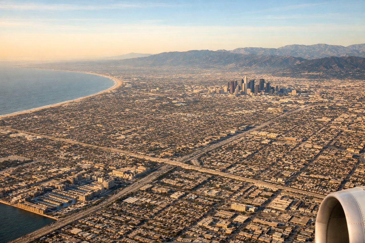
Landing at LAX
RIGHTArriving from the southeast on runway 31 (heading northwest into the valley), the right (north) side captures the approach over the Pioneer Mountains and the dramatic final descent into the narrow valley. The left side shows the Sawtooth Range receding to the south as the aircraft descends.
Will your flight be in sunlight?
Pick a date and time in the Sun Map to watch the sun move across your whole flight.
About This Route
Which side of the plane should I sit on flying from Friedman Memorial Airport (SUN) to Los Angeles International (LAX)?
Sit on the Left side of the plane for the best views on flights from Hailey to Los Angeles. The left side scores higher due to the dramatic Sawtooth Range visible during the entire flight—spectacular during takeoff climb-out and cruise, and continuously visible as a scenic backdrop. While the right side offers a more engaging landing sequence with the Pioneer Mountains, the left side's sustained mountain drama and the Sawtooths' distinctive jagged profile throughout the flight outweigh the landing advantage. The cruise phase over central Idaho and Nevada shows the left side facing the Sierra Nevada and Great Basin ranges, while the right side sees mostly open desert and plains.
What can I see during takeoff from Friedman Memorial Airport in Hailey?
During takeoff from Friedman Memorial Airport (SUN), sit on the Left side for the best views. Departing southeast on runway 13, the left (south) side faces the Wood River Valley floor and the Sawtooth Range immediately to the south. The right side looks north toward the Pioneer Mountains and valley terrain with less dramatic relief. Notable sights include: Sawtooth Range peaks (south), Wood River Valley floor, Bald Mountain ski area, Pioneer Mountains (north, right side).
What can I see when landing at Los Angeles International in Los Angeles?
When landing at Los Angeles International (LAX), sit on the Right side for the best views. Arriving from the southeast on runway 31 (heading northwest into the valley), the right (north) side captures the approach over the Pioneer Mountains and the dramatic final descent into the narrow valley. The left side shows the Sawtooth Range receding to the south as the aircraft descends. Notable sights include: Pioneer Mountains (north/right), Wood River Valley approach corridor, Bald Mountain, Sawtooth Range (south/left, receding).
How long is the flight from Hailey to Los Angeles?
The flight from Friedman Memorial Airport (SUN) to Los Angeles International (LAX) takes about 2 hours 15 minutes. The shortest flight path between them is 697 miles (1,121 km); winds and air traffic control usually add a few percent.
What does the Hailey to Los Angeles flight path pass over?
Sawtooth Range and Stanley Basin (initial climb), Challis National Forest, Lost River Range, Lemhi Range, central Idaho high desert, Owyhee Mountains, Great Basin transition zone, Nevada high desert and basin-and-range topography, Sierra Nevada eastern escarpment (final descent phase), Mono Basin and Inyo Mountains (approach to California), Owens Valley, Sierra crest visible to the east during descent into Southern California