The northbound departure from SXM on the right side provides superior scenic value with the Caribbean island landscape and open ocean. While the Boston landing favors the left, the takeoff experience is more visually distinctive and sustained.
Flown SXM to BOS? Did we get it right?
Flight Path
Philipsburg to Boston is 1,743 miles (2,806 km), a flight of about 4 hours.
The flight path crosses the open Atlantic Ocean for roughly 1,200 nautical miles. Notable features include: the Sargasso Sea region (no visible landmarks, but deep blue water), the continental shelf break southeast of Cape Cod (visible as a subtle color change in water depth on clear days), and the Gulf Stream's warm-water corridor (not visually distinct but influences water color). No major islands or landmasses are visible during the mid-ocean portion of this route. Approaching the US coast, the continental shelf becomes visible as lighter blue water, followed by the Massachusetts coastline and Cape Cod.
Great circle distance and headings ›Phase by phase
Takeoff from SXM
RIGHTRight-side seats capture the dramatic northern coast of Sint Maarten and the Caribbean Sea during northbound climb-out. You'll see the island's irregular coastline, Philipsburg's waterfront, and the deeper blue Atlantic opening up to the north.
Landing at BOS
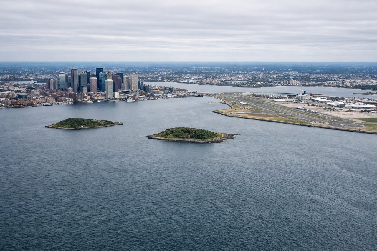
LEFTLeft-side seats on approach to Boston offer the best views of the New England coastline, including the Atlantic shoreline, Cape Cod's distinctive hook shape, and the Boston metropolitan area sprawl before touchdown.
Will your flight be in sunlight?
Pick a date and time in the Sun Map to watch the sun move across your whole flight.
About This Route
Which side of the plane should I sit on flying from Princess Juliana International (SXM) to General Edward Lawrence Logan International (BOS)?
Sit on the Right side of the plane for the best views on flights from Philipsburg to Boston. The northbound departure from SXM on the right side provides superior scenic value with the Caribbean island landscape and open ocean. While the Boston landing favors the left, the takeoff experience is more visually distinctive and sustained.
What can I see during takeoff from Princess Juliana International in Philipsburg?
During takeoff from Princess Juliana International (SXM), sit on the Right side for the best views. Right-side seats capture the dramatic northern coast of Sint Maarten and the Caribbean Sea during northbound climb-out. You'll see the island's irregular coastline, Philipsburg's waterfront, and the deeper blue Atlantic opening up to the north. Notable sights include: Philipsburg harbor and Great Salt Pond, Sint Maarten's northern coastline, the Caribbean Sea transitioning to Atlantic blue, Anguilla island (visible to the northeast at distance).
What can I see when landing at General Edward Lawrence Logan International in Boston?
When landing at General Edward Lawrence Logan International (BOS), sit on the Left side for the best views. Left-side seats on approach to Boston offer the best views of the New England coastline, including the Atlantic shoreline, Cape Cod's distinctive hook shape, and the Boston metropolitan area sprawl before touchdown. Notable sights include: Cape Cod and Cape Cod Bay, the Atlantic coastline of Massachusetts, Boston Harbor and the city's downtown skyline, the Charles River and surrounding urban development.
How long is the flight from Philipsburg to Boston?
The flight from Princess Juliana International (SXM) to General Edward Lawrence Logan International (BOS) takes about 4 hours. The shortest flight path between them is 1,743 miles (2,806 km); winds and air traffic control usually add a few percent.
What does the Philipsburg to Boston flight path pass over?
The flight path crosses the open Atlantic Ocean for roughly 1,200 nautical miles. Notable features include: the Sargasso Sea region (no visible landmarks, but deep blue water), the continental shelf break southeast of Cape Cod (visible as a subtle color change in water depth on clear days), and the Gulf Stream's warm-water corridor (not visually distinct but influences water color). No major islands or landmasses are visible during the mid-ocean portion of this route. Approaching the US coast, the continental shelf becomes visible as lighter blue water, followed by the Massachusetts coastline and Cape Cod.