Right-side seats provide superior views at both ends of the flight: Onondaga Lake and Finger Lakes on departure, and Tampa Bay with downtown skyline on arrival. The flight path itself (heading south-southwest) means right-side views capture the most distinctive geographic features.
Flown SYR to TPA? Did we get it right?
Flight Path
Syracuse to Tampa is 1,106 miles (1,779 km), a flight of about 3 hours 15 minutes.
The flight crosses the Appalachian foothills of Pennsylvania and West Virginia (visible as rolling terrain with ridge patterns), then transitions over the Piedmont region of the Carolinas. The Great Smoky Mountains appear as a distant ridge line on the left (west) side around midpoint. The flight then crosses into the Coastal Plain of Georgia and Florida, with increasing visibility of swamps, lakes, and flat terrain as it approaches Florida. The Atlantic Intracoastal Waterway becomes visible in the final 30 minutes as a thin linear feature running parallel to the Florida coast.
Great circle distance and headings ›Phase by phase
Takeoff from SYR
RIGHTSyracuse typically departs runways 06 or 24 depending on wind. Right-side seats offer views of Onondaga Lake immediately north of the airport, and the Finger Lakes region extending southward. Left side faces inland terrain with fewer distinctive features.
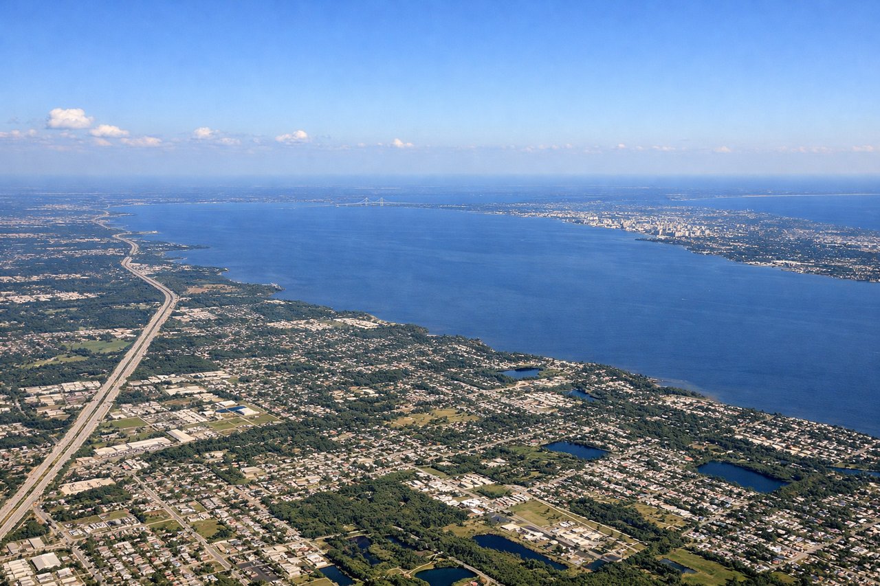
Landing at TPA
RIGHTTampa International uses runways 18L/18R or 36L/36R. Right-side seats on approach to either runway offer views of Tampa Bay's eastern shoreline, Hillsborough Bay, and the distinctive downtown Tampa skyline. Left side faces the Gulf of Mexico with fewer ground references.
Will your flight be in sunlight?
Pick a date and time in the Sun Map to watch the sun move across your whole flight.
About This Route
Which side of the plane should I sit on flying from Syracuse Hancock International (SYR) to Tampa International (TPA)?
Sit on the Right side of the plane for the best views on flights from Syracuse to Tampa. Right-side seats provide superior views at both ends of the flight: Onondaga Lake and Finger Lakes on departure, and Tampa Bay with downtown skyline on arrival. The flight path itself (heading south-southwest) means right-side views capture the most distinctive geographic features.
What can I see during takeoff from Syracuse Hancock International in Syracuse?
During takeoff from Syracuse Hancock International (SYR), sit on the Right side for the best views. Syracuse typically departs runways 06 or 24 depending on wind. Right-side seats offer views of Onondaga Lake immediately north of the airport, and the Finger Lakes region extending southward. Left side faces inland terrain with fewer distinctive features. Notable sights include: Onondaga Lake (directly north, visible for 5+ minutes), Finger Lakes chain (south and southeast), Syracuse urban grid (south), Oswego River valley (northeast).
What can I see when landing at Tampa International in Tampa?
When landing at Tampa International (TPA), sit on the Right side for the best views. Tampa International uses runways 18L/18R or 36L/36R. Right-side seats on approach to either runway offer views of Tampa Bay's eastern shoreline, Hillsborough Bay, and the distinctive downtown Tampa skyline. Left side faces the Gulf of Mexico with fewer ground references. Notable sights include: Tampa Bay and Hillsborough Bay (primary water feature), downtown Tampa skyline (recognizable cluster of mid-rise buildings), Ybor City district (historic grid pattern southeast of downtown), Bayshore Boulevard waterfront (curved shoreline south of downtown).
How long is the flight from Syracuse to Tampa?
The flight from Syracuse Hancock International (SYR) to Tampa International (TPA) takes about 3 hours 15 minutes. The shortest flight path between them is 1,106 miles (1,779 km); winds and air traffic control usually add a few percent.
What does the Syracuse to Tampa flight path pass over?
The flight crosses the Appalachian foothills of Pennsylvania and West Virginia (visible as rolling terrain with ridge patterns), then transitions over the Piedmont region of the Carolinas. The Great Smoky Mountains appear as a distant ridge line on the left (west) side around midpoint. The flight then crosses into the Coastal Plain of Georgia and Florida, with increasing visibility of swamps, lakes, and flat terrain as it approaches Florida. The Atlantic Intracoastal Waterway becomes visible in the final 30 minutes as a thin linear feature running parallel to the Florida coast.