Panglao to Manila is 388 miles (625 km), a flight of about 1 hour 15 minutes.
While takeoff offers scenic island and strait views, the landing approach provides more dramatic and varied scenery—Manila Bay's distinctive geography, the contrast between water and urban development, and views of the Sierra Madre range make the westbound descent more visually rewarding overall.
Flight Path
The flight path crosses the Visayan Sea, passing over or near Masbate Island's western coast and the Sibuyan Sea. The Mindoro Strait separates Mindoro Island (to the south) from Luzon. As you approach Manila, you'll see the transition from open water to the increasingly developed coastal plains of Calabarzon region (Cavite, Laguna, Batangas, Quezon provinces).
Great circle distance and headings ›Phase by phase
Takeoff from TAG
RIGHTRight-side seats capture the Bohol Strait and the transition from Panglao Island toward the Visayas archipelago. You'll see the irregular coastline of central Bohol and multiple smaller islands dotting the seascape as the aircraft climbs northwestward.
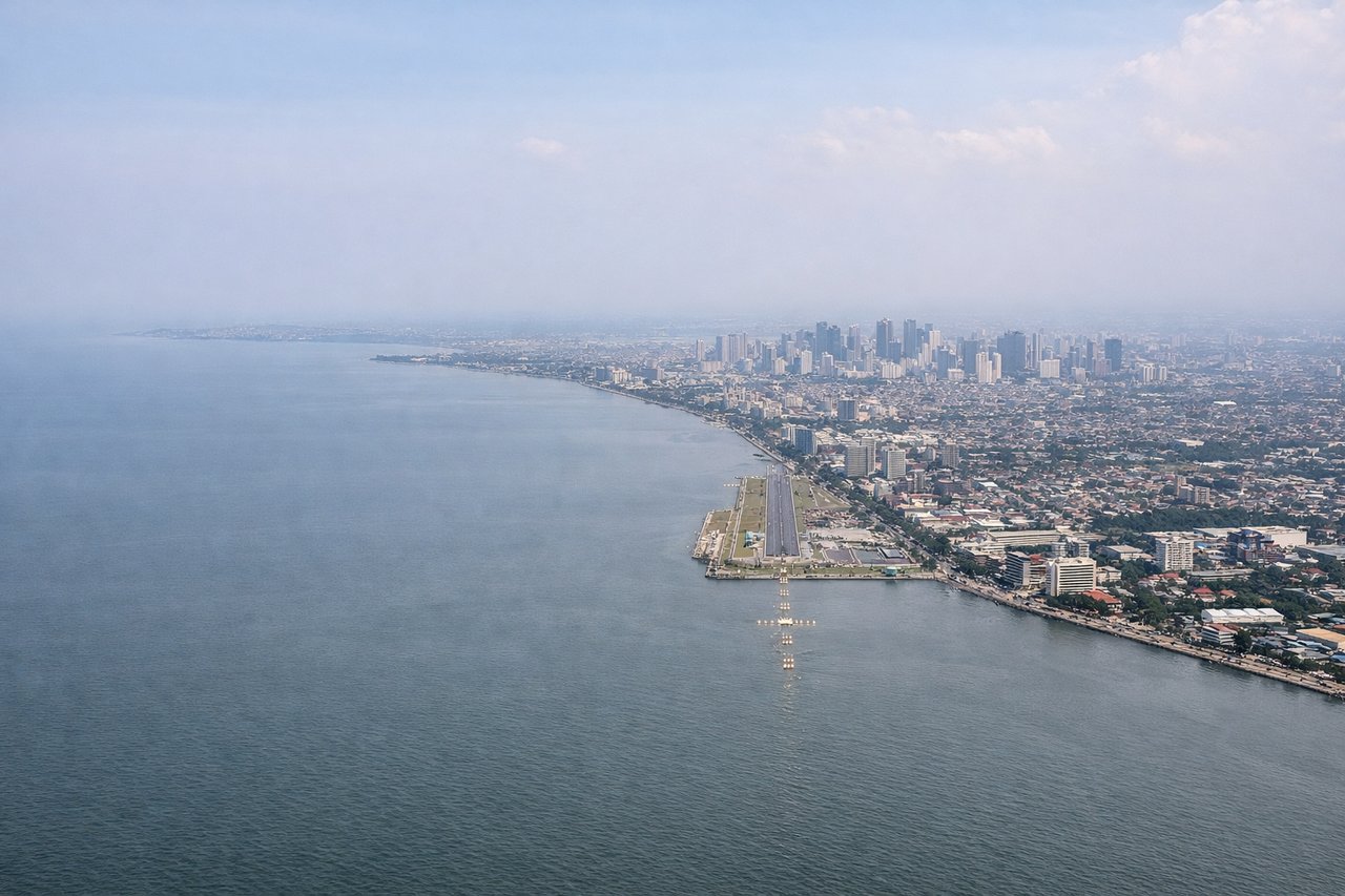
Landing at MNL
LEFTLeft-side seats offer views of Manila Bay's eastern shoreline, the Laguna de Bay, and the approach over Rizal and Quezon provinces. You'll see the urban sprawl of Metro Manila's eastern districts and the bay's distinctive shape as you descend toward NAIA.
Landmarks on this routeAll landmarks →
Will your flight be in sunlight?
Pick a date and time in the Sun Map to watch the sun move across your whole flight.
About This Route
Which side of the plane should I sit on flying from Bohol-Panglao International Airport (TAG) to Ninoy Aquino International (MNL)?
Sit on the Left side of the plane for the best views on flights from Panglao to Manila. While takeoff offers scenic island and strait views, the landing approach provides more dramatic and varied scenery—Manila Bay's distinctive geography, the contrast between water and urban development, and views of the Sierra Madre range make the westbound descent more visually rewarding overall.
What can I see during takeoff from Bohol-Panglao International Airport in Panglao?
During takeoff from Bohol-Panglao International Airport (TAG), sit on the Right side for the best views. Right-side seats capture the Bohol Strait and the transition from Panglao Island toward the Visayas archipelago. You'll see the irregular coastline of central Bohol and multiple smaller islands dotting the seascape as the aircraft climbs northwestward. Notable sights include: Bohol Strait, Panglao Island coastline, Cebu Island (distant, southeastern horizon), scattered Visayan islands.
What can I see when landing at Ninoy Aquino International in Manila?
When landing at Ninoy Aquino International (MNL), sit on the Left side for the best views. Left-side seats offer views of Manila Bay's eastern shoreline, the Laguna de Bay, and the approach over Rizal and Quezon provinces. You'll see the urban sprawl of Metro Manila's eastern districts and the bay's distinctive shape as you descend toward NAIA. Notable sights include: Manila Bay, Laguna de Bay, Rizal province urban areas, Sierra Madre mountain range (distant northeastern horizon).
How long is the flight from Panglao to Manila?
The flight from Bohol-Panglao International Airport (TAG) to Ninoy Aquino International (MNL) takes about 1 hour 15 minutes. The shortest flight path between them is 388 miles (625 km); winds and air traffic control usually add a few percent.
What does the Panglao to Manila flight path pass over?
The flight path crosses the Visayan Sea, passing over or near Masbate Island's western coast and the Sibuyan Sea. The Mindoro Strait separates Mindoro Island (to the south) from Luzon. As you approach Manila, you'll see the transition from open water to the increasingly developed coastal plains of Calabarzon region (Cavite, Laguna, Batangas, Quezon provinces).