Tashkent to Dubai is 1,363 miles (2,194 km), a flight of about 3 hours 30 minutes.
Left side wins both ends of the flight. During the cruise over Turkmenistan and Iran, the left side also tracks closer to the Alborz and Zagros mountain ranges visible as distant ridgelines to the south, making it the consistently better seat for the full journey.
Flight Path
The route crosses the Amu Darya river and Turkmenistan's Karakum Desert — vast flat sand terrain with almost no features. Over northeastern Iran the Kopet Dag range appears as low ridgelines. The central Iranian plateau follows, dry and brown with occasional salt flats. The Zagros Mountains appear as corrugated parallel ridges in western Iran before the route descends toward the Persian Gulf coast and the UAE.
Great circle distance and headings ›
.jpg?width=600)
_and_the_Dubai_skyline_(25781049892).jpg?width=600)
.jpg?width=600)
Phase by phase
Takeoff from TAS
LEFTTashkent's primary runway 08/26 means westbound departures head roughly west-southwest. A left (south) seat gives you views over the city center and the Chirchiq River valley as you climb out. The Tian Shan foothills rise to the south and southeast, visible on the left side during the initial climb.
Landing at DXB
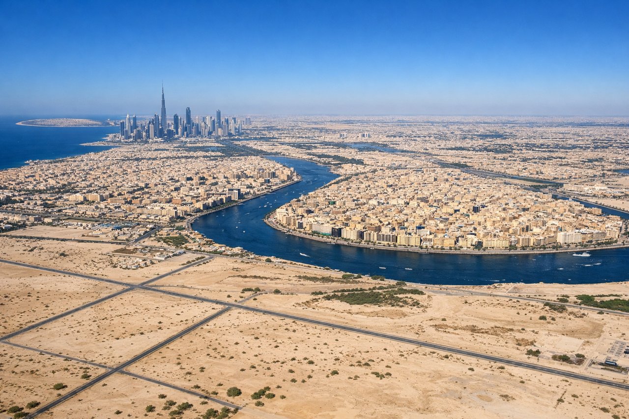
LEFTDubai International's primary arrival runways 12L/12R bring aircraft in from the northwest over the desert, tracking southeast toward the coast. A left (east) seat on approach gives you the Dubai skyline including Downtown Dubai and the Burj Khalifa, the Creek, and Deira to the north. The right seat faces mostly desert and the southern outskirts.
Landmarks on this routeAll landmarks →
Will your flight be in sunlight?
Pick a date and time in the Sun Map to watch the sun move across your whole flight.
About This Route
Which side of the plane should I sit on flying from Tashkent International Airport (TAS) to Dubai International (DXB)?
Sit on the Left side of the plane for the best views on flights from Tashkent to Dubai. Left side wins both ends of the flight. During the cruise over Turkmenistan and Iran, the left side also tracks closer to the Alborz and Zagros mountain ranges visible as distant ridgelines to the south, making it the consistently better seat for the full journey.
What can I see during takeoff from Tashkent International Airport in Tashkent?
During takeoff from Tashkent International Airport (TAS), sit on the Left side for the best views. Tashkent's primary runway 08/26 means westbound departures head roughly west-southwest. A left (south) seat gives you views over the city center and the Chirchiq River valley as you climb out. The Tian Shan foothills rise to the south and southeast, visible on the left side during the initial climb. Notable sights include: Tashkent city grid and Chorsu Bazaar area, Chirchiq River valley, Tian Shan foothills to the southeast, Charvak Reservoir in the mountains to the northeast (briefly visible right side on climb).
What can I see when landing at Dubai International in Dubai?
When landing at Dubai International (DXB), sit on the Left side for the best views. Dubai International's primary arrival runways 12L/12R bring aircraft in from the northwest over the desert, tracking southeast toward the coast. A left (east) seat on approach gives you the Dubai skyline including Downtown Dubai and the Burj Khalifa, the Creek, and Deira to the north. The right seat faces mostly desert and the southern outskirts. Notable sights include: Burj Khalifa and Downtown Dubai skyline, Dubai Creek and Deira district, Palm Jumeirah (visible to the west, briefly), Dubai Marina towers.
How long is the flight from Tashkent to Dubai?
The flight from Tashkent International Airport (TAS) to Dubai International (DXB) takes about 3 hours 30 minutes. The shortest flight path between them is 1,363 miles (2,194 km); winds and air traffic control usually add a few percent.
What does the Tashkent to Dubai flight path pass over?
The route crosses the Amu Darya river and Turkmenistan's Karakum Desert — vast flat sand terrain with almost no features. Over northeastern Iran the Kopet Dag range appears as low ridgelines. The central Iranian plateau follows, dry and brown with occasional salt flats. The Zagros Mountains appear as corrugated parallel ridges in western Iran before the route descends toward the Persian Gulf coast and the UAE.