While takeoff offers river delta views, the landing approach into Seattle provides far more dramatic and memorable scenery with Mount Rainier and the Cascade Range. Left side captures the most iconic visual features of this route.
Flown THE to SEA? Did we get it right?
Flight Path
Teresina to Seattle is 5,989 miles (9,638 km), a flight of about 10 hours.
The flight path crosses the Gulf of Mexico (viewing the Yucatan Peninsula and Mexican coastline), then traverses the southern United States including the Mississippi River valley, Great Plains, and Rocky Mountain foothills. Notable features include the Mississippi River delta near New Orleans, the Rio Grande valley, the Colorado Plateau, and the Sierra Nevada range before reaching the Pacific Northwest.
Great circle distance and headings ›


Phase by phase
Takeoff from THE
RIGHTRight side offers views of the Parnaíba River delta and floodplain wetlands as the aircraft climbs northwestward from Teresina. The river's braided channels and oxbow lakes are distinctive from altitude and visible during the initial climb phase.
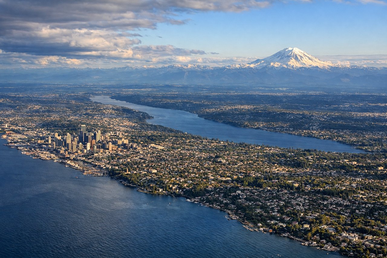
Landing at SEA
LEFTLeft side provides excellent views of the Cascade Range and Mount Rainier during descent into Seattle. As the aircraft approaches from the southeast, the left wing reveals the dramatic volcanic peaks and foothills that dominate the approach corridor.
Will your flight be in sunlight?
Pick a date and time in the Sun Map to watch the sun move across your whole flight.
About This Route
Which side of the plane should I sit on flying from Senador Petronio Portella (THE) to Seattle Tacoma International (SEA)?
Sit on the Left side of the plane for the best views on flights from Teresina to Seattle. While takeoff offers river delta views, the landing approach into Seattle provides far more dramatic and memorable scenery with Mount Rainier and the Cascade Range. Left side captures the most iconic visual features of this route.
What can I see during takeoff from Senador Petronio Portella in Teresina?
During takeoff from Senador Petronio Portella (THE), sit on the Right side for the best views. Right side offers views of the Parnaíba River delta and floodplain wetlands as the aircraft climbs northwestward from Teresina. The river's braided channels and oxbow lakes are distinctive from altitude and visible during the initial climb phase. Notable sights include: Parnaíba River delta and floodplain, Teresina city grid below, Atlantic coastal plains to the northeast, cerrado scrubland transitioning northward.
What can I see when landing at Seattle Tacoma International in Seattle?
When landing at Seattle Tacoma International (SEA), sit on the Left side for the best views. Left side provides excellent views of the Cascade Range and Mount Rainier during descent into Seattle. As the aircraft approaches from the southeast, the left wing reveals the dramatic volcanic peaks and foothills that dominate the approach corridor. Notable sights include: Mount Rainier (14,411 ft), Cascade Range peaks, Puget Sound, Seattle urban area and Elliott Bay.
How long is the flight from Teresina to Seattle?
The flight from Senador Petronio Portella (THE) to Seattle Tacoma International (SEA) takes about 10 hours. The shortest flight path between them is 5,989 miles (9,638 km); winds and air traffic control usually add a few percent.
What does the Teresina to Seattle flight path pass over?
The flight path crosses the Gulf of Mexico (viewing the Yucatan Peninsula and Mexican coastline), then traverses the southern United States including the Mississippi River valley, Great Plains, and Rocky Mountain foothills. Notable features include the Mississippi River delta near New Orleans, the Rio Grande valley, the Colorado Plateau, and the Sierra Nevada range before reaching the Pacific Northwest.