The right side strings together the most distinctive scenery of the trip: the Pacific coastline and islands at departure, a stretch over the Gulf of California and the Sierra Madre Occidental during cruise, and the iconic volcano-framed descent into the Valley of Mexico. The left side mostly faces the flatter high plains of northern and central Mexico with far fewer standout features.
Flown TIJ to MEX? Did we get it right?
Flight Path
Tijuana to Mexico City is 1,430 miles (2,301 km), a flight of about 2 hours 50 minutes.
Gulf of California (Sea of Cortez) crossing, Sierra Madre Occidental peaks over Sinaloa and Durango, and the agricultural Bajío plains of Zacatecas and Guanajuato before descending into the Valley of Mexico
Great circle distance and headings ›


Phase by phase
Takeoff from TIJ
RIGHTDeparting TIJ on runway 27, the initial climb heads straight out over Playas de Tijuana and the Pacific. As the aircraft banks left toward its southeast routing, the right side keeps the coastline and the Coronado Islands in view a bit longer before the plane turns inland.
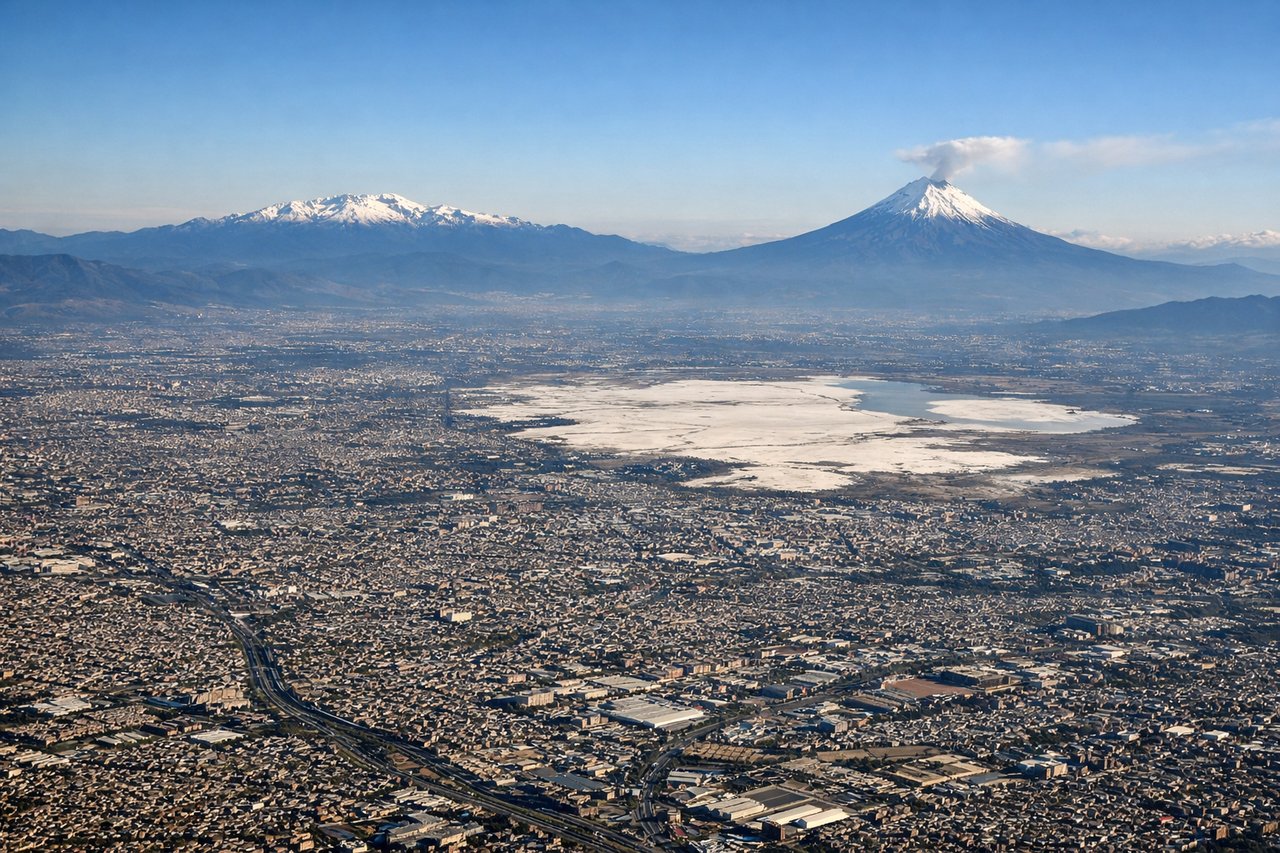
Landing at MEX
RIGHTOn the typical southwest-to-northeast final approach into MEX runway 05R, the descent path swings past the eastern edge of the Valley of Mexico. Passengers on the right side get a clear view of the snow-capped volcanoes Popocatépetl and Iztaccíhuatl rising above the valley floor as the city spreads out below.
Will your flight be in sunlight?
Pick a date and time in the Sun Map to watch the sun move across your whole flight.
About This Route
Which side of the plane should I sit on flying from General Abelardo L Rodriguez International (TIJ) to Licenciado Benito Juarez International (MEX)?
Sit on the Right side of the plane for the best views on flights from Tijuana to Mexico City. The right side strings together the most distinctive scenery of the trip: the Pacific coastline and islands at departure, a stretch over the Gulf of California and the Sierra Madre Occidental during cruise, and the iconic volcano-framed descent into the Valley of Mexico. The left side mostly faces the flatter high plains of northern and central Mexico with far fewer standout features.
What can I see during takeoff from General Abelardo L Rodriguez International in Tijuana?
During takeoff from General Abelardo L Rodriguez International (TIJ), sit on the Right side for the best views. Departing TIJ on runway 27, the initial climb heads straight out over Playas de Tijuana and the Pacific. As the aircraft banks left toward its southeast routing, the right side keeps the coastline and the Coronado Islands in view a bit longer before the plane turns inland. Notable sights include: Pacific Ocean coastline, Playas de Tijuana, Coronado Islands offshore, Tijuana's urban sprawl fading behind.
What can I see when landing at Licenciado Benito Juarez International in Mexico City?
When landing at Licenciado Benito Juarez International (MEX), sit on the Right side for the best views. On the typical southwest-to-northeast final approach into MEX runway 05R, the descent path swings past the eastern edge of the Valley of Mexico. Passengers on the right side get a clear view of the snow-capped volcanoes Popocatépetl and Iztaccíhuatl rising above the valley floor as the city spreads out below. Notable sights include: Popocatépetl volcano, Iztaccíhuatl volcano, Valley of Mexico basin, dense Mexico City urban sprawl.
How long is the flight from Tijuana to Mexico City?
The flight from General Abelardo L Rodriguez International (TIJ) to Licenciado Benito Juarez International (MEX) takes about 2 hours 50 minutes. The shortest flight path between them is 1,430 miles (2,301 km); winds and air traffic control usually add a few percent.
What does the Tijuana to Mexico City flight path pass over?
Gulf of California (Sea of Cortez) crossing, Sierra Madre Occidental peaks over Sinaloa and Durango, and the agricultural Bajío plains of Zacatecas and Guanajuato before descending into the Valley of Mexico