While the left side offers volcanic scenery during departure, the right side provides superior overall variety and visual drama. The Yucatan karst landscape with cenotes is geologically distinctive and visually striking, and the Caribbean approach with turquoise waters and reef systems creates a more memorable scenic experience than the plateau departure. The landing sequence on the right significantly outweighs the takeoff advantage on the left.
Flown TLC to CUN? Did we get it right?
Flight Path
Toluca to Cancun is 831 miles (1,338 km), a flight of about 2 hours 20 minutes.
The flight crosses the Yucatan Peninsula at cruise altitude. Notable features include the flat limestone plateau of the peninsula interior, scattered cenote formations visible as dark circular features in the terrain, and the transition from inland scrubland to coastal mangrove forests and lagoon systems as the aircraft approaches the Caribbean coast.
Great circle distance and headings ›


Phase by phase
Takeoff from TLC
LEFTToluca sits in the high Mexican plateau at 8,600 feet elevation. Left-side departure offers views of the surrounding volcanic peaks and the descent from the altiplano toward lower terrain. Right side faces inland plateau with minimal relief.
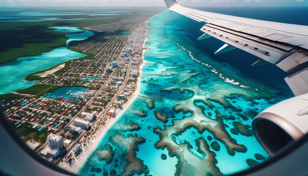
Landing at CUN
RIGHTThe approach to Cancun from the west crosses the Yucatan Peninsula's distinctive karst landscape and cenotes, then reveals the Caribbean coastline with its turquoise shallow waters and barrier reef system. This provides dramatic visual contrast and genuine scenic interest during descent.
Will your flight be in sunlight?
Pick a date and time in the Sun Map to watch the sun move across your whole flight.
About This Route
Which side of the plane should I sit on flying from Licenciado Adolfo Lopez Mateos International (TLC) to Cancun International (CUN)?
Sit on the Right side of the plane for the best views on flights from Toluca to Cancun. While the left side offers volcanic scenery during departure, the right side provides superior overall variety and visual drama. The Yucatan karst landscape with cenotes is geologically distinctive and visually striking, and the Caribbean approach with turquoise waters and reef systems creates a more memorable scenic experience than the plateau departure. The landing sequence on the right significantly outweighs the takeoff advantage on the left.
What can I see during takeoff from Licenciado Adolfo Lopez Mateos International in Toluca?
During takeoff from Licenciado Adolfo Lopez Mateos International (TLC), sit on the Left side for the best views. Toluca sits in the high Mexican plateau at 8,600 feet elevation. Left-side departure offers views of the surrounding volcanic peaks and the descent from the altiplano toward lower terrain. Right side faces inland plateau with minimal relief. Notable sights include: Nevado de Toluca (dormant volcano, 15,016 ft), Sierra de las Cruces mountain range to the north, Mexico City metropolitan area sprawl to the southeast.
What can I see when landing at Cancun International in Cancun?
When landing at Cancun International (CUN), sit on the Right side for the best views. The approach to Cancun from the west crosses the Yucatan Peninsula's distinctive karst landscape and cenotes, then reveals the Caribbean coastline with its turquoise shallow waters and barrier reef system. This provides dramatic visual contrast and genuine scenic interest during descent. Notable sights include: Yucatan Peninsula limestone karst terrain with visible cenote formations, Caribbean Sea with turquoise shallow waters and white sand beaches, Cancun's beachfront hotel zone and lagoon system.
How long is the flight from Toluca to Cancun?
The flight from Licenciado Adolfo Lopez Mateos International (TLC) to Cancun International (CUN) takes about 2 hours 20 minutes. The shortest flight path between them is 831 miles (1,338 km); winds and air traffic control usually add a few percent.
What does the Toluca to Cancun flight path pass over?
The flight crosses the Yucatan Peninsula at cruise altitude. Notable features include the flat limestone plateau of the peninsula interior, scattered cenote formations visible as dark circular features in the terrain, and the transition from inland scrubland to coastal mangrove forests and lagoon systems as the aircraft approaches the Caribbean coast.