Both sides score equally on the full flight due to the route's geography: takeoff from Turpan offers modest arid basin scenery, but the landing approach into Shanghai provides significantly more visual interest with the Yangtze estuary, Huangpu River meanders, and urban skyline. The landing experience outweighs the takeoff advantage, making right-side seats the better choice overall.
Flown TLQ to SHA? Did we get it right?
Flight Path
Turpan to Shanghai is 1,939 miles (3,121 km), a flight of about 3 hours 45 minutes.
The flight path crosses the North China Plain, passing over or near Henan Province's agricultural regions, the Yellow River (Huang He) valley, and Anhui Province's landscape before descending toward the Yangtze River delta. Notable midpoint features include the Yellow River's broad, silt-laden channel visible around 1.5 hours into flight, and the transition from northern plains to the more densely populated Yangtze River basin approximately 1 hour before landing. The Dabie Mountains appear as a low ridge on the horizon during cruise over central China.
Great circle distance and headings ›


Phase by phase
Takeoff from TLQ
LEFTLeft side captures the Turpan Depression and surrounding arid terrain during climb-out. The basin's distinctive topography and the Flaming Mountains (Huoyan Shan) to the north are visible during initial ascent, providing more immediate visual interest than the right side's featureless plains.
Landing at SHA
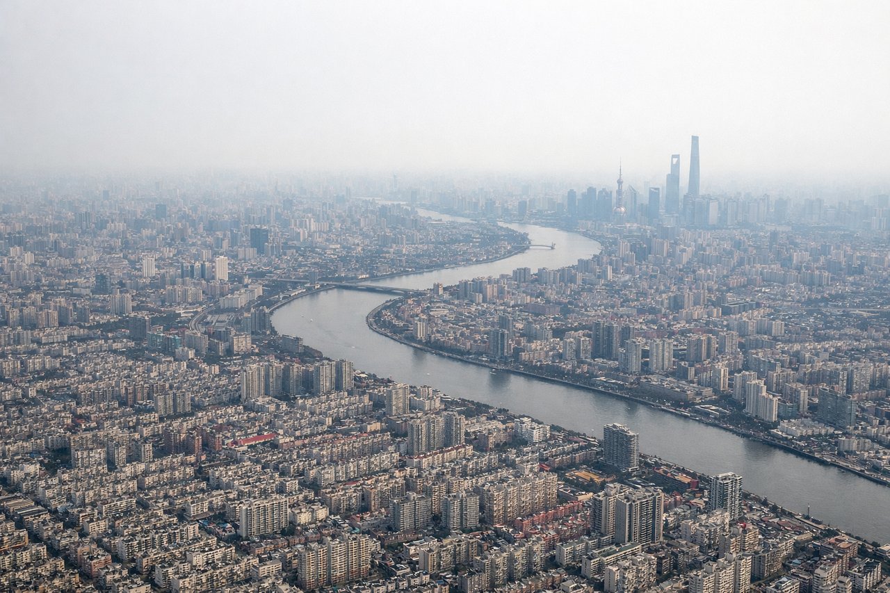
RIGHTRight side provides superior landing approach scenery. The descent into Shanghai crosses the Yangtze River estuary and approaches Hongqiao through the Huangpu River valley, with visible urban development, the river's distinctive meanders, and the city's skyline becoming prominent during final approach.
Will your flight be in sunlight?
Pick a date and time in the Sun Map to watch the sun move across your whole flight.
About This Route
Which side of the plane should I sit on flying from Turpan Jiaohe Airport (TLQ) to Hongqiao International (SHA)?
Sit on the Right side of the plane for the best views on flights from Turpan to Shanghai. Both sides score equally on the full flight due to the route's geography: takeoff from Turpan offers modest arid basin scenery, but the landing approach into Shanghai provides significantly more visual interest with the Yangtze estuary, Huangpu River meanders, and urban skyline. The landing experience outweighs the takeoff advantage, making right-side seats the better choice overall.
What can I see during takeoff from Turpan Jiaohe Airport in Turpan?
During takeoff from Turpan Jiaohe Airport (TLQ), sit on the Left side for the best views. Left side captures the Turpan Depression and surrounding arid terrain during climb-out. The basin's distinctive topography and the Flaming Mountains (Huoyan Shan) to the north are visible during initial ascent, providing more immediate visual interest than the right side's featureless plains. Notable sights include: Turpan Depression basin, Flaming Mountains (Huoyan Shan) to the north, Jiaohang River valley, arid Gobi terrain.
What can I see when landing at Hongqiao International in Shanghai?
When landing at Hongqiao International (SHA), sit on the Right side for the best views. Right side provides superior landing approach scenery. The descent into Shanghai crosses the Yangtze River estuary and approaches Hongqiao through the Huangpu River valley, with visible urban development, the river's distinctive meanders, and the city's skyline becoming prominent during final approach. Notable sights include: Yangtze River estuary and delta, Huangpu River meanders, Shanghai urban sprawl and skyline, Hongqiao International Airport terminal area.
How long is the flight from Turpan to Shanghai?
The flight from Turpan Jiaohe Airport (TLQ) to Hongqiao International (SHA) takes about 3 hours 45 minutes. The shortest flight path between them is 1,939 miles (3,121 km); winds and air traffic control usually add a few percent.
What does the Turpan to Shanghai flight path pass over?
The flight path crosses the North China Plain, passing over or near Henan Province's agricultural regions, the Yellow River (Huang He) valley, and Anhui Province's landscape before descending toward the Yangtze River delta. Notable midpoint features include the Yellow River's broad, silt-laden channel visible around 1.5 hours into flight, and the transition from northern plains to the more densely populated Yangtze River basin approximately 1 hour before landing. The Dabie Mountains appear as a low ridge on the horizon during cruise over central China.