While both sides score equally at 2.5, the right side edges ahead for the full flight experience. Takeoff from TRU on the commonly-used runway 20 (southbound) provides immediate coastal and urban scenery over Trujillo. Although landing favors the left side, the superior takeoff experience and the fact that most departures use runway 20 make right-side seats the better overall choice for this short, relatively flat coastal route.
Flown TRU to LIM? Did we get it right?
Flight Path
Trujillo to Lima is 304 miles (489 km), a flight of about 45 minutes.
The flight path runs south-southwest along Peru's northern coast at approximately 15,000-20,000 feet. Notable features include the flat coastal plain between Trujillo and Lima, the Sechura Desert to the east (inland), and the Pacific coastline to the west. The Rimac River valley becomes visible as the aircraft descends toward Lima. No major mountain ranges or dramatic terrain features are encountered on this coastal route.
Great circle distance and headings ›Phase by phase
Takeoff from TRU
RIGHTRunway 20 departures (southbound) from TRU turn right over the Pacific coastal plain, offering immediate views of the Trujillo urban area and the coastline. Left departures (northbound on runway 02) climb inland over flat agricultural terrain with minimal visual interest.
Landing at LIM
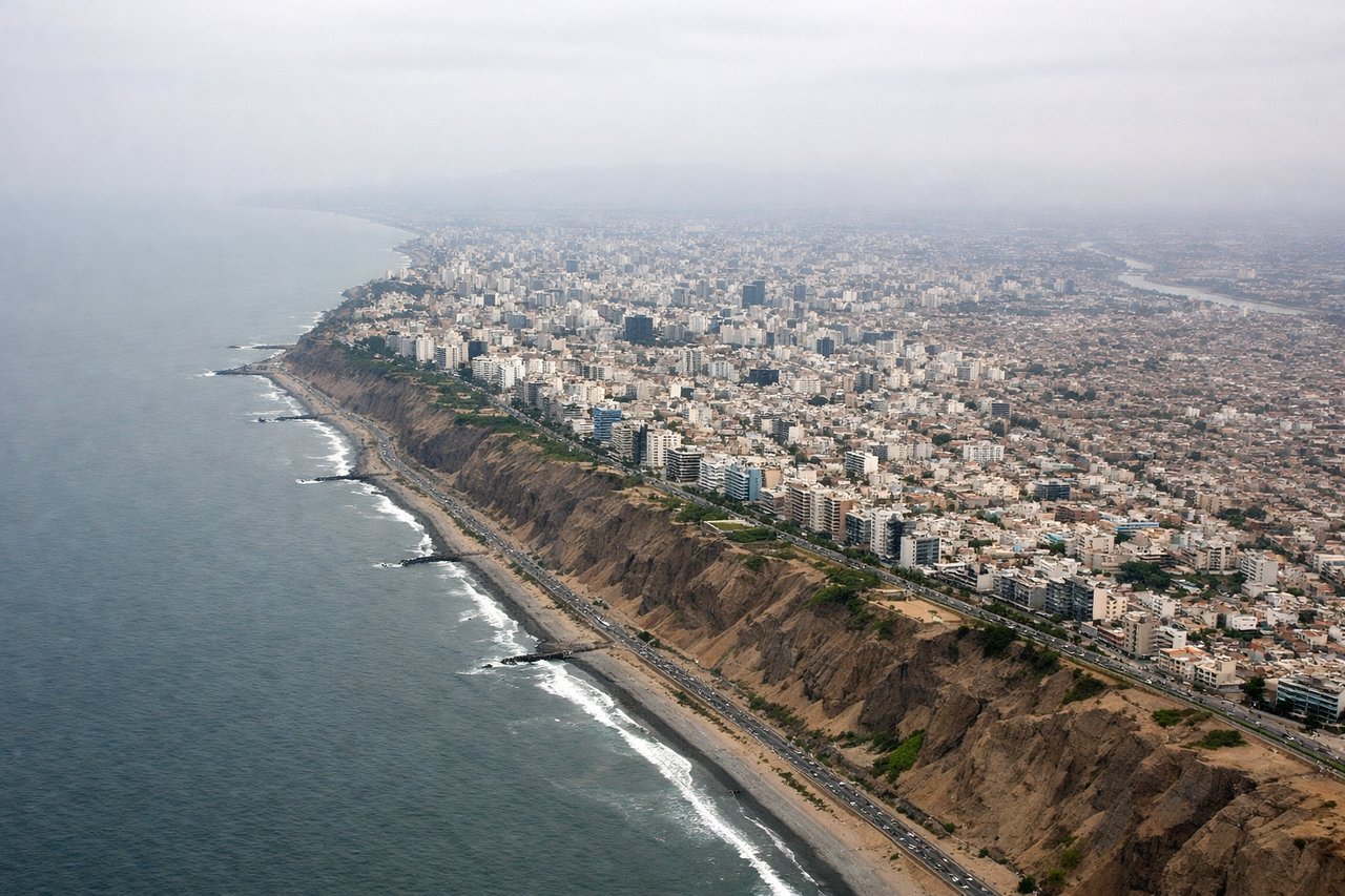
LEFTRunway 16 approaches into LIM require descent from the south over the coastal plain and agricultural valleys. Left-side passengers see the Rimac River valley, Lima's sprawling southern districts, and the approach path over the flat terrain leading to the airport. Right-side views are dominated by open Pacific Ocean with minimal landmarks.
Will your flight be in sunlight?
Pick a date and time in the Sun Map to watch the sun move across your whole flight.
About This Route
Which side of the plane should I sit on flying from Capitan Carlos Martinez De Pinillos (TRU) to Jorge Chávez International Airport (LIM)?
Sit on the Right side of the plane for the best views on flights from Trujillo to Lima. While both sides score equally at 2.5, the right side edges ahead for the full flight experience. Takeoff from TRU on the commonly-used runway 20 (southbound) provides immediate coastal and urban scenery over Trujillo. Although landing favors the left side, the superior takeoff experience and the fact that most departures use runway 20 make right-side seats the better overall choice for this short, relatively flat coastal route.
What can I see during takeoff from Capitan Carlos Martinez De Pinillos in Trujillo?
During takeoff from Capitan Carlos Martinez De Pinillos (TRU), sit on the Right side for the best views. Runway 20 departures (southbound) from TRU turn right over the Pacific coastal plain, offering immediate views of the Trujillo urban area and the coastline. Left departures (northbound on runway 02) climb inland over flat agricultural terrain with minimal visual interest. Notable sights include: Trujillo city sprawl, Pacific coastline south of the airport, Moche River valley, flat coastal plain extending south.
What can I see when landing at Jorge Chávez International Airport in Lima?
When landing at Jorge Chávez International Airport (LIM), sit on the Left side for the best views. Runway 16 approaches into LIM require descent from the south over the coastal plain and agricultural valleys. Left-side passengers see the Rimac River valley, Lima's sprawling southern districts, and the approach path over the flat terrain leading to the airport. Right-side views are dominated by open Pacific Ocean with minimal landmarks. Notable sights include: Rimac River valley, Lima's southern residential and industrial districts, flat coastal plain, Jorge Chávez Airport runway complex.
How long is the flight from Trujillo to Lima?
The flight from Capitan Carlos Martinez De Pinillos (TRU) to Jorge Chávez International Airport (LIM) takes about 45 minutes. The shortest flight path between them is 304 miles (489 km); winds and air traffic control usually add a few percent.
What does the Trujillo to Lima flight path pass over?
The flight path runs south-southwest along Peru's northern coast at approximately 15,000-20,000 feet. Notable features include the flat coastal plain between Trujillo and Lima, the Sechura Desert to the east (inland), and the Pacific coastline to the west. The Rimac River valley becomes visible as the aircraft descends toward Lima. No major mountain ranges or dramatic terrain features are encountered on this coastal route.