The right side wins because it captures Taipei's volcanic terrain at departure, a glimpse of the Ryukyu island chain during cruise, and a mountain-and-harbor view of Kobe/Osaka on arrival, while the left side is dominated by open, featureless sea for most of the flight.
Flown TSA to KIX? Did we get it right?
Flight Path
Taipei to Osaka is 1,044 miles (1,679 km), a flight of about 2 hours 15 minutes.
East China Sea crossing with possible distant views of the northern Ryukyu Islands (Amami-Oshima area) before the route curves toward Shikoku and into Osaka Bay
Great circle distance and headings ›Phase by phase
Takeoff from TSA
RIGHTDeparting Sungshan, the right side gives a clear view of Taipei's basin ringed by the Yangmingshan volcanic massif and the Keelung coastline as the aircraft climbs and turns north toward Japan. The left side mostly shows the flatter Taipei suburbs and the Taiwan Strait beyond, with less relief.
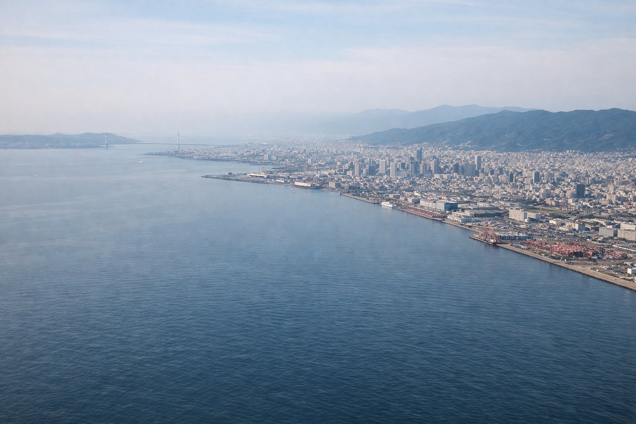
Landing at KIX
RIGHTOn the typical runway 24 approach into Kansai, the aircraft descends from the northeast over Osaka Bay, and the right side faces north toward Kobe's port, the Rokko mountain range, and the distant Osaka skyline. The left side only shows open bay water and the hazy Wakayama coast to the south.
Will your flight be in sunlight?
Pick a date and time in the Sun Map to watch the sun move across your whole flight.
About This Route
Which side of the plane should I sit on flying from Sungshan (TSA) to Kansai International (KIX)?
Sit on the Right side of the plane for the best views on flights from Taipei to Osaka. The right side wins because it captures Taipei's volcanic terrain at departure, a glimpse of the Ryukyu island chain during cruise, and a mountain-and-harbor view of Kobe/Osaka on arrival, while the left side is dominated by open, featureless sea for most of the flight.
What can I see during takeoff from Sungshan in Taipei?
During takeoff from Sungshan (TSA), sit on the Right side for the best views. Departing Sungshan, the right side gives a clear view of Taipei's basin ringed by the Yangmingshan volcanic massif and the Keelung coastline as the aircraft climbs and turns north toward Japan. The left side mostly shows the flatter Taipei suburbs and the Taiwan Strait beyond, with less relief. Notable sights include: Yangmingshan National Park peaks, Keelung coastline, Taipei Basin cityscape, Datun volcanic group.
What can I see when landing at Kansai International in Osaka?
When landing at Kansai International (KIX), sit on the Right side for the best views. On the typical runway 24 approach into Kansai, the aircraft descends from the northeast over Osaka Bay, and the right side faces north toward Kobe's port, the Rokko mountain range, and the distant Osaka skyline. The left side only shows open bay water and the hazy Wakayama coast to the south. Notable sights include: Kobe port and cityscape, Rokko mountain range, Osaka skyline in the distance, Osaka Bay shipping lanes.
How long is the flight from Taipei to Osaka?
The flight from Sungshan (TSA) to Kansai International (KIX) takes about 2 hours 15 minutes. The shortest flight path between them is 1,044 miles (1,679 km); winds and air traffic control usually add a few percent.
What does the Taipei to Osaka flight path pass over?
East China Sea crossing with possible distant views of the northern Ryukyu Islands (Amami-Oshima area) before the route curves toward Shikoku and into Osaka Bay