Taipei to San Francisco is 6,443 miles (10,369 km), a flight of about 12 hours 5 minutes.
Both bookends offer solid scenery, but the San Francisco arrival delivers one of the most recognizable urban-coastal views in commercial aviation, the Golden Gate Bridge and skyline, which outweighs the Taipei departure's mountain-and-city view in landmark fame and visual impact.
Flight Path
The great-circle route curves far north across the open North Pacific, passing well south of the Aleutian Islands and north of Japan; for roughly nine to ten hours there is no land visible, only open ocean, before the coastline of the Pacific Northwest or Northern California comes into view during descent.
Great circle distance and headings ›

Phase by phase
Takeoff from TSA
LEFTClimbing out of Songshan, the aircraft banks over the Taipei Basin, giving left-side passengers a view of the city skyline and the volcanic peaks of Yangmingshan before heading out toward the coast. The right side mostly faces the flatter Keelung River valley and open water beyond, with less texture.
Landing at SFO
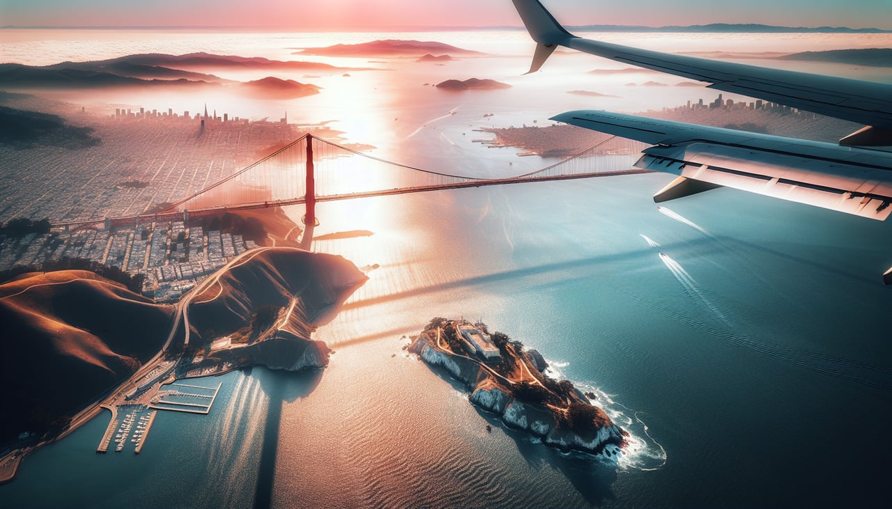
RIGHTOn final approach into SFO from over the Pacific, the flight path swings past the Golden Gate and the San Francisco peninsula before lining up on the bayside runways, putting the bridge and skyline on the right side. The left side instead faces the East Bay hills and open bay water, a less distinctive view.
Landmarks on this routeAll landmarks →
Will your flight be in sunlight?
Pick a date and time in the Sun Map to watch the sun move across your whole flight.
About This Route
Which side of the plane should I sit on flying from Sungshan (TSA) to San Francisco International (SFO)?
Sit on the Right side of the plane for the best views on flights from Taipei to San Francisco. Both bookends offer solid scenery, but the San Francisco arrival delivers one of the most recognizable urban-coastal views in commercial aviation, the Golden Gate Bridge and skyline, which outweighs the Taipei departure's mountain-and-city view in landmark fame and visual impact.
What can I see during takeoff from Sungshan in Taipei?
During takeoff from Sungshan (TSA), sit on the Left side for the best views. Climbing out of Songshan, the aircraft banks over the Taipei Basin, giving left-side passengers a view of the city skyline and the volcanic peaks of Yangmingshan before heading out toward the coast. The right side mostly faces the flatter Keelung River valley and open water beyond, with less texture. Notable sights include: Taipei 101 and downtown skyline, Yangmingshan National Park volcanic peaks, Keelung River, Keelung coastline.
What can I see when landing at San Francisco International in San Francisco?
When landing at San Francisco International (SFO), sit on the Right side for the best views. On final approach into SFO from over the Pacific, the flight path swings past the Golden Gate and the San Francisco peninsula before lining up on the bayside runways, putting the bridge and skyline on the right side. The left side instead faces the East Bay hills and open bay water, a less distinctive view. Notable sights include: Golden Gate Bridge, San Francisco skyline and Alcatraz Island, Marin Headlands, San Francisco Bay.
How long is the flight from Taipei to San Francisco?
The flight from Sungshan (TSA) to San Francisco International (SFO) takes about 12 hours 5 minutes. The shortest flight path between them is 6,443 miles (10,369 km); winds and air traffic control usually add a few percent.
What does the Taipei to San Francisco flight path pass over?
The great-circle route curves far north across the open North Pacific, passing well south of the Aleutian Islands and north of Japan; for roughly nine to ten hours there is no land visible, only open ocean, before the coastline of the Pacific Northwest or Northern California comes into view during descent.