Tucson to Seattle is 1,216 miles (1,958 km), a flight of about 2 hours 55 minutes.
While the takeoff offers good mountain views on the right, the landing approach provides superior scenery on the left with Mount Rainier and the Cascades as the flight's visual climax. The left side captures the most dramatic and iconic landmarks of the entire route.
Flight Path
The flight path crosses central Oregon and northern California, passing east of the Cascade Range. Notable midpoint features include the high desert plateau of central Oregon (sparse, tan terrain with occasional volcanic features), the Deschutes River canyon (visible as a linear feature cutting through the plateau), and the transition from arid interior to the wetter Pacific Northwest around the Oregon-Washington border. The Wallowa Mountains appear as a distant range to the northeast during the cruise phase. As the aircraft approaches Washington, the Cascade Range becomes increasingly prominent on the left, with Mount Hood visible to the south (right side) during the descent phase.
Great circle distance and headings ›.jpeg?width=600)

Phase by phase
Takeoff from TUS
RIGHTRight-side seats offer immediate views of the Santa Catalina Mountains as the aircraft climbs northward out of Tucson. The range rises dramatically to the northeast, creating a striking backdrop during the initial climb phase.
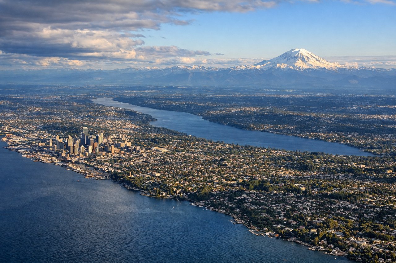
Landing at SEA
LEFTLeft-side seats provide excellent views during the descent into Seattle, particularly of the Cascade Range and Mount Rainier as the aircraft approaches from the south. The mountain views are most dramatic on the left side as the plane descends toward the Puget Sound region.
Landmarks on this routeAll landmarks →
Will your flight be in sunlight?
Pick a date and time in the Sun Map to watch the sun move across your whole flight.
About This Route
Which side of the plane should I sit on flying from Tucson International (TUS) to Seattle Tacoma International (SEA)?
Sit on the Left side of the plane for the best views on flights from Tucson to Seattle. While the takeoff offers good mountain views on the right, the landing approach provides superior scenery on the left with Mount Rainier and the Cascades as the flight's visual climax. The left side captures the most dramatic and iconic landmarks of the entire route.
What can I see during takeoff from Tucson International in Tucson?
During takeoff from Tucson International (TUS), sit on the Right side for the best views. Right-side seats offer immediate views of the Santa Catalina Mountains as the aircraft climbs northward out of Tucson. The range rises dramatically to the northeast, creating a striking backdrop during the initial climb phase. Notable sights include: Santa Catalina Mountains, Tucson urban sprawl (visible as grid pattern below), Saguaro National Park East (distant, southeast), Arizona-Sonora Desert (tan, arid terrain extending to horizon).
What can I see when landing at Seattle Tacoma International in Seattle?
When landing at Seattle Tacoma International (SEA), sit on the Left side for the best views. Left-side seats provide excellent views during the descent into Seattle, particularly of the Cascade Range and Mount Rainier as the aircraft approaches from the south. The mountain views are most dramatic on the left side as the plane descends toward the Puget Sound region. Notable sights include: Mount Rainier (dominant snow-capped peak, visible 50+ miles away), Cascade Range (extending north-south), Puget Sound (dark water body with islands), Seattle skyline and Elliott Bay (visible during final approach).
How long is the flight from Tucson to Seattle?
The flight from Tucson International (TUS) to Seattle Tacoma International (SEA) takes about 2 hours 55 minutes. The shortest flight path between them is 1,216 miles (1,958 km); winds and air traffic control usually add a few percent.
What does the Tucson to Seattle flight path pass over?
The flight path crosses central Oregon and northern California, passing east of the Cascade Range. Notable midpoint features include the high desert plateau of central Oregon (sparse, tan terrain with occasional volcanic features), the Deschutes River canyon (visible as a linear feature cutting through the plateau), and the transition from arid interior to the wetter Pacific Northwest around the Oregon-Washington border. The Wallowa Mountains appear as a distant range to the northeast during the cruise phase. As the aircraft approaches Washington, the Cascade Range becomes increasingly prominent on the left, with Mount Hood visible to the south (right side) during the descent phase.