Seattle to Tucson is 1,216 miles (1,958 km), a flight of about 2 hours 55 minutes.
Left side wins both ends of the flight. Departure offers Seattle's urban waterfront and the Olympics, and landing delivers the dramatic Santa Catalina wall above Tucson. The mid-flight view over Oregon's Cascades and northern Nevada is decent from either side, but the left side also catches better angles on the Cascades during the Oregon segment.
Flight Path
Southern Oregon Cascades including Mount McLoughlin, the high desert plateau of northern Nevada around Winnemucca, the Basin and Range terrain of central Nevada with parallel fault-block mountain ranges, the Mojave Desert transition zone, and the Colorado Plateau edge before descending into the Sonoran Desert approaching Tucson
Great circle distance and headings ›
.jpeg?width=600)
Phase by phase
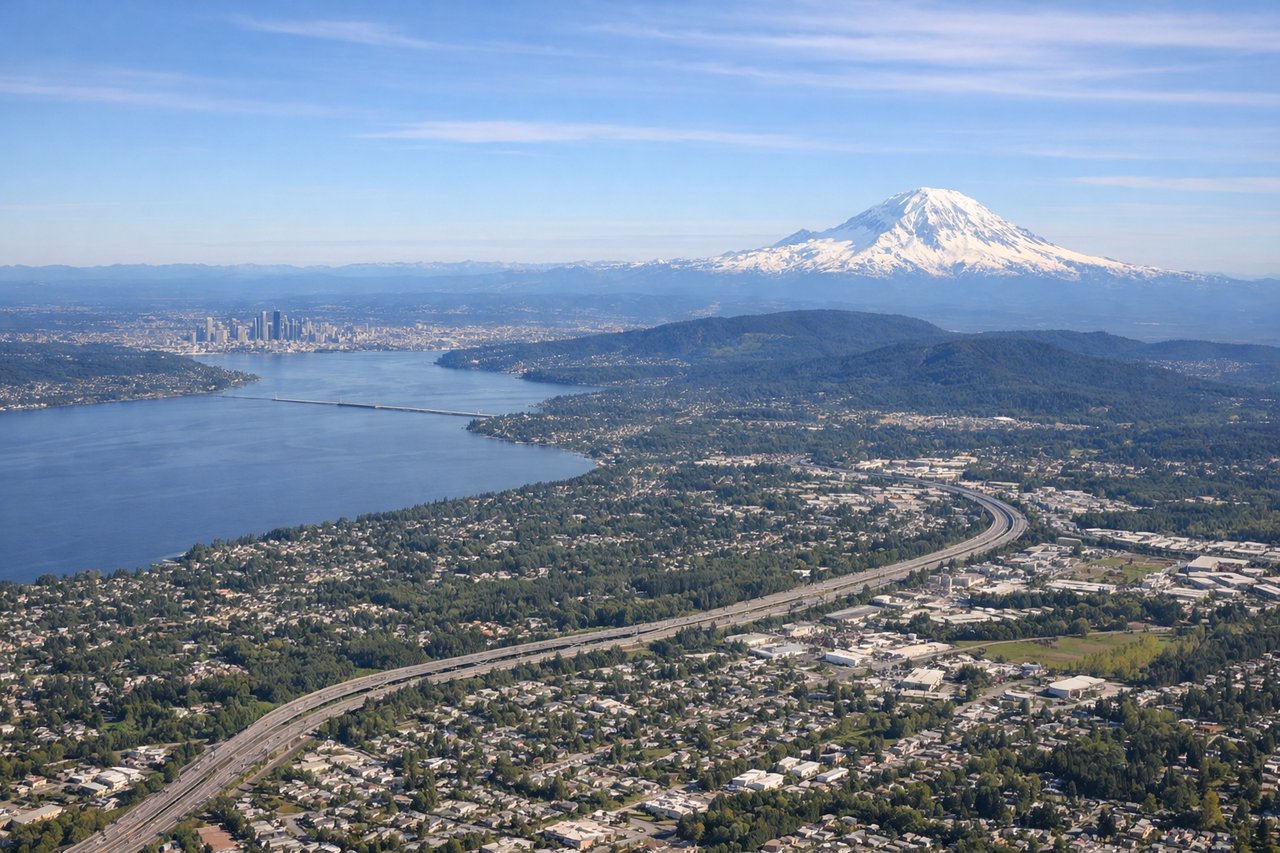
Takeoff from SEA
LEFTSeaTac's primary departure runway 16L/34R means southbound departures often climb out heading south then bank southeast. The left side captures Elliott Bay, downtown Seattle, and the Olympic Mountains across Puget Sound. Right side gets suburban sprawl toward Renton.
Landing at TUS
LEFTTucson typically uses runways 11L/29R or 11R/29L. Arriving from the northwest on runway 11, the aircraft approaches from the northwest heading southeast, putting the Santa Catalina Mountains and Mount Lemmon on the left side with the city grid visible below. Right side faces open desert toward the Rincon Mountains.
Landmarks on this routeAll landmarks →
Will your flight be in sunlight?
Pick a date and time in the Sun Map to watch the sun move across your whole flight.
About This Route
Which side of the plane should I sit on flying from Seattle Tacoma International (SEA) to Tucson International (TUS)?
Sit on the Left side of the plane for the best views on flights from Seattle to Tucson. Left side wins both ends of the flight. Departure offers Seattle's urban waterfront and the Olympics, and landing delivers the dramatic Santa Catalina wall above Tucson. The mid-flight view over Oregon's Cascades and northern Nevada is decent from either side, but the left side also catches better angles on the Cascades during the Oregon segment.
What can I see during takeoff from Seattle Tacoma International in Seattle?
During takeoff from Seattle Tacoma International (SEA), sit on the Left side for the best views. SeaTac's primary departure runway 16L/34R means southbound departures often climb out heading south then bank southeast. The left side captures Elliott Bay, downtown Seattle, and the Olympic Mountains across Puget Sound. Right side gets suburban sprawl toward Renton. Notable sights include: Elliott Bay and downtown Seattle skyline, Puget Sound, Olympic Mountains (west), Mount Rainier (southeast).
What can I see when landing at Tucson International in Tucson?
When landing at Tucson International (TUS), sit on the Left side for the best views. Tucson typically uses runways 11L/29R or 11R/29L. Arriving from the northwest on runway 11, the aircraft approaches from the northwest heading southeast, putting the Santa Catalina Mountains and Mount Lemmon on the left side with the city grid visible below. Right side faces open desert toward the Rincon Mountains. Notable sights include: Santa Catalina Mountains and Mount Lemmon (9,157 ft), Tucson city grid, Saguaro National Park West, Santa Cruz River corridor.
How long is the flight from Seattle to Tucson?
The flight from Seattle Tacoma International (SEA) to Tucson International (TUS) takes about 2 hours 55 minutes. The shortest flight path between them is 1,216 miles (1,958 km); winds and air traffic control usually add a few percent.
What does the Seattle to Tucson flight path pass over?
Southern Oregon Cascades including Mount McLoughlin, the high desert plateau of northern Nevada around Winnemucca, the Basin and Range terrain of central Nevada with parallel fault-block mountain ranges, the Mojave Desert transition zone, and the Colorado Plateau edge before descending into the Sonoran Desert approaching Tucson