The left side captures the dramatic Great Smoky Mountains departure view, which is the most visually distinctive feature of this route. The landing right-side view is good but the DC skyline at distance is subtle. The Smokies on departure are the highlight of the flight.
Flown TYS to IAD? Did we get it right?
Flight Path
Knoxville to Washington is 419 miles (674 km), a flight of about 1 hour 20 minutes.
The flight tracks northeast across the Virginia Blue Ridge, crossing the Shenandoah Valley and the parallel ridges of the Appalachians including Massanutten Mountain. The New River and James River drainages are visible as the route crosses central Virginia. Roanoke, Virginia sits roughly below the midpoint of the route. The terrain flattens noticeably as the flight crosses the Virginia Piedmont approaching the DC suburbs.
Great circle distance and headings ›Phase by phase
Takeoff from TYS
LEFTTYS runway 23L departure heads southwest initially before turning northeast toward IAD. The left side faces southeast toward the Great Smoky Mountains, giving a clear view of the ridgelines and the broad Tennessee Valley floor below Knoxville. The Smokies' distinctive layered blue ridges are unmistakable from this angle.
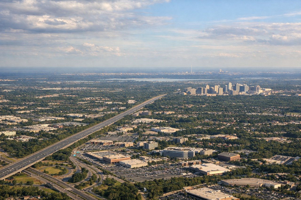
Landing at IAD
RIGHTDulles typically uses runway 01R/19L or 01L/19R for arrivals from the southwest. An approach from the southwest on runway 01 heading north puts the right side facing east, with views over the Virginia suburbs, the Potomac River, and the Washington DC skyline visible in the distance to the northeast. The Capitol dome and monuments are genuinely visible on clear days during the final approach arc.
Will your flight be in sunlight?
Pick a date and time in the Sun Map to watch the sun move across your whole flight.
About This Route
Which side of the plane should I sit on flying from Mc Ghee Tyson (TYS) to Washington Dulles International (IAD)?
Sit on the Left side of the plane for the best views on flights from Knoxville to Washington. The left side captures the dramatic Great Smoky Mountains departure view, which is the most visually distinctive feature of this route. The landing right-side view is good but the DC skyline at distance is subtle. The Smokies on departure are the highlight of the flight.
What can I see during takeoff from Mc Ghee Tyson in Knoxville?
During takeoff from Mc Ghee Tyson (TYS), sit on the Left side for the best views. TYS runway 23L departure heads southwest initially before turning northeast toward IAD. The left side faces southeast toward the Great Smoky Mountains, giving a clear view of the ridgelines and the broad Tennessee Valley floor below Knoxville. The Smokies' distinctive layered blue ridges are unmistakable from this angle. Notable sights include: Great Smoky Mountains ridgelines to the southeast, Tennessee River and Fort Loudoun Lake curving through the valley, downtown Knoxville grid visible below, Clinch Mountain ridge to the north.
What can I see when landing at Washington Dulles International in Washington?
When landing at Washington Dulles International (IAD), sit on the Right side for the best views. Dulles typically uses runway 01R/19L or 01L/19R for arrivals from the southwest. An approach from the southwest on runway 01 heading north puts the right side facing east, with views over the Virginia suburbs, the Potomac River, and the Washington DC skyline visible in the distance to the northeast. The Capitol dome and monuments are genuinely visible on clear days during the final approach arc. Notable sights include: Potomac River and its broad bend near DC, Washington Monument and Capitol dome visible on the horizon to the northeast, Tysons Corner dense urban cluster in the middle distance, Shenandoah Valley ridges fading behind to the west.
How long is the flight from Knoxville to Washington?
The flight from Mc Ghee Tyson (TYS) to Washington Dulles International (IAD) takes about 1 hour 20 minutes. The shortest flight path between them is 419 miles (674 km); winds and air traffic control usually add a few percent.
What does the Knoxville to Washington flight path pass over?
The flight tracks northeast across the Virginia Blue Ridge, crossing the Shenandoah Valley and the parallel ridges of the Appalachians including Massanutten Mountain. The New River and James River drainages are visible as the route crosses central Virginia. Roanoke, Virginia sits roughly below the midpoint of the route. The terrain flattens noticeably as the flight crosses the Virginia Piedmont approaching the DC suburbs.