While takeoff offers good mountain views on the right, the landing approach on the left provides more iconic and visually distinctive landmarks—the Great Wall and Ming Tombs are far more recognizable and memorable than the Mongolian steppe and foothills.
Flown UBN to PEK? Did we get it right?
Flight Path
Ulaanbaatar to Beijing is 714 miles (1,148 km), a flight of about 2 hours 30 minutes.
The flight path crosses from Mongolia into Inner Mongolia, passing over the Yinshan Mountains and the Hetao Plain. The Yangtze River is not on this route. Notable midpoint features include the transition from Mongolian grassland to Chinese agricultural plains, the Yinshan range (visible as a low mountain chain roughly 100 miles north of Beijing), and increasing density of human settlement and field patterns as the aircraft approaches Beijing airspace. The terrain gradually descends from approximately 4,000-5,000 feet elevation in central Mongolia to the North China Plain at roughly 1,000-1,500 feet near Beijing.
Great circle distance and headings ›Phase by phase
Takeoff from UBN
RIGHTRight-side seats offer views of the Khangai Mountains and the Tuul River valley as the aircraft climbs southwestward from Ulaanbaatar. The terrain immediately south and west of the airport is more visually dramatic than the flatter steppe to the north and east.
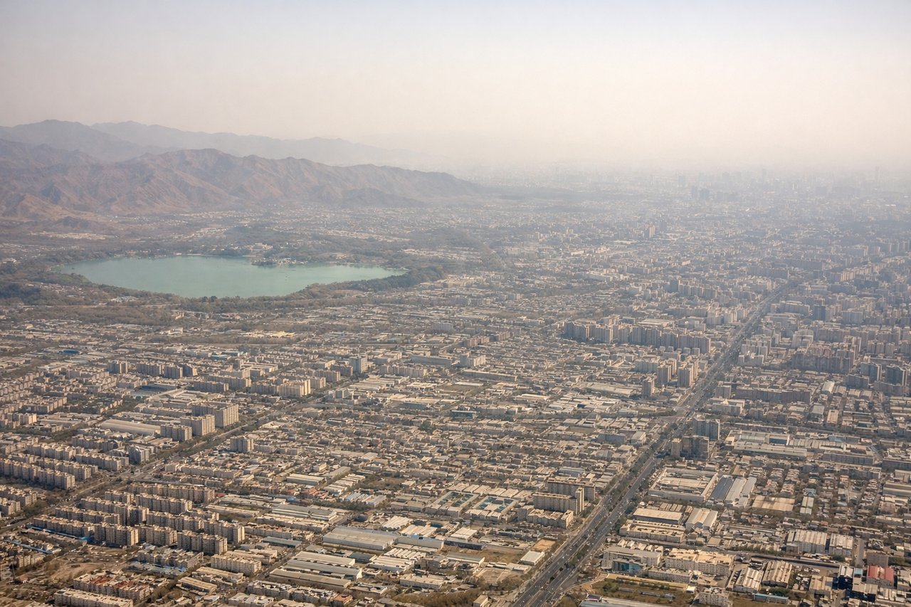
Landing at PEK
LEFTLeft-side seats provide excellent views of the Ming Tombs, the Great Wall sections near Badaling, and the Yanqing District mountains during the descent approach from the northwest. These landmarks are positioned well to the left as the aircraft descends toward Beijing Capital Airport.
Will your flight be in sunlight?
Pick a date and time in the Sun Map to watch the sun move across your whole flight.
About This Route
Which side of the plane should I sit on flying from Ulaanbaatar Chinggis Khaan International Airport (UBN) to Capital (PEK)?
Sit on the Left side of the plane for the best views on flights from Ulaanbaatar to Beijing. While takeoff offers good mountain views on the right, the landing approach on the left provides more iconic and visually distinctive landmarks—the Great Wall and Ming Tombs are far more recognizable and memorable than the Mongolian steppe and foothills.
What can I see during takeoff from Ulaanbaatar Chinggis Khaan International Airport in Ulaanbaatar?
During takeoff from Ulaanbaatar Chinggis Khaan International Airport (UBN), sit on the Right side for the best views. Right-side seats offer views of the Khangai Mountains and the Tuul River valley as the aircraft climbs southwestward from Ulaanbaatar. The terrain immediately south and west of the airport is more visually dramatic than the flatter steppe to the north and east. Notable sights include: Khangai Mountains (distant southwestern horizon), Tuul River valley (below and right during initial climb), Bogd Khan Mountain (visible to the south as a prominent peak), Ulaanbaatar urban sprawl (receding beneath).
What can I see when landing at Capital in Beijing?
When landing at Capital (PEK), sit on the Left side for the best views. Left-side seats provide excellent views of the Ming Tombs, the Great Wall sections near Badaling, and the Yanqing District mountains during the descent approach from the northwest. These landmarks are positioned well to the left as the aircraft descends toward Beijing Capital Airport. Notable sights include: Great Wall of China near Badaling (visible as a thin line on distant ridges to the left), Yanqing District mountains (left and slightly forward), Ming Tombs area (left-center during mid-descent), North China Plain (spreading beneath as altitude decreases).
How long is the flight from Ulaanbaatar to Beijing?
The flight from Ulaanbaatar Chinggis Khaan International Airport (UBN) to Capital (PEK) takes about 2 hours 30 minutes. The shortest flight path between them is 714 miles (1,148 km); winds and air traffic control usually add a few percent.
What does the Ulaanbaatar to Beijing flight path pass over?
The flight path crosses from Mongolia into Inner Mongolia, passing over the Yinshan Mountains and the Hetao Plain. The Yangtze River is not on this route. Notable midpoint features include the transition from Mongolian grassland to Chinese agricultural plains, the Yinshan range (visible as a low mountain chain roughly 100 miles north of Beijing), and increasing density of human settlement and field patterns as the aircraft approaches Beijing airspace. The terrain gradually descends from approximately 4,000-5,000 feet elevation in central Mongolia to the North China Plain at roughly 1,000-1,500 feet near Beijing.