Both sides score equally at 2.5 due to the short flight duration (1 hour 15 minutes) over relatively flat terrain with limited dramatic geography. However, the right side edges ahead for the full flight experience: the Tapi River delta and mangrove wetlands provide more visual interest during takeoff than the left side's open water, and the right side maintains slightly better landmark visibility during the cruise phase over the Gulf of Thailand before the approach phase favors the left side's Chao Phraya views.
Flown URT to BKK? Did we get it right?
Flight Path
Surat Thani to Bangkok is 333 miles (535 km), a flight of about 1 hour 15 minutes.
Gulf of Thailand coastline, scattered islands and shallow water features, transition from Surat Thani province's coastal plains to the Bangkok metropolitan region's river delta system
Great circle distance and headings ›Phase by phase
Takeoff from URT
RIGHTRight side captures the Surat Thani urban area and the initial climb over the Tapi River delta during departure. The river's braided channels and surrounding mangrove wetlands are visible during the initial climb-out phase before the aircraft turns toward Bangkok.
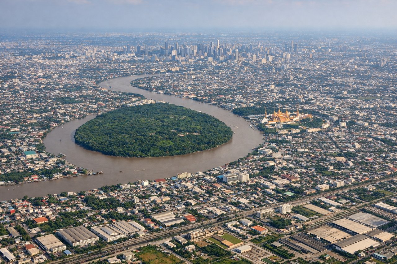
Landing at BKK
LEFTLeft side during approach to Bangkok captures the Chao Phraya River's distinctive meanders and the sprawling Bangkok metropolitan area. The river's serpentine curves are a major visual landmark during descent, and the city's urban density becomes increasingly apparent as the aircraft descends toward Suvarnabhumi.
Will your flight be in sunlight?
Pick a date and time in the Sun Map to watch the sun move across your whole flight.
About This Route
Which side of the plane should I sit on flying from Surat Thani Airport (URT) to Suvarnabhumi Airport (BKK)?
Sit on the Right side of the plane for the best views on flights from Surat Thani to Bangkok. Both sides score equally at 2.5 due to the short flight duration (1 hour 15 minutes) over relatively flat terrain with limited dramatic geography. However, the right side edges ahead for the full flight experience: the Tapi River delta and mangrove wetlands provide more visual interest during takeoff than the left side's open water, and the right side maintains slightly better landmark visibility during the cruise phase over the Gulf of Thailand before the approach phase favors the left side's Chao Phraya views.
What can I see during takeoff from Surat Thani Airport in Surat Thani?
During takeoff from Surat Thani Airport (URT), sit on the Right side for the best views. Right side captures the Surat Thani urban area and the initial climb over the Tapi River delta during departure. The river's braided channels and surrounding mangrove wetlands are visible during the initial climb-out phase before the aircraft turns toward Bangkok. Notable sights include: Tapi River delta with mangrove channels, Surat Thani city grid, Gulf of Thailand coastline to the southeast.
What can I see when landing at Suvarnabhumi Airport in Bangkok?
When landing at Suvarnabhumi Airport (BKK), sit on the Left side for the best views. Left side during approach to Bangkok captures the Chao Phraya River's distinctive meanders and the sprawling Bangkok metropolitan area. The river's serpentine curves are a major visual landmark during descent, and the city's urban density becomes increasingly apparent as the aircraft descends toward Suvarnabhumi. Notable sights include: Chao Phraya River with characteristic meanders, Bangkok city sprawl and street grid, Suvarnabhumi Airport runways and surrounding industrial zones.
How long is the flight from Surat Thani to Bangkok?
The flight from Surat Thani Airport (URT) to Suvarnabhumi Airport (BKK) takes about 1 hour 15 minutes. The shortest flight path between them is 333 miles (535 km); winds and air traffic control usually add a few percent.
What does the Surat Thani to Bangkok flight path pass over?
Gulf of Thailand coastline, scattered islands and shallow water features, transition from Surat Thani province's coastal plains to the Bangkok metropolitan region's river delta system