While takeoff offers lagoon scenery, the landing approach provides more dramatic and sustained views of the Rocky Mountain Front Range, which is the most visually striking feature of this transatlantic route. Left seats capture the mountains during the critical descent phase when they're most prominent.
Flown VCE to DEN? Did we get it right?
Flight Path
Venice to Denver is 5,370 miles (8,642 km), a flight of about 10 hours 45 minutes.
The flight path crosses the Atlantic over the North Atlantic shipping lanes and typically passes over Greenland's southern coast or the Canadian Arctic Archipelago depending on routing. Over North America, you'll cross the Canadian prairies (visible as vast agricultural grid patterns), then the Canadian Rockies (visible as a north-south mountain chain in Alberta/British Columbia), before descending toward the U.S. Rockies. The Great Plains of eastern Colorado and Wyoming are visible during final approach, showing the dramatic elevation change from sea-level Atlantic to the 5,280-foot Denver plateau.
Great circle distance and headings ›


Phase by phase

Takeoff from VCE
RIGHTRight side seats capture the Venetian Lagoon and the Adriatic coastline as you climb out northeastward from Tessera. You'll see the distinctive shallow lagoon waters, barrier islands, and the Italian coast receding beneath you.
Landing at DEN
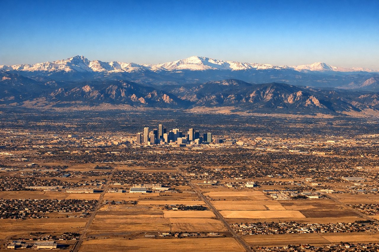
LEFTLeft side seats provide the best views during descent into Denver. You'll see the Rocky Mountains dominating the western approach, with the Front Range peaks clearly visible, and the Denver metropolitan area sprawling across the high plains to the east.
Will your flight be in sunlight?
Pick a date and time in the Sun Map to watch the sun move across your whole flight.
About This Route
Which side of the plane should I sit on flying from Venezia Tessera (VCE) to Denver International (DEN)?
Sit on the Left side of the plane for the best views on flights from Venice to Denver. While takeoff offers lagoon scenery, the landing approach provides more dramatic and sustained views of the Rocky Mountain Front Range, which is the most visually striking feature of this transatlantic route. Left seats capture the mountains during the critical descent phase when they're most prominent.
What can I see during takeoff from Venezia Tessera in Venice?
During takeoff from Venezia Tessera (VCE), sit on the Right side for the best views. Right side seats capture the Venetian Lagoon and the Adriatic coastline as you climb out northeastward from Tessera. You'll see the distinctive shallow lagoon waters, barrier islands, and the Italian coast receding beneath you. Notable sights include: Venetian Lagoon (shallow turquoise waters with barrier islands), Adriatic Sea coastline, Friuli-Venezia Giulia coastal plain, Alps on distant northern horizon.
What can I see when landing at Denver International in Denver?
When landing at Denver International (DEN), sit on the Left side for the best views. Left side seats provide the best views during descent into Denver. You'll see the Rocky Mountains dominating the western approach, with the Front Range peaks clearly visible, and the Denver metropolitan area sprawling across the high plains to the east. Notable sights include: Rocky Mountain Front Range (including peaks near Boulder and Colorado Springs), South Platte River valley, Denver metropolitan area, High Plains extending eastward.
How long is the flight from Venice to Denver?
The flight from Venezia Tessera (VCE) to Denver International (DEN) takes about 10 hours 45 minutes. The shortest flight path between them is 5,370 miles (8,642 km); winds and air traffic control usually add a few percent.
What does the Venice to Denver flight path pass over?
The flight path crosses the Atlantic over the North Atlantic shipping lanes and typically passes over Greenland's southern coast or the Canadian Arctic Archipelago depending on routing. Over North America, you'll cross the Canadian prairies (visible as vast agricultural grid patterns), then the Canadian Rockies (visible as a north-south mountain chain in Alberta/British Columbia), before descending toward the U.S. Rockies. The Great Plains of eastern Colorado and Wyoming are visible during final approach, showing the dramatic elevation change from sea-level Atlantic to the 5,280-foot Denver plateau.