Campinas to Brasilia is 496 miles (798 km), a flight of about 1 hour 15 minutes.
While takeoff favors the right, landing provides the more distinctive and recognizable view of Brasília's unique modernist urban plan and Lago Paranoá. The landing experience outweighs the takeoff advantage.
Flight Path
The flight path crosses the interior plateau of São Paulo and Minas Gerais states, passing over agricultural regions and cerrado vegetation. The Serra da Mantiqueira remains to the east (left) throughout the flight. The landscape transitions gradually from the more densely cultivated lands near Campinas to the sparser cerrado scrubland as the aircraft approaches Brasília. No major rivers or lakes are directly beneath the typical flight path, though the Paraíba do Sul River system lies to the east.
Great circle distance and headings ›Phase by phase
Takeoff from VCP
RIGHTVCP typically departs to the northeast on runway 15. Right-side seats offer views of the Atibaia River valley and the transition from Campinas' urban sprawl into the agricultural plateau. Left seats face away from the terrain.
Landing at BSB
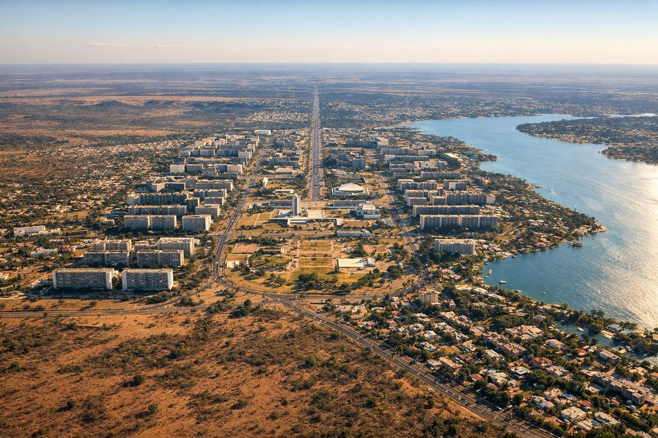
LEFTBSB typically lands on runway 29 (westbound approach). Left-side seats provide views of Brasilia's distinctive modernist city plan—the curved wings of the Plano Piloto and the artificial Lago Paranoá—during the final descent. Right seats face the cerrado scrubland to the east.
Will your flight be in sunlight?
Pick a date and time in the Sun Map to watch the sun move across your whole flight.
About This Route
Which side of the plane should I sit on flying from Viracopos (VCP) to Presidente Juscelino Kubitschek (BSB)?
Sit on the Left side of the plane for the best views on flights from Campinas to Brasilia. While takeoff favors the right, landing provides the more distinctive and recognizable view of Brasília's unique modernist urban plan and Lago Paranoá. The landing experience outweighs the takeoff advantage.
What can I see during takeoff from Viracopos in Campinas?
During takeoff from Viracopos (VCP), sit on the Right side for the best views. VCP typically departs to the northeast on runway 15. Right-side seats offer views of the Atibaia River valley and the transition from Campinas' urban sprawl into the agricultural plateau. Left seats face away from the terrain. Notable sights include: Atibaia River valley, Campinas urban grid, Serra da Mantiqueira foothills (distant northeast), agricultural plateau of interior São Paulo.
What can I see when landing at Presidente Juscelino Kubitschek in Brasilia?
When landing at Presidente Juscelino Kubitschek (BSB), sit on the Left side for the best views. BSB typically lands on runway 29 (westbound approach). Left-side seats provide views of Brasilia's distinctive modernist city plan—the curved wings of the Plano Piloto and the artificial Lago Paranoá—during the final descent. Right seats face the cerrado scrubland to the east. Notable sights include: Lago Paranoá (artificial lake), Plano Piloto's curved urban geometry, Esplanade of Ministries, cerrado vegetation.
How long is the flight from Campinas to Brasilia?
The flight from Viracopos (VCP) to Presidente Juscelino Kubitschek (BSB) takes about 1 hour 15 minutes. The shortest flight path between them is 496 miles (798 km); winds and air traffic control usually add a few percent.
What does the Campinas to Brasilia flight path pass over?
The flight path crosses the interior plateau of São Paulo and Minas Gerais states, passing over agricultural regions and cerrado vegetation. The Serra da Mantiqueira remains to the east (left) throughout the flight. The landscape transitions gradually from the more densely cultivated lands near Campinas to the sparser cerrado scrubland as the aircraft approaches Brasília. No major rivers or lakes are directly beneath the typical flight path, though the Paraíba do Sul River system lies to the east.