Vientiane to Singapore is 1,153 miles (1,856 km), a flight of about 2 hours 15 minutes.
The right side captures the Mekong River on departure and tracks the western side of the flight path over peninsular Malaysia, offering views of the Main Range mountains of Malaysia in the distance and the western coastline. The left side wins at landing for the Singapore skyline, but the right side provides more sustained interest across the full flight including the Mekong and Malaysian terrain.
Flight Path
The flight tracks south-southeast over central Laos, crossing into Cambodia near Stung Treng, then over the Tonle Sap basin and Phnom Penh area, before crossing the Gulf of Thailand coastline near Ho Chi Minh City's latitude, then over the South China Sea and down the eastern coast of peninsular Malaysia, crossing the Strait of Malacca approach into Singapore. The Cardamom Mountains of Cambodia and the Main Range of peninsular Malaysia are the most topographically notable features along the route.
Great circle distance and headings ›Phase by phase
Takeoff from VTE
RIGHTWattay typically departs on runway 13 (southeast) or 20 (south). On a southward departure, the right side gives you the Mekong River curving through Vientiane and the Thai lowlands beyond. The left side faces the city center but quickly transitions to flat terrain.
Landing at SIN
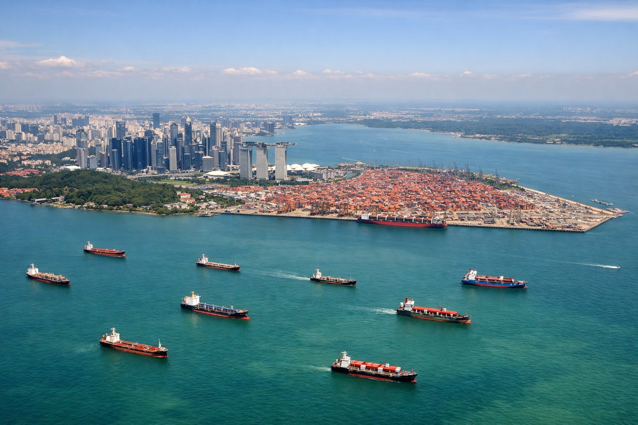
LEFTChangi typically lands on runways 02L/02C from the south, meaning the approach comes in from the south over the Strait of Singapore. The left side faces west toward the city skyline of Marina Bay and the CBD, which is the dominant visual spectacle on approach. The right side looks east over open sea and Changi's eastern coastline.
Landmarks on this routeAll landmarks →
Will your flight be in sunlight?
Pick a date and time in the Sun Map to watch the sun move across your whole flight.
About This Route
Which side of the plane should I sit on flying from Wattay International (VTE) to Singapore Changi (SIN)?
Sit on the Right side of the plane for the best views on flights from Vientiane to Singapore. The right side captures the Mekong River on departure and tracks the western side of the flight path over peninsular Malaysia, offering views of the Main Range mountains of Malaysia in the distance and the western coastline. The left side wins at landing for the Singapore skyline, but the right side provides more sustained interest across the full flight including the Mekong and Malaysian terrain.
What can I see during takeoff from Wattay International in Vientiane?
During takeoff from Wattay International (VTE), sit on the Right side for the best views. Wattay typically departs on runway 13 (southeast) or 20 (south). On a southward departure, the right side gives you the Mekong River curving through Vientiane and the Thai lowlands beyond. The left side faces the city center but quickly transitions to flat terrain. Notable sights include: Mekong River bend at Vientiane, Thai side of the river (Nong Khai), flat Khorat Plateau stretching west, Vientiane urban grid.
What can I see when landing at Singapore Changi in Singapore?
When landing at Singapore Changi (SIN), sit on the Left side for the best views. Changi typically lands on runways 02L/02C from the south, meaning the approach comes in from the south over the Strait of Singapore. The left side faces west toward the city skyline of Marina Bay and the CBD, which is the dominant visual spectacle on approach. The right side looks east over open sea and Changi's eastern coastline. Notable sights include: Marina Bay Sands and CBD skyline, Sentosa Island and the Southern Islands, Strait of Singapore shipping lanes, Jurong Island industrial complex.
How long is the flight from Vientiane to Singapore?
The flight from Wattay International (VTE) to Singapore Changi (SIN) takes about 2 hours 15 minutes. The shortest flight path between them is 1,153 miles (1,856 km); winds and air traffic control usually add a few percent.
What does the Vientiane to Singapore flight path pass over?
The flight tracks south-southeast over central Laos, crossing into Cambodia near Stung Treng, then over the Tonle Sap basin and Phnom Penh area, before crossing the Gulf of Thailand coastline near Ho Chi Minh City's latitude, then over the South China Sea and down the eastern coast of peninsular Malaysia, crossing the Strait of Malacca approach into Singapore. The Cardamom Mountains of Cambodia and the Main Range of peninsular Malaysia are the most topographically notable features along the route.