Vientiane to Bangkok is 321 miles (517 km), a flight of about 55 minutes.
Both the Vientiane departure and the Bangkok arrival place the Mekong River and Bangkok's cityscape on the right side, while the left side offers only flat, featureless plains for the entire short flight.
Flight Path
Flat agricultural plains of Thailand's Khorat Plateau (Isaan region), scattered rice paddies and small towns, with the Mekong's tributaries fading behind as the route cuts southwest toward the Chao Phraya basin
Great circle distance and headings ›Phase by phase
Takeoff from VTE
RIGHTDeparting Wattay on runway 13 toward the southeast, the Mekong River and the low-rise sprawl of Vientiane sit just south of the runway, putting them on the right side of the aircraft as it climbs out. The left side shows only flat farmland stretching toward the Laos interior.
Landing at BKK
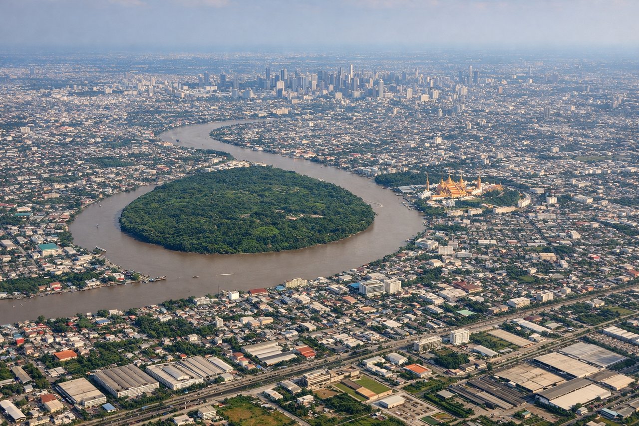
RIGHTOn approach into Suvarnabhumi from the north (runway 19), the aircraft tracks down the eastern edge of Bangkok, keeping the Chao Phraya River and the dense high-rise core of the city visible off the right side, while the left side faces open flat suburbs and canals with less visual interest.
Landmarks on this routeAll landmarks →
Will your flight be in sunlight?
Pick a date and time in the Sun Map to watch the sun move across your whole flight.
About This Route
Which side of the plane should I sit on flying from Wattay International (VTE) to Suvarnabhumi Airport (BKK)?
Sit on the Right side of the plane for the best views on flights from Vientiane to Bangkok. Both the Vientiane departure and the Bangkok arrival place the Mekong River and Bangkok's cityscape on the right side, while the left side offers only flat, featureless plains for the entire short flight.
What can I see during takeoff from Wattay International in Vientiane?
During takeoff from Wattay International (VTE), sit on the Right side for the best views. Departing Wattay on runway 13 toward the southeast, the Mekong River and the low-rise sprawl of Vientiane sit just south of the runway, putting them on the right side of the aircraft as it climbs out. The left side shows only flat farmland stretching toward the Laos interior. Notable sights include: Mekong River, Vientiane cityscape, That Luang area, Nong Khai on the Thai riverbank.
What can I see when landing at Suvarnabhumi Airport in Bangkok?
When landing at Suvarnabhumi Airport (BKK), sit on the Right side for the best views. On approach into Suvarnabhumi from the north (runway 19), the aircraft tracks down the eastern edge of Bangkok, keeping the Chao Phraya River and the dense high-rise core of the city visible off the right side, while the left side faces open flat suburbs and canals with less visual interest. Notable sights include: Chao Phraya River, Bangkok skyline (Sukhumvit/CBD towers), canal (klong) network, Suvarnabhumi's surrounding wetlands.
How long is the flight from Vientiane to Bangkok?
The flight from Wattay International (VTE) to Suvarnabhumi Airport (BKK) takes about 55 minutes. The shortest flight path between them is 321 miles (517 km); winds and air traffic control usually add a few percent.
What does the Vientiane to Bangkok flight path pass over?
Flat agricultural plains of Thailand's Khorat Plateau (Isaan region), scattered rice paddies and small towns, with the Mekong's tributaries fading behind as the route cuts southwest toward the Chao Phraya basin