Bangkok to Vientiane is 321 miles (517 km), a flight of about 1 hour 5 minutes.
The right side edges out the left because the Mekong River and the first hints of Laos's highland terrain during the approach add more geographic interest than the mostly flat plains seen on departure, even though Bangkok's skyline gives the left side a brief boost.
Flight Path
Flat agricultural plains of Thailand's Isaan region transitioning to the Mekong River floodplain near the Laos border
Great circle distance and headings ›Phase by phase
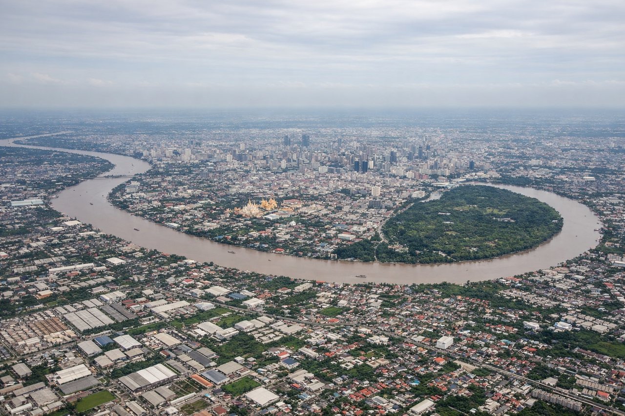
Takeoff from BKK
LEFTSuvarnabhumi's runways point north, and as the aircraft climbs out, Bangkok's sprawling skyline and the looping bends of the Chao Phraya River sit off to the west (left side), giving a brief but genuine urban-river view before the plains take over.
Landing at VTE
RIGHTOn approach into Wattay, the flight path parallels the Mekong River, which forms the Thailand-Laos border right beside Vientiane, and the first low ridgelines of Laos's Annamite foothills appear to the east (right side) as the plains give way to hillier terrain.
Landmarks on this routeAll landmarks →
Will your flight be in sunlight?
Pick a date and time in the Sun Map to watch the sun move across your whole flight.
About This Route
Which side of the plane should I sit on flying from Suvarnabhumi Airport (BKK) to Wattay International (VTE)?
Sit on the Right side of the plane for the best views on flights from Bangkok to Vientiane. The right side edges out the left because the Mekong River and the first hints of Laos's highland terrain during the approach add more geographic interest than the mostly flat plains seen on departure, even though Bangkok's skyline gives the left side a brief boost.
What can I see during takeoff from Suvarnabhumi Airport in Bangkok?
During takeoff from Suvarnabhumi Airport (BKK), sit on the Left side for the best views. Suvarnabhumi's runways point north, and as the aircraft climbs out, Bangkok's sprawling skyline and the looping bends of the Chao Phraya River sit off to the west (left side), giving a brief but genuine urban-river view before the plains take over. Notable sights include: Chao Phraya River bends, Bangkok's high-rise core, Chao Phraya basin farmland.
What can I see when landing at Wattay International in Vientiane?
When landing at Wattay International (VTE), sit on the Right side for the best views. On approach into Wattay, the flight path parallels the Mekong River, which forms the Thailand-Laos border right beside Vientiane, and the first low ridgelines of Laos's Annamite foothills appear to the east (right side) as the plains give way to hillier terrain. Notable sights include: Mekong River, Vientiane's riverside cityscape, distant Annamite foothills, patchwork rice fields of the Vientiane Plain.
How long is the flight from Bangkok to Vientiane?
The flight from Suvarnabhumi Airport (BKK) to Wattay International (VTE) takes about 1 hour 5 minutes. The shortest flight path between them is 321 miles (517 km); winds and air traffic control usually add a few percent.
What does the Bangkok to Vientiane flight path pass over?
Flat agricultural plains of Thailand's Isaan region transitioning to the Mekong River floodplain near the Laos border