Vientiane to Hanoi is 307 miles (495 km), a flight of about 1 hour 10 minutes.
Right-side seats offer the most continuous scenic value: the Mekong River and foothills during climb-out, the Annamite Range ridgeline during cruise, and approach views of the Red River delta. Left seats see good landing scenery but less during the climb and cruise phases.
Flight Path
Annamite Range (Truong Son Mountains) running north-south along the Laos-Vietnam border; the range's forested ridges and valleys are visible from cruise altitude. The landscape transitions from Mekong lowlands to increasingly rugged terrain. Several river valleys cut through the range, including tributaries of the Red River system that eventually feed into the Red River delta near Hanoi.
Great circle distance and headings ›Phase by phase
Takeoff from VTE
RIGHTClimbing northeast from Vientiane, right-side seats face the Mekong River valley and the initial terrain toward Hanoi. You'll see the river's broad curves and the transition from lowland plains to foothills.
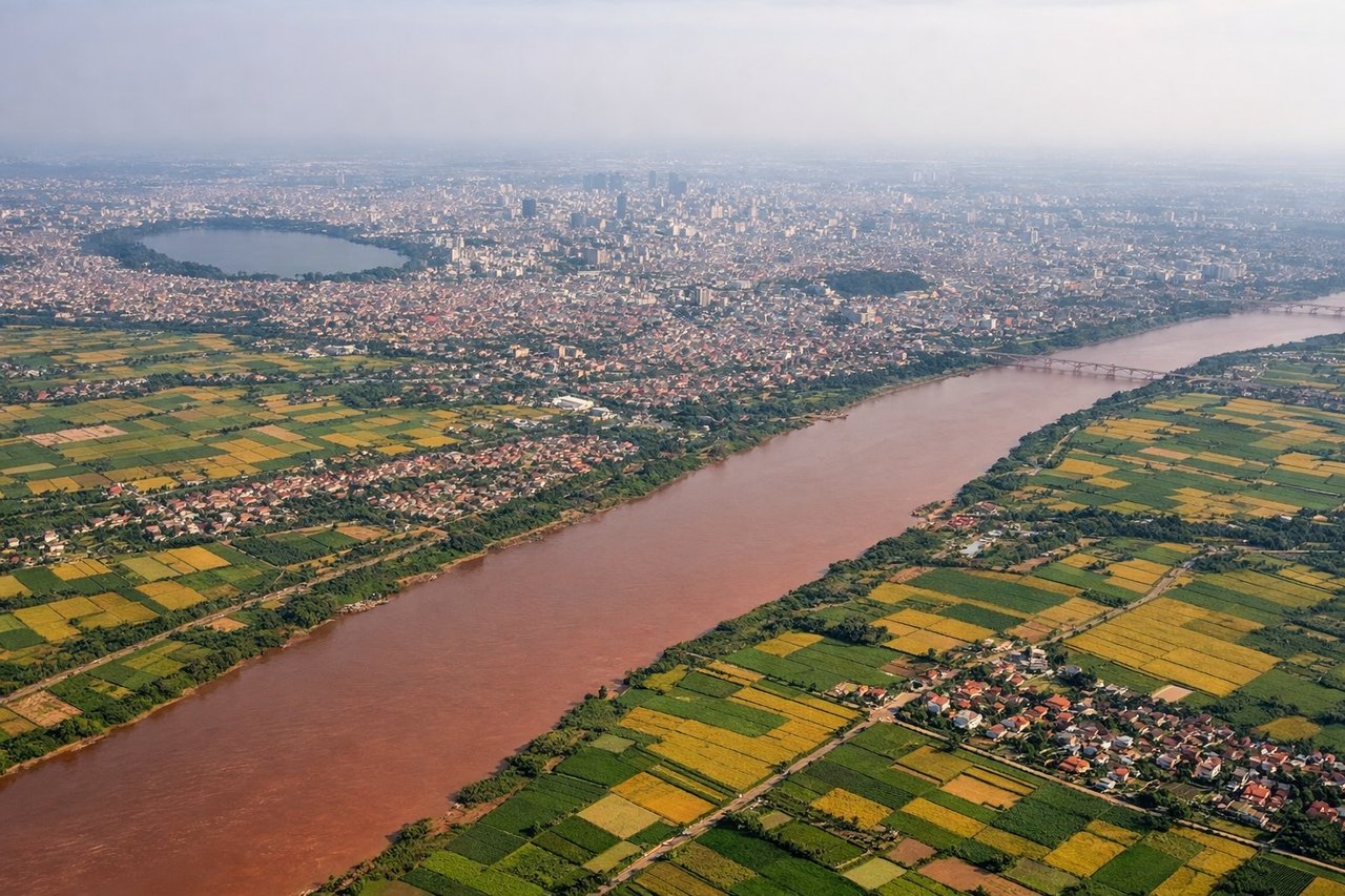
Landing at HAN
LEFTOn descent into Hanoi from the southwest, left-side seats face the Red River delta and approach corridor. You'll see the river's distinctive red-colored water, the flat delta landscape, and Hanoi's urban sprawl as you descend.
Will your flight be in sunlight?
Pick a date and time in the Sun Map to watch the sun move across your whole flight.
About This Route
Which side of the plane should I sit on flying from Wattay International (VTE) to Noibai International (HAN)?
Sit on the Right side of the plane for the best views on flights from Vientiane to Hanoi. Right-side seats offer the most continuous scenic value: the Mekong River and foothills during climb-out, the Annamite Range ridgeline during cruise, and approach views of the Red River delta. Left seats see good landing scenery but less during the climb and cruise phases.
What can I see during takeoff from Wattay International in Vientiane?
During takeoff from Wattay International (VTE), sit on the Right side for the best views. Climbing northeast from Vientiane, right-side seats face the Mekong River valley and the initial terrain toward Hanoi. You'll see the river's broad curves and the transition from lowland plains to foothills. Notable sights include: Mekong River (immediate departure corridor), Vientiane urban sprawl below, foothills of the Annamite Range emerging to the northeast.
What can I see when landing at Noibai International in Hanoi?
When landing at Noibai International (HAN), sit on the Left side for the best views. On descent into Hanoi from the southwest, left-side seats face the Red River delta and approach corridor. You'll see the river's distinctive red-colored water, the flat delta landscape, and Hanoi's urban sprawl as you descend. Notable sights include: Red River (visible as rust-colored waterway), Hanoi city districts and urban grid, Red River Delta agricultural plains, Tam Dao Mountains visible to the northwest on the horizon.
How long is the flight from Vientiane to Hanoi?
The flight from Wattay International (VTE) to Noibai International (HAN) takes about 1 hour 10 minutes. The shortest flight path between them is 307 miles (495 km); winds and air traffic control usually add a few percent.
What does the Vientiane to Hanoi flight path pass over?
Annamite Range (Truong Son Mountains) running north-south along the Laos-Vietnam border; the range's forested ridges and valleys are visible from cruise altitude. The landscape transitions from Mekong lowlands to increasingly rugged terrain. Several river valleys cut through the range, including tributaries of the Red River system that eventually feed into the Red River delta near Hanoi.