Hanoi to Vientiane is 307 miles (495 km), a flight of about 1 hour 15 minutes.
Right-side seats capture the most dramatic geography: the Red River Delta's complexity during departure and the Mekong River's scale during approach. The flight path itself runs roughly southwest, so right seats face the more visually interesting terrain throughout the journey.
Flight Path
The flight crosses central Laos, passing over the Vientiane Plain's transition zone. Visible features include the Phou Khao Khouay plateau (low mountains) to the east around 19.5°N, scattered settlements in the Vientiane Plain, and the Mekong River's course as it flows south. The terrain transitions from the Red River Delta's flat, densely settled landscape to Laos's more open, forested plateau with sparse settlement. Clear weather typically allows views of the Annamite Range's western foothills on the eastern horizon.
Great circle distance and headings ›Phase by phase
Takeoff from HAN
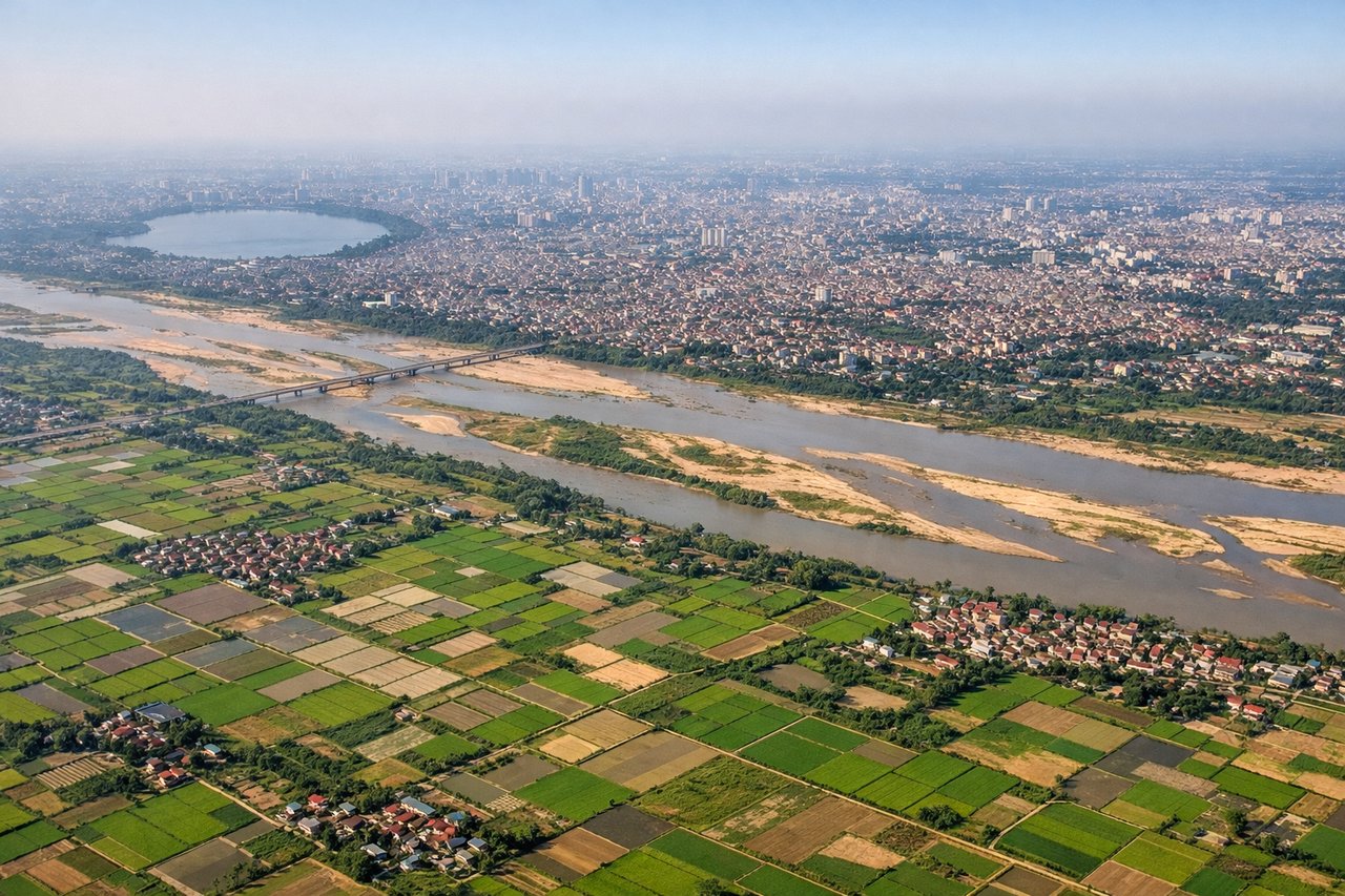
RIGHTNoibai typically departs on runway 01L/01R (northbound) or 20L/20R (southbound). Right-side seats on northbound departures offer views of the Red River Delta's intricate waterway network and agricultural patchwork. Southbound departures favor right seats for views of Hanoi's urban sprawl and the delta's eastern extent toward Haiphong.
Landing at VTE
LEFTApproach to Wattay (runway 03/21) typically comes from the northeast. Left-side seats on final approach offer direct views of the Mekong River's wide, braided channels and the Vientiane Plain's agricultural landscape. The river's oxbow bends and sandbars are particularly striking at lower altitudes.
Will your flight be in sunlight?
Pick a date and time in the Sun Map to watch the sun move across your whole flight.
About This Route
Which side of the plane should I sit on flying from Noibai International (HAN) to Wattay International (VTE)?
Sit on the Right side of the plane for the best views on flights from Hanoi to Vientiane. Right-side seats capture the most dramatic geography: the Red River Delta's complexity during departure and the Mekong River's scale during approach. The flight path itself runs roughly southwest, so right seats face the more visually interesting terrain throughout the journey.
What can I see during takeoff from Noibai International in Hanoi?
During takeoff from Noibai International (HAN), sit on the Right side for the best views. Noibai typically departs on runway 01L/01R (northbound) or 20L/20R (southbound). Right-side seats on northbound departures offer views of the Red River Delta's intricate waterway network and agricultural patchwork. Southbound departures favor right seats for views of Hanoi's urban sprawl and the delta's eastern extent toward Haiphong. Notable sights include: Red River (winding northwest from Hanoi), Hanoi city grid (visible as geometric street patterns), Haiphong port area (eastern horizon), Thai Nguyen highlands (distant northern ridgeline).
What can I see when landing at Wattay International in Vientiane?
When landing at Wattay International (VTE), sit on the Left side for the best views. Approach to Wattay (runway 03/21) typically comes from the northeast. Left-side seats on final approach offer direct views of the Mekong River's wide, braided channels and the Vientiane Plain's agricultural landscape. The river's oxbow bends and sandbars are particularly striking at lower altitudes. Notable sights include: Mekong River (wide, multi-channel, with visible sandbars), Vientiane city center (grid pattern on river's left bank), That Luang stupa area (golden spire visible in city), Thai border across Mekong (right bank settlements and forest).
How long is the flight from Hanoi to Vientiane?
The flight from Noibai International (HAN) to Wattay International (VTE) takes about 1 hour 15 minutes. The shortest flight path between them is 307 miles (495 km); winds and air traffic control usually add a few percent.
What does the Hanoi to Vientiane flight path pass over?
The flight crosses central Laos, passing over the Vientiane Plain's transition zone. Visible features include the Phou Khao Khouay plateau (low mountains) to the east around 19.5°N, scattered settlements in the Vientiane Plain, and the Mekong River's course as it flows south. The terrain transitions from the Red River Delta's flat, densely settled landscape to Laos's more open, forested plateau with sparse settlement. Clear weather typically allows views of the Annamite Range's western foothills on the eastern horizon.