While takeoff from Wanganui offers scenic New Zealand geography, the landing approach into Houston provides more dramatic and sustained visual interest—the convergence of major waterways, extensive urban sprawl, and industrial infrastructure creates a more compelling aerial composition than the relatively flat farmland visible on departure.
Flown WAG to IAH? Did we get it right?
Flight Path
Wanganui to Houston is 7,494 miles (12,061 km), a flight of about 16 hours 30 minutes.
The flight path crosses the South Pacific, passing south of Fiji and Samoa. Approaching North America, the aircraft typically crosses the US West Coast near California or Oregon, offering views of the Sierra Nevada and Cascade ranges (if routed northerly) or the Rocky Mountains (if routed more southerly). The Great Plains and Mississippi River valley are crossed during descent into Texas. Actual routing varies by weather, air traffic control, and prevailing winds.
Great circle distance and headings ›Phase by phase
Takeoff from WAG
RIGHTRight-side seats offer views of the Whanganui River valley and the North Island's western coastline as the aircraft climbs. The river's distinctive meandering path through farmland is visible during initial climb, and the Tasman Sea comes into view as altitude increases.
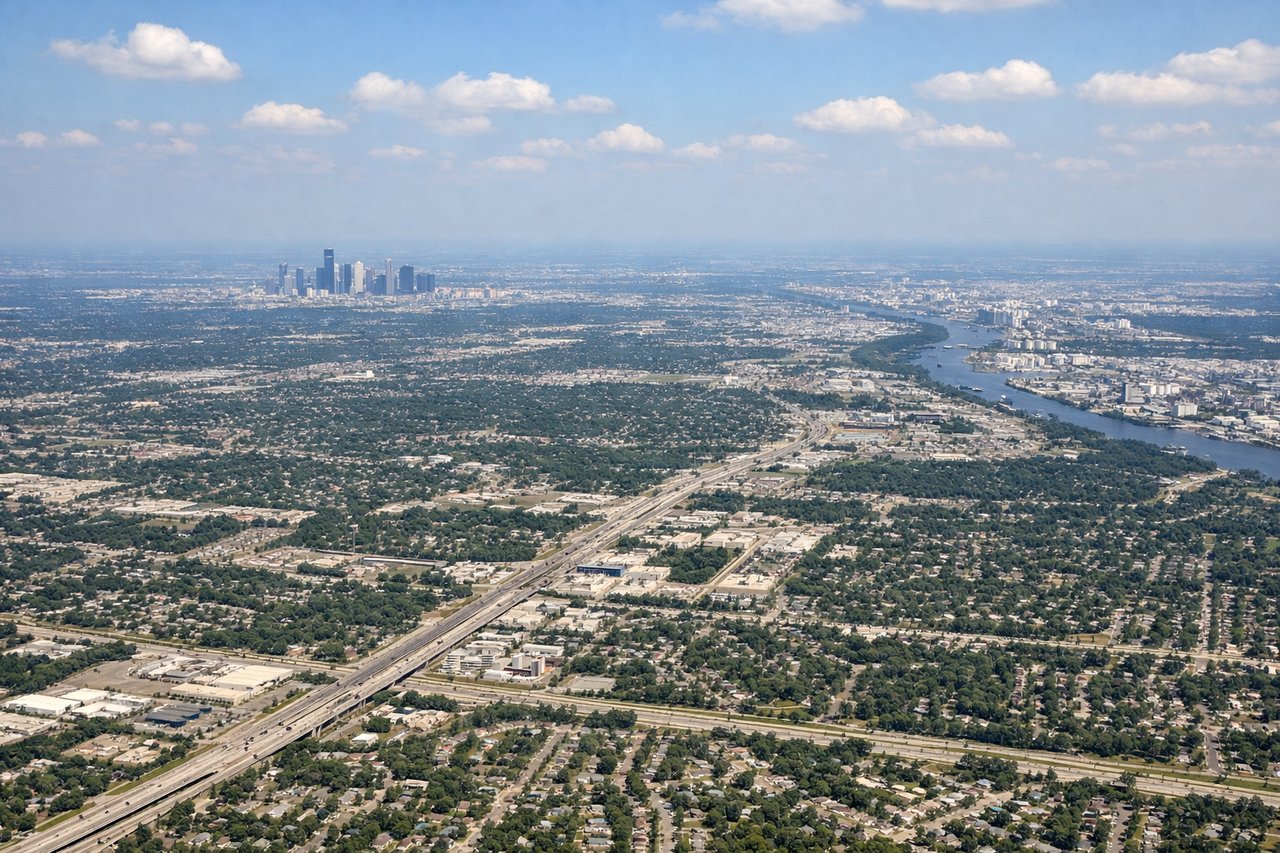
Landing at IAH
LEFTLeft-side seats provide views of the Houston metropolitan area, Buffalo Bayou, and the Texas Gulf Coast during descent. The city's sprawl, major highways, and industrial areas along the bayou are clearly visible from 10,000–15,000 feet on approach to IAH.
Will your flight be in sunlight?
Pick a date and time in the Sun Map to watch the sun move across your whole flight.
About This Route
Which side of the plane should I sit on flying from Wanganui (WAG) to George Bush Intcntl Houston (IAH)?
Sit on the Left side of the plane for the best views on flights from Wanganui to Houston. While takeoff from Wanganui offers scenic New Zealand geography, the landing approach into Houston provides more dramatic and sustained visual interest—the convergence of major waterways, extensive urban sprawl, and industrial infrastructure creates a more compelling aerial composition than the relatively flat farmland visible on departure.
What can I see during takeoff from Wanganui in Wanganui?
During takeoff from Wanganui (WAG), sit on the Right side for the best views. Right-side seats offer views of the Whanganui River valley and the North Island's western coastline as the aircraft climbs. The river's distinctive meandering path through farmland is visible during initial climb, and the Tasman Sea comes into view as altitude increases. Notable sights include: Whanganui River (meandering through lowlands), Tasman Sea coastline, farmland plains of the Whanganui region, Ruapehu volcanic massif (distant, to the south-southeast).
What can I see when landing at George Bush Intcntl Houston in Houston?
When landing at George Bush Intcntl Houston (IAH), sit on the Left side for the best views. Left-side seats provide views of the Houston metropolitan area, Buffalo Bayou, and the Texas Gulf Coast during descent. The city's sprawl, major highways, and industrial areas along the bayou are clearly visible from 10,000–15,000 feet on approach to IAH. Notable sights include: Buffalo Bayou (winding through downtown Houston), Houston metropolitan sprawl, San Jacinto River confluence, Galveston Bay (visible in distance to the southeast).
How long is the flight from Wanganui to Houston?
The flight from Wanganui (WAG) to George Bush Intcntl Houston (IAH) takes about 16 hours 30 minutes. The shortest flight path between them is 7,494 miles (12,061 km); winds and air traffic control usually add a few percent.
What does the Wanganui to Houston flight path pass over?
The flight path crosses the South Pacific, passing south of Fiji and Samoa. Approaching North America, the aircraft typically crosses the US West Coast near California or Oregon, offering views of the Sierra Nevada and Cascade ranges (if routed northerly) or the Rocky Mountains (if routed more southerly). The Great Plains and Mississippi River valley are crossed during descent into Texas. Actual routing varies by weather, air traffic control, and prevailing winds.