Whakatane to Beijing is 6,602 miles (10,625 km), a flight of about 13 hours 30 minutes.
While takeoff offers excellent Bay of Plenty coastal scenery, the landing approach into Beijing provides more sustained and dramatic views of a major geographic transition zone—from the North China Plain's agricultural landscape to one of the world's largest cities. The approach descent offers longer viewing time of distinctive features.
Flight Path
This route crosses the Tasman Sea, then traverses the Australian continent (Great Dividing Range visible on approach to Australian airspace), crosses the Indian Ocean, and passes over Southeast Asia including parts of Thailand, Laos, or Vietnam depending on exact routing. The flight typically follows a great-circle route northwestward across the Pacific, then over Indonesia or the Philippines, before entering Chinese airspace over the South China Sea or approaching from the southwest. Notable midpoint landmarks include the Australian east coast ranges, the Coral Sea, and the mountainous terrain of Southeast Asia on final approach to Beijing.
Great circle distance and headings ›


Phase by phase
Takeoff from WHK
RIGHTRight-side seats offer views of the Bay of Plenty coastline and Whakatane's immediate coastal geography as the aircraft climbs northwestward. The Bay of Plenty's distinctive curved shoreline and nearby Matakana Island are visible during initial climb.
Landing at PEK
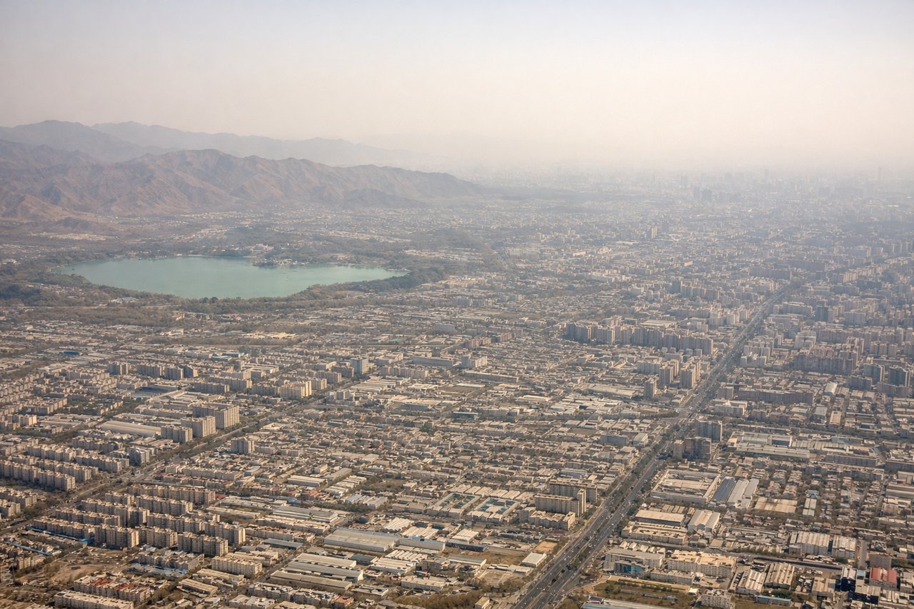
LEFTLeft-side seats provide views of the North China Plain and Beijing's urban sprawl during descent into Capital Airport. The approach from the southeast reveals the city's grid pattern and surrounding agricultural flatlands characteristic of the region.
Landmarks on this routeAll landmarks →
Will your flight be in sunlight?
Pick a date and time in the Sun Map to watch the sun move across your whole flight.
About This Route
Which side of the plane should I sit on flying from Whakatane (WHK) to Capital (PEK)?
Sit on the Left side of the plane for the best views on flights from Whakatane to Beijing. While takeoff offers excellent Bay of Plenty coastal scenery, the landing approach into Beijing provides more sustained and dramatic views of a major geographic transition zone—from the North China Plain's agricultural landscape to one of the world's largest cities. The approach descent offers longer viewing time of distinctive features.
What can I see during takeoff from Whakatane in Whakatane?
During takeoff from Whakatane (WHK), sit on the Right side for the best views. Right-side seats offer views of the Bay of Plenty coastline and Whakatane's immediate coastal geography as the aircraft climbs northwestward. The Bay of Plenty's distinctive curved shoreline and nearby Matakana Island are visible during initial climb. Notable sights include: Bay of Plenty coastline, Matakana Island, Whakatane River mouth, White Island (Whakaari) volcanic cone to the northeast.
What can I see when landing at Capital in Beijing?
When landing at Capital (PEK), sit on the Left side for the best views. Left-side seats provide views of the North China Plain and Beijing's urban sprawl during descent into Capital Airport. The approach from the southeast reveals the city's grid pattern and surrounding agricultural flatlands characteristic of the region. Notable sights include: North China Plain agricultural fields, Beijing urban grid and high-rise districts, Ming Tombs reservoir area to the northwest, Yanqing District mountains in the far distance.
How long is the flight from Whakatane to Beijing?
The flight from Whakatane (WHK) to Capital (PEK) takes about 13 hours 30 minutes. The shortest flight path between them is 6,602 miles (10,625 km); winds and air traffic control usually add a few percent.
What does the Whakatane to Beijing flight path pass over?
This route crosses the Tasman Sea, then traverses the Australian continent (Great Dividing Range visible on approach to Australian airspace), crosses the Indian Ocean, and passes over Southeast Asia including parts of Thailand, Laos, or Vietnam depending on exact routing. The flight typically follows a great-circle route northwestward across the Pacific, then over Indonesia or the Philippines, before entering Chinese airspace over the South China Sea or approaching from the southwest. Notable midpoint landmarks include the Australian east coast ranges, the Coral Sea, and the mountainous terrain of Southeast Asia on final approach to Beijing.