While takeoff favors the right for Nairobi's dramatic rift valley views, the landing approach to JNB on the left side offers superior views of the Magaliesburg Mountains and Johannesburg's geography. The left side captures more visually distinctive terrain during descent.
Flown WIL to JNB? Did we get it right?
Flight Path
Nairobi to Johannesburg is 1,807 miles (2,908 km), a flight of about 4 hours 5 minutes.
The flight path crosses the Kenya-Tanzania border near the Amboseli region (Mount Kilimanjaro visible on clear days to the left/west), then continues south over the Tanzanian plateau. The Arusha region and Mount Mawenzi appear as distant peaks. Further south, the flight crosses into Zambia/Zimbabwe airspace, passing east of Lake Kariba (visible as a large blue water body on the left/west during mid-flight). The terrain transitions from highland plateaus to lower savanna. Approaching JNB, the Limpopo River valley becomes visible, marking the South Africa border, followed by the distinctive Magaliesburg range.
Great circle distance and headings ›Phase by phase
Takeoff from WIL
RIGHTWilson typically departs runway 24 (southwest heading). Right-side seats face toward the Rift Valley escarpment and the highlands south of Nairobi during initial climb, offering dramatic topography. Left seats show the sprawling city and industrial areas.
Landing at JNB
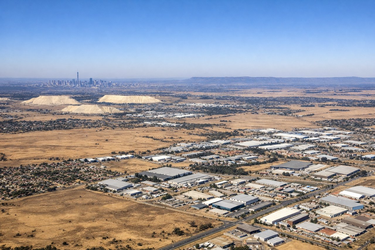
LEFTJNB typically lands runway 03L or 03R (northbound). Left-side seats provide views of the Witwatersrand ridge, Johannesburg's northern suburbs, and the approach over the Magaliesburg Mountains. Right seats face the industrial southern sprawl and mining areas.
Will your flight be in sunlight?
Pick a date and time in the Sun Map to watch the sun move across your whole flight.
About This Route
Which side of the plane should I sit on flying from Nairobi Wilson (WIL) to O.R. Tambo International Airport (JNB)?
Sit on the Left side of the plane for the best views on flights from Nairobi to Johannesburg. While takeoff favors the right for Nairobi's dramatic rift valley views, the landing approach to JNB on the left side offers superior views of the Magaliesburg Mountains and Johannesburg's geography. The left side captures more visually distinctive terrain during descent.
What can I see during takeoff from Nairobi Wilson in Nairobi?
During takeoff from Nairobi Wilson (WIL), sit on the Right side for the best views. Wilson typically departs runway 24 (southwest heading). Right-side seats face toward the Rift Valley escarpment and the highlands south of Nairobi during initial climb, offering dramatic topography. Left seats show the sprawling city and industrial areas. Notable sights include: Nairobi city grid (immediate foreground), Ngong Hills (southwest, distinctive ridge), Great Rift Valley escarpment (receding southward), Kikuyu highlands (western horizon).
What can I see when landing at O.R. Tambo International Airport in Johannesburg?
When landing at O.R. Tambo International Airport (JNB), sit on the Left side for the best views. JNB typically lands runway 03L or 03R (northbound). Left-side seats provide views of the Witwatersrand ridge, Johannesburg's northern suburbs, and the approach over the Magaliesburg Mountains. Right seats face the industrial southern sprawl and mining areas. Notable sights include: Magaliesburg Mountains (northern approach, receding northward), Johannesburg CBD skyline (eastern side during descent), Witwatersrand ridge (underlying geology visible as terrain), Pretoria's northern suburbs (left wing during final approach).
How long is the flight from Nairobi to Johannesburg?
The flight from Nairobi Wilson (WIL) to O.R. Tambo International Airport (JNB) takes about 4 hours 5 minutes. The shortest flight path between them is 1,807 miles (2,908 km); winds and air traffic control usually add a few percent.
What does the Nairobi to Johannesburg flight path pass over?
The flight path crosses the Kenya-Tanzania border near the Amboseli region (Mount Kilimanjaro visible on clear days to the left/west), then continues south over the Tanzanian plateau. The Arusha region and Mount Mawenzi appear as distant peaks. Further south, the flight crosses into Zambia/Zimbabwe airspace, passing east of Lake Kariba (visible as a large blue water body on the left/west during mid-flight). The terrain transitions from highland plateaus to lower savanna. Approaching JNB, the Limpopo River valley becomes visible, marking the South Africa border, followed by the distinctive Magaliesburg range.