Although the left side wins the takeoff with Wellington's harbour views, the right side delivers two strong scenic phases: the snow-capped volcanoes of Ruapehu, Ngauruhoe, and Tongariro along with Lake Taupo during cruise, followed by Auckland's skyline and Rangitoto Island on final approach, giving it the edge for the full flight.
Flight Path
Central North Island volcanic plateau with Mount Ruapehu, Ngauruhoe, and Tongariro visible to the east, along with Lake Taupo; Mount Taranaki's isolated cone visible in the distance to the west.
Great circle distance and headings ›Phase by phase
Takeoff from WLG
LEFTDeparting on runway 34, the climb-out passes directly over Wellington Harbour with the compact CBD skyline and surrounding hills visible on the left, a classic harbour-city view. The right side only shows the Hutt Valley suburbs and the lower Tararua foothills, which are far less distinctive.
Landing at AKL
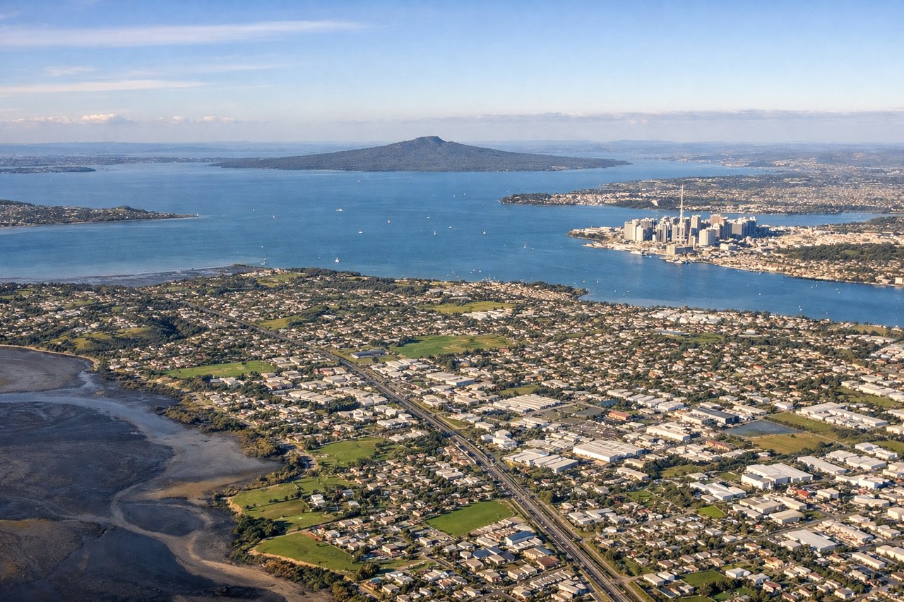
RIGHTOn approach to runway 23L, aircraft typically track down over the Hauraki Gulf before turning onto final, putting Auckland's CBD skyline, the Harbour Bridge, and the volcanic cone of Rangitoto Island on the right side. The left side mostly shows flatter South Auckland suburbs and the Manukau Harbour with less visual drama.
Will your flight be in sunlight?
See exactly which side of the plane gets sun and shade at your departure time.
About This Route
Which side of the plane should I sit on flying from Wellington International (WLG) to Auckland International (AKL)?
Sit on the Right side of the plane for the best views on flights from Wellington to Auckland. Although the left side wins the takeoff with Wellington's harbour views, the right side delivers two strong scenic phases: the snow-capped volcanoes of Ruapehu, Ngauruhoe, and Tongariro along with Lake Taupo during cruise, followed by Auckland's skyline and Rangitoto Island on final approach, giving it the edge for the full flight.
What can I see during takeoff from Wellington International in Wellington?
During takeoff from Wellington International (WLG), sit on the Left side for the best views. Departing on runway 34, the climb-out passes directly over Wellington Harbour with the compact CBD skyline and surrounding hills visible on the left, a classic harbour-city view. The right side only shows the Hutt Valley suburbs and the lower Tararua foothills, which are far less distinctive. Notable sights include: Wellington Harbour, Wellington CBD skyline, Lyall Bay/Cook Strait entrance, Miramar Peninsula.
What can I see when landing at Auckland International in Auckland?
When landing at Auckland International (AKL), sit on the Right side for the best views. On approach to runway 23L, aircraft typically track down over the Hauraki Gulf before turning onto final, putting Auckland's CBD skyline, the Harbour Bridge, and the volcanic cone of Rangitoto Island on the right side. The left side mostly shows flatter South Auckland suburbs and the Manukau Harbour with less visual drama. Notable sights include: Auckland CBD skyline (Sky Tower), Waitemata Harbour and Harbour Bridge, Rangitoto Island, North Shore coastline.
How long is the flight from Wellington to Auckland?
The flight from Wellington International (WLG) to Auckland International (AKL) takes 1h 10m.
What does the Wellington to Auckland flight path pass over?
Central North Island volcanic plateau with Mount Ruapehu, Ngauruhoe, and Tongariro visible to the east, along with Lake Taupo; Mount Taranaki's isolated cone visible in the distance to the west.