Left seats capture the most dramatic geography on both departure and arrival. The Cook Strait and Remutaka Range during climb-out, combined with the Adelaide Hills escarpment and Gulf St Vincent during descent, make left the superior choice for this route's full visual experience.
Flown WLG to ADL? Did we get it right?
Flight Path
Wellington to Adelaide is 2,005 miles (3,226 km), a flight of about 4 hours 25 minutes.
The flight crosses the Tasman Sea for approximately 2,000 kilometers. At cruise altitude (around 30,000 feet), the sea itself dominates the view with occasional cloud formations. The midpoint occurs roughly 100 kilometers west of the New South Wales coast. No significant land features are visible at cruise altitude during the crossing, though on clear days the Australian mainland becomes visible as a low, hazy line on the western horizon approximately 1 hour before descent begins. The approach to Adelaide brings the South Australian coast into view, with the Yorke Peninsula visible to the southeast and the Fleurieu Peninsula to the south before turning final for runway 12.
Great circle distance and headings ›Phase by phase
Takeoff from WLG
RIGHTWellington typically departs runway 16 (northbound) or 34 (southbound). Right-side seats offer views of Cook Strait and the Remutaka Range as the aircraft climbs northwestward. The strait's dramatic water patterns and the range's ridgelines are distinctive during initial climb.
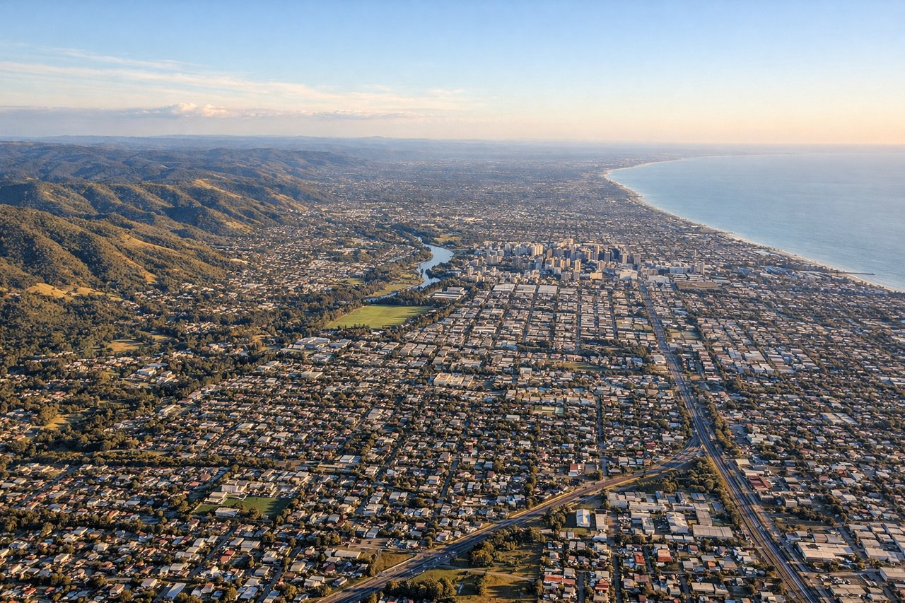
Landing at ADL
LEFTDescent into Adelaide typically uses runway 12 (from the north) or 30 (from the south). Left-side seats during approach from the southeast offer clear views of the Adelaide Hills, Gulf St Vincent, and the city's grid layout against the coastal plain. The hills' distinctive escarpment and the gulf's blue water provide strong visual reference.
Will your flight be in sunlight?
Pick a date and time in the Sun Map to watch the sun move across your whole flight.
About This Route
Which side of the plane should I sit on flying from Wellington International (WLG) to Adelaide International (ADL)?
Sit on the Left side of the plane for the best views on flights from Wellington to Adelaide. Left seats capture the most dramatic geography on both departure and arrival. The Cook Strait and Remutaka Range during climb-out, combined with the Adelaide Hills escarpment and Gulf St Vincent during descent, make left the superior choice for this route's full visual experience.
What can I see during takeoff from Wellington International in Wellington?
During takeoff from Wellington International (WLG), sit on the Right side for the best views. Wellington typically departs runway 16 (northbound) or 34 (southbound). Right-side seats offer views of Cook Strait and the Remutaka Range as the aircraft climbs northwestward. The strait's dramatic water patterns and the range's ridgelines are distinctive during initial climb. Notable sights include: Cook Strait (water body separating North and South Islands), Remutaka Range (mountain range to the northeast), Picton/Blenheim region (visible across the strait in Marlborough Sounds), Wellington Harbour (receding below during climb).
What can I see when landing at Adelaide International in Adelaide?
When landing at Adelaide International (ADL), sit on the Left side for the best views. Descent into Adelaide typically uses runway 12 (from the north) or 30 (from the south). Left-side seats during approach from the southeast offer clear views of the Adelaide Hills, Gulf St Vincent, and the city's grid layout against the coastal plain. The hills' distinctive escarpment and the gulf's blue water provide strong visual reference. Notable sights include: Adelaide Hills (mountain range with visible escarpment), Gulf St Vincent (body of water to the west), Adelaide city grid (urban area in the plain), Mount Lofty (highest point in the hills, visible as a distinct peak).
How long is the flight from Wellington to Adelaide?
The flight from Wellington International (WLG) to Adelaide International (ADL) takes about 4 hours 25 minutes. The shortest flight path between them is 2,005 miles (3,226 km); winds and air traffic control usually add a few percent.
What does the Wellington to Adelaide flight path pass over?
The flight crosses the Tasman Sea for approximately 2,000 kilometers. At cruise altitude (around 30,000 feet), the sea itself dominates the view with occasional cloud formations. The midpoint occurs roughly 100 kilometers west of the New South Wales coast. No significant land features are visible at cruise altitude during the crossing, though on clear days the Australian mainland becomes visible as a low, hazy line on the western horizon approximately 1 hour before descent begins. The approach to Adelaide brings the South Australian coast into view, with the Yorke Peninsula visible to the southeast and the Fleurieu Peninsula to the south before turning final for runway 12.