Both sides score equally at 2.5 due to the route's fundamental geography: a short 1h 15m flight over predominantly flat Central European plains with minimal dramatic terrain. Right side edges ahead marginally because Warsaw's urban departure offers slightly more visual interest than Budapest's approach, and the Vistula River valley provides more defined landmarks during climb-out than the Danube approach provides during descent. Neither side qualifies for higher scores because the route lacks mountains, significant coastlines, or sustained scenic features—it is a flat-terrain regional flight with only brief urban interest at each end.
Flown WMI to BUD? Did we get it right?
Flight Path
Nowy Dwór Mazowiecki to Budapest is 352 miles (567 km), a flight of about 1 hour 15 minutes.
Flat agricultural plains of central Poland and western Hungary; the Vistula River valley near Warsaw; scattered towns and villages across the Mazovian and Greater Polish regions; the transition zone between Polish and Hungarian countryside with minimal elevation change; no significant mountain ranges, lakes, or dramatic geological features visible from cruise altitude
Great circle distance and headings ›Phase by phase
Takeoff from WMI
RIGHTRight side captures Warsaw's urban sprawl and the Vistula River valley during initial climb. The city's eastern districts and suburban development are more visually defined from this angle, offering brief urban interest before transitioning to flat terrain.
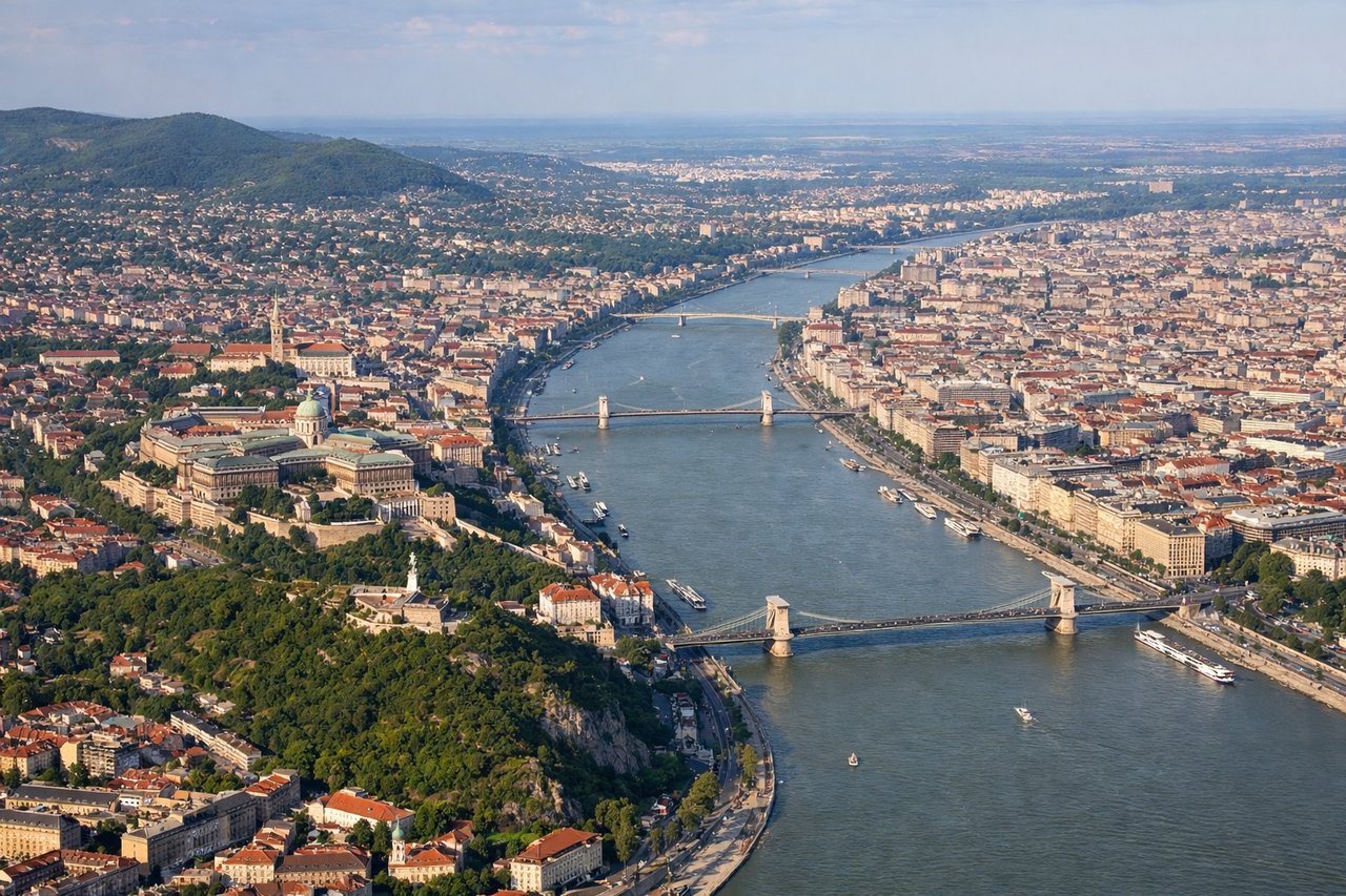
Landing at BUD
LEFTLeft side (north) provides views of Budapest's Danube River and the city's distinctive geography during approach. The river's dramatic bends, Margaret Island, and the Buda Hills create more visual interest than the flat southern approach corridor.
Will your flight be in sunlight?
Pick a date and time in the Sun Map to watch the sun move across your whole flight.
About This Route
Which side of the plane should I sit on flying from Warsaw Modlin Airport (WMI) to Ferihegy (BUD)?
Sit on the Right side of the plane for the best views on flights from Nowy Dwór Mazowiecki to Budapest. Both sides score equally at 2.5 due to the route's fundamental geography: a short 1h 15m flight over predominantly flat Central European plains with minimal dramatic terrain. Right side edges ahead marginally because Warsaw's urban departure offers slightly more visual interest than Budapest's approach, and the Vistula River valley provides more defined landmarks during climb-out than the Danube approach provides during descent. Neither side qualifies for higher scores because the route lacks mountains, significant coastlines, or sustained scenic features—it is a flat-terrain regional flight with only brief urban interest at each end.
What can I see during takeoff from Warsaw Modlin Airport in Nowy Dwór Mazowiecki?
During takeoff from Warsaw Modlin Airport (WMI), sit on the Right side for the best views. Right side captures Warsaw's urban sprawl and the Vistula River valley during initial climb. The city's eastern districts and suburban development are more visually defined from this angle, offering brief urban interest before transitioning to flat terrain. Notable sights include: Warsaw city center and eastern suburbs, Vistula River meanders, Modlin Airport's surrounding agricultural plains.
What can I see when landing at Ferihegy in Budapest?
When landing at Ferihegy (BUD), sit on the Left side for the best views. Left side (north) provides views of Budapest's Danube River and the city's distinctive geography during approach. The river's dramatic bends, Margaret Island, and the Buda Hills create more visual interest than the flat southern approach corridor. Notable sights include: Danube River with its characteristic meanders, Margaret Island (Margit-sziget), Buda Hills rising on the western bank, Budapest's urban districts.
How long is the flight from Nowy Dwór Mazowiecki to Budapest?
The flight from Warsaw Modlin Airport (WMI) to Ferihegy (BUD) takes about 1 hour 15 minutes. The shortest flight path between them is 352 miles (567 km); winds and air traffic control usually add a few percent.
What does the Nowy Dwór Mazowiecki to Budapest flight path pass over?
Flat agricultural plains of central Poland and western Hungary; the Vistula River valley near Warsaw; scattered towns and villages across the Mazovian and Greater Polish regions; the transition zone between Polish and Hungarian countryside with minimal elevation change; no significant mountain ranges, lakes, or dramatic geological features visible from cruise altitude