While takeoff offers right-side interest, the landing approach provides more dramatic and sustained visual interest with the Wasatch Range and Great Salt Lake. The left side captures the most distinctive geographical features of the destination.
Flown XLS to SLC? Did we get it right?
Flight Path
St. Louis to Salt Lake City is 5,780 miles (9,301 km), a flight of about 13 hours 30 minutes.
Flight crosses the Atlantic Ocean for roughly 8-9 hours with no significant landmarks visible. Typical routing passes south of Greenland and Iceland. Over North America, the flight crosses the Canadian prairies and northern Great Plains before descending toward Utah. The Rocky Mountains become visible in the final 2-3 hours of flight, with the Wasatch Range appearing roughly 45 minutes before landing.
Great circle distance and headings ›


Phase by phase
Takeoff from XLS
RIGHTSaint-Louis sits on the Senegal River delta with the Atlantic Ocean immediately west. Right-side seats capture the river's distinctive braided channels and the coastline as you climb out. The city itself is built on an island, creating a sharp contrast between water and urban development that's visually striking during initial climb.
Landing at SLC
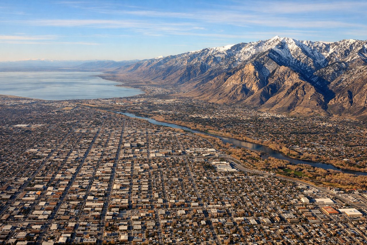
LEFTApproaching Salt Lake City typically uses runways 16L/R or 34L/R depending on wind. On descent from the northeast, left-side seats offer the best view of the Wasatch Range's dramatic eastern escarpment and the Great Salt Lake itself. The lake's distinctive shape and the mountain wall create a striking visual approach corridor.
Will your flight be in sunlight?
Pick a date and time in the Sun Map to watch the sun move across your whole flight.
About This Route
Which side of the plane should I sit on flying from Saint Louis (XLS) to Salt Lake City International (SLC)?
Sit on the Left side of the plane for the best views on flights from St. Louis to Salt Lake City. While takeoff offers right-side interest, the landing approach provides more dramatic and sustained visual interest with the Wasatch Range and Great Salt Lake. The left side captures the most distinctive geographical features of the destination.
What can I see during takeoff from Saint Louis in St. Louis?
During takeoff from Saint Louis (XLS), sit on the Right side for the best views. Saint-Louis sits on the Senegal River delta with the Atlantic Ocean immediately west. Right-side seats capture the river's distinctive braided channels and the coastline as you climb out. The city itself is built on an island, creating a sharp contrast between water and urban development that's visually striking during initial climb. Notable sights include: Senegal River delta with its multiple channels, Atlantic Ocean coastline, Saint-Louis island urban core, Langue de Barbarie sandbar to the west.
What can I see when landing at Salt Lake City International in Salt Lake City?
When landing at Salt Lake City International (SLC), sit on the Left side for the best views. Approaching Salt Lake City typically uses runways 16L/R or 34L/R depending on wind. On descent from the northeast, left-side seats offer the best view of the Wasatch Range's dramatic eastern escarpment and the Great Salt Lake itself. The lake's distinctive shape and the mountain wall create a striking visual approach corridor. Notable sights include: Wasatch Range (Cottonwood Canyons visible), Great Salt Lake with its irregular shoreline, Salt Lake Valley floor with grid pattern, Antelope Island in the lake.
How long is the flight from St. Louis to Salt Lake City?
The flight from Saint Louis (XLS) to Salt Lake City International (SLC) takes about 13 hours 30 minutes. The shortest flight path between them is 5,780 miles (9,301 km); winds and air traffic control usually add a few percent.
What does the St. Louis to Salt Lake City flight path pass over?
Flight crosses the Atlantic Ocean for roughly 8-9 hours with no significant landmarks visible. Typical routing passes south of Greenland and Iceland. Over North America, the flight crosses the Canadian prairies and northern Great Plains before descending toward Utah. The Rocky Mountains become visible in the final 2-3 hours of flight, with the Wasatch Range appearing roughly 45 minutes before landing.