While takeoff slightly favors the right side with Ozark terrain, the landing experience decisively favors the left. The River Visual approach into DCA is one of the most iconic scenic approaches in North American aviation, offering unobstructed views of the Potomac River, Washington Monument, Lincoln Memorial, and Arlington—genuine landmarks of national significance. This landing advantage outweighs the modest takeoff benefit on the right, making left the superior choice for the full flight experience.
Flown XNA to DCA? Did we get it right?
Flight Path
Fayetteville/Springdale/Rogers to Washington is 961 miles (1,546 km), a flight of about 3 hours 15 minutes.
Appalachian ridges (Cumberland Plateau in Tennessee/Kentucky), Ohio River valley, Shenandoah Valley, Blue Ridge Mountains, Potomac River drainage basin
Great circle distance and headings ›Phase by phase
Takeoff from XNA
RIGHTRight side captures the Ozark Plateau terrain immediately after departure. With typical southerly winds favoring runway 34 (northwest departure), the right wing shows the rolling hills and forested landscape of the Boston Mountains to the east, providing immediate visual interest during climb-out.
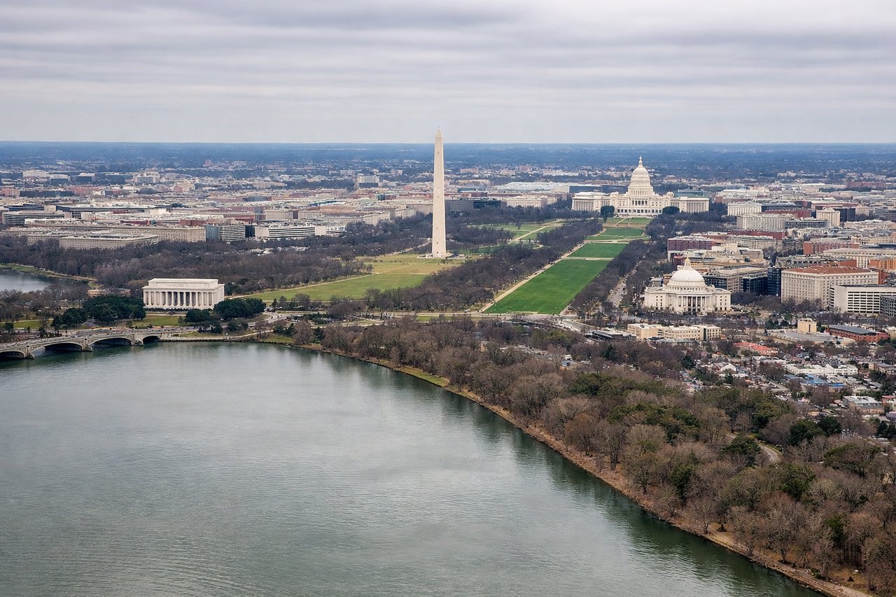
Landing at DCA
LEFTLeft side provides superior approach scenery into DCA. The standard River Visual approach on runway 19 tracks the Potomac River northbound, placing left-side passengers directly over the river corridor with views of downtown Washington monuments, the National Mall, and Arlington landmarks during final descent.
Will your flight be in sunlight?
Pick a date and time in the Sun Map to watch the sun move across your whole flight.
About This Route
Which side of the plane should I sit on flying from Northwest Arkansas National Airport (XNA) to Ronald Reagan Washington National (DCA)?
Sit on the Left side of the plane for the best views on flights from Fayetteville/Springdale/Rogers to Washington. While takeoff slightly favors the right side with Ozark terrain, the landing experience decisively favors the left. The River Visual approach into DCA is one of the most iconic scenic approaches in North American aviation, offering unobstructed views of the Potomac River, Washington Monument, Lincoln Memorial, and Arlington—genuine landmarks of national significance. This landing advantage outweighs the modest takeoff benefit on the right, making left the superior choice for the full flight experience.
What can I see during takeoff from Northwest Arkansas National Airport in Fayetteville/Springdale/Rogers?
During takeoff from Northwest Arkansas National Airport (XNA), sit on the Right side for the best views. Right side captures the Ozark Plateau terrain immediately after departure. With typical southerly winds favoring runway 34 (northwest departure), the right wing shows the rolling hills and forested landscape of the Boston Mountains to the east, providing immediate visual interest during climb-out. Notable sights include: Boston Mountains (Ozark Plateau), Illinois River valley, Lake Sequoyah (if visible during initial climb), Rogers/Springdale urban sprawl.
What can I see when landing at Ronald Reagan Washington National in Washington?
When landing at Ronald Reagan Washington National (DCA), sit on the Left side for the best views. Left side provides superior approach scenery into DCA. The standard River Visual approach on runway 19 tracks the Potomac River northbound, placing left-side passengers directly over the river corridor with views of downtown Washington monuments, the National Mall, and Arlington landmarks during final descent. Notable sights include: Potomac River, Washington Monument, Lincoln Memorial, Arlington National Cemetery, Theodore Roosevelt Island.
How long is the flight from Fayetteville/Springdale/Rogers to Washington?
The flight from Northwest Arkansas National Airport (XNA) to Ronald Reagan Washington National (DCA) takes about 3 hours 15 minutes. The shortest flight path between them is 961 miles (1,546 km); winds and air traffic control usually add a few percent.
What does the Fayetteville/Springdale/Rogers to Washington flight path pass over?
Appalachian ridges (Cumberland Plateau in Tennessee/Kentucky), Ohio River valley, Shenandoah Valley, Blue Ridge Mountains, Potomac River drainage basin