While the takeoff offers some mountain foothills views, the landing approach into BWI provides superior scenic value with the Potomac River, Chesapeake Bay, and Washington DC metropolitan area clearly visible. The right side captures more dramatic urban and water features during descent.
Flown YDQ to BWI? Did we get it right?
Flight Path
Dawson Creek to Baltimore is 2,281 miles (3,671 km), a flight of about 4 hours 15 minutes.
Great Lakes region (Lake Michigan and Lake Huron visible from cruising altitude), Ohio River valley, Appalachian plateau terrain, transition from boreal forest to deciduous forest and agricultural lands across the Great Plains and Midwest
Great circle distance and headings ›

Phase by phase
Takeoff from YDQ
LEFTLeft side offers views of the Rocky Mountain foothills and the Peace River valley as you climb out eastbound. The terrain rises dramatically to the west, but the left wing shows the river system and lower elevation terrain that defines the departure corridor.
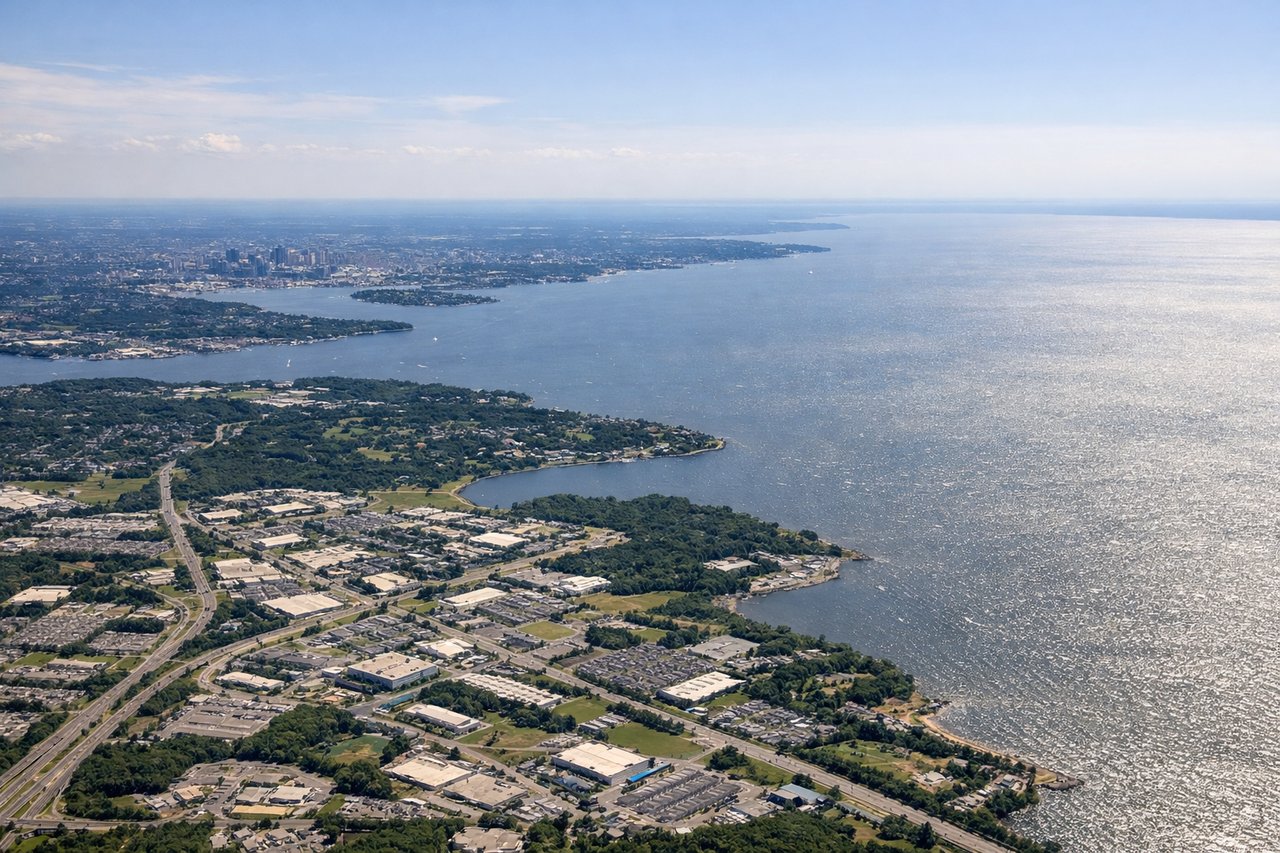
Landing at BWI
RIGHTRight side provides excellent views of the Potomac River, Washington DC's urban grid, and the Chesapeake Bay region during descent into BWI. The approach typically brings you over central Maryland with the Patuxent River and Chesapeake Bay visible to the right.
Will your flight be in sunlight?
Pick a date and time in the Sun Map to watch the sun move across your whole flight.
About This Route
Which side of the plane should I sit on flying from Dawson Creek (YDQ) to Baltimore Washington International (BWI)?
Sit on the Right side of the plane for the best views on flights from Dawson Creek to Baltimore. While the takeoff offers some mountain foothills views, the landing approach into BWI provides superior scenic value with the Potomac River, Chesapeake Bay, and Washington DC metropolitan area clearly visible. The right side captures more dramatic urban and water features during descent.
What can I see during takeoff from Dawson Creek in Dawson Creek?
During takeoff from Dawson Creek (YDQ), sit on the Left side for the best views. Left side offers views of the Rocky Mountain foothills and the Peace River valley as you climb out eastbound. The terrain rises dramatically to the west, but the left wing shows the river system and lower elevation terrain that defines the departure corridor. Notable sights include: Peace River valley, Rocky Mountain eastern slopes, Dawson Creek town grid, boreal forest canopy.
What can I see when landing at Baltimore Washington International in Baltimore?
When landing at Baltimore Washington International (BWI), sit on the Right side for the best views. Right side provides excellent views of the Potomac River, Washington DC's urban grid, and the Chesapeake Bay region during descent into BWI. The approach typically brings you over central Maryland with the Patuxent River and Chesapeake Bay visible to the right. Notable sights include: Potomac River, Washington DC downtown core and monuments, Chesapeake Bay, Baltimore Harbor.
How long is the flight from Dawson Creek to Baltimore?
The flight from Dawson Creek (YDQ) to Baltimore Washington International (BWI) takes about 4 hours 15 minutes. The shortest flight path between them is 2,281 miles (3,671 km); winds and air traffic control usually add a few percent.
What does the Dawson Creek to Baltimore flight path pass over?
Great Lakes region (Lake Michigan and Lake Huron visible from cruising altitude), Ohio River valley, Appalachian plateau terrain, transition from boreal forest to deciduous forest and agricultural lands across the Great Plains and Midwest